Pensaukee, Wisconsin facts for kids
Quick facts for kids
Pensaukee, Wisconsin
|
|
|---|---|

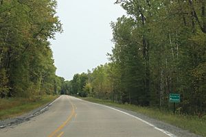
Sign for the town of Pensaukee
|
|

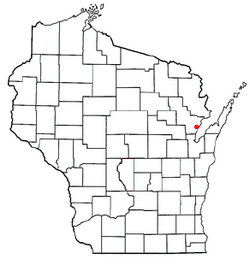
Location of Pensaukee, Wisconsin
|
|
| Country | |
| State | |
| County | Oconto |
| Area | |
| • Total | 35.6 sq mi (92.3 km2) |
| • Land | 35.5 sq mi (92.0 km2) |
| • Water | 0.1 sq mi (0.33 km2) |
| Elevation | 604 ft (184 m) |
| Population
(2010)
|
|
| • Total | 1,381 |
| • Density | 34.2/sq mi (13.2/km2) |
| Time zone | UTC-6 (Central (CST)) |
| • Summer (DST) | UTC-5 (CDT) |
| FIPS code | 55-61900 |
| GNIS feature ID | 1583907 |
| Website | http://www.townofpensaukee.org |
Pensaukee is a small town located in Oconto County, Wisconsin, in the United States. It sits right on the coast of Green Bay, which is part of Lake Michigan. In the year 2000, about 1,214 people lived here.
Contents
Communities in Pensaukee
Pensaukee is home to a few smaller communities:
- Brookside is a small area located near County Road J and Brookside Road. It's north of US Highway 41. The name "Brookside" comes from a small stream or brook nearby.
- Oak Orchard is another small area. You can find it along County Road S, south of Pensaukee.
- The main community of Pensaukee is located where County Road S and SS meet, east of US 41. This area is right at the mouth of the Pensaukee River.
History of Pensaukee
Where Did the Name Pensaukee Come From?
The name Pensaukee has a special meaning. It comes from the Menominee language, which is spoken by the Menominee Native American people. The town started as a Menominee settlement.
The name Pensaukee comes from the Menominee words pindj-sau-gee. This means 'inside the mouth of a river'. Another idea is that it comes from Apǣhsahkyah, which means 'brant goose'.
A post office was opened in the town in 1855. It stayed open for over 100 years, finally closing in 1957.
The Pensaukee Tornado of 1877
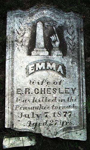
On July 7, 1877, a powerful tornado hit Pensaukee. At that time, Pensaukee was a busy town known for its lumber industry. The tornado was very strong, like an F3 on the Fujita scale.
The storm caused a lot of damage in just two minutes. It destroyed many buildings, including the town's hotel, sawmill, flour mill, school, and train station. About 50 buildings were ruined.
Sadly, six people lost their lives in the tornado. This included four children and two adults. Many horses and cattle were also killed. About 32 people were hurt.
Geography of Pensaukee
Pensaukee covers a total area of about 35.6 square miles (92.3 square kilometers). Most of this area is land, about 35.5 square miles (92.0 square kilometers). A small part, about 0.1 square miles (0.3 square kilometers), is water.
Population and People
In 2000, there were 1,214 people living in Pensaukee. The town had 471 households, which are groups of people living together. Most of these were families.
The population was spread out by age:
- About 23.6% were under 18 years old.
- About 32.3% were between 25 and 44 years old.
- About 11.4% were 65 years or older.
The average age in Pensaukee was 39 years. For every 100 females, there were about 107 males.
The average income for a household in the town was around $48,098 per year. For families, it was about $51,875 per year. A small number of people, about 3.5% of the population, lived below the poverty line.
Famous People from Pensaukee
- John Verkuilen was born in Pensaukee. He was a farmer and later became a Wisconsin State Representative, helping to make laws for Wisconsin.
See also
 In Spanish: Pensaukee (Wisconsin) para niños
 | Precious Adams |
 | Lauren Anderson |
 | Janet Collins |


