Pensaukee River facts for kids
Quick facts for kids Pensaukee River |
|
|---|---|

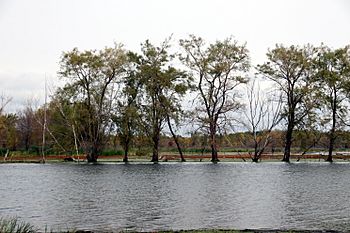
Flooding on the Pensaukee River near its mouth at Green Bay.
|
|
| Other name(s) | Pensaukie River |
| Country | United States |
| State | Wisconsin |
| Physical characteristics | |
| Main source | East of Bonduel 44°44′37″N 88°24′37″W / 44.7436022°N 88.4103799°W |
| River mouth | Green Bay Pensaukee 584 ft (178 m) 44°49′21″N 87°54′06″W / 44.8224914°N 87.9017697°W |
| Basin features | |
| Tributaries |
|
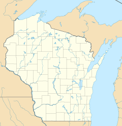
The Pensaukee River is a river found in the northeastern part of Wisconsin. It is a tributary, which means it's a smaller stream or river that flows into a larger one. The Pensaukee River flows into Green Bay, which is part of Lake Michigan.
River's Journey
The Pensaukee River is about 47 miles (76 km) long. It has two main parts, like two arms reaching out.
Its southern part starts from Pautz Lake in Shawano County. The northern part begins in the Pensaukee Lakes, also in Shawano County.
As the river flows, it passes by several communities. These include Krakow, Klondike, and Abrams. Finally, the river's end, called its mouth, empties into Green Bay near the community of Pensaukee.
River's Home Area
The area of land that collects all the rainfall and snowmelt that eventually flows into the Pensaukee River is called its drainage basin. This basin covers parts of Oconto County and Shawano County, Wisconsin.
The entire watershed, which is another name for the drainage basin, is quite large. It covers about 160 square miles (410 km2) of land. A big part of this land, about 61%, is used for farming. This means many farms are located within the area that drains into the Pensaukee River.
 | Jessica Watkins |
 | Robert Henry Lawrence Jr. |
 | Mae Jemison |
 | Sian Proctor |
 | Guion Bluford |


