
Langlade County, Wisconsin facts for kids
Quick facts for kids
Langlade County
|
||
|---|---|---|

Langlade County Courthouse in 2014
|
||
|
||

Location within the U.S. state of Wisconsin
|
||
 Wisconsin's location within the U.S. |
||
| Country | ||
| State | ||
| Created | March 3, 1879 | |
| Named for | Charles Michel de Langlade | |
| Seat | Antigo | |
| Largest city | Antigo | |
| Area | ||
| • Total | 888 sq mi (2,300 km2) | |
| • Land | 871 sq mi (2,260 km2) | |
| • Water | 17 sq mi (40 km2) 1.9%% | |
| Population
(2020)
|
||
| • Total | 19,491 | |
| • Estimate
(2023)
|
19,404 |
|
| • Density | 22.4/sq mi (8.6/km2) | |
| Time zone | UTC−6 (Central) | |
| • Summer (DST) | UTC−5 (CDT) | |
| Congressional district | 7th | |
Langlade County is a special area called a county in the state of Wisconsin, USA. In 2020, about 19,491 people lived here. The main town and county seat (like the capital of the county) is Antigo.
Contents
History of Langlade County
Langlade County started on March 3, 1879. It was first called New County. Later, on February 20, 1880, its name changed to Langlade County. This was to honor Charles de Langlade, an important person in Wisconsin's history. The county officially began operating on February 19, 1881.
When it was first created, Langlade County was much bigger. Its northern border reached all the way to Michigan. But over time, between 1881 and 1885, the county's borders changed. Some parts were given to nearby counties like Lincoln and Shawano. In 1885, Langlade County lost its northernmost area to a new county called Forest County.
Geography of Langlade County
Langlade County covers a total area of about 888 square miles. Most of this area, about 871 square miles, is land. The rest, about 17 square miles, is water. This means about 1.9% of the county is covered by water.
The highest point in Langlade County is near the Basswood Lookout Tower. This spot is west of Summit Lake and is about 1,857 feet high.
Neighboring Counties
Langlade County shares its borders with several other counties:
- Oneida County to the northwest
- Forest County to the northeast
- Oconto County to the east
- Menominee County to the southeast
- Shawano County to the south
- Marathon County to the southwest
- Lincoln County to the west
Protected Natural Areas
Part of the Nicolet National Forest is located within Langlade County. This is a large protected area of forests and natural spaces.
People of Langlade County
The word "demographics" describes the different groups of people living in an area. According to the census taken in 2020, Langlade County had 19,491 people. This means there were about 22.4 people living in each square mile.
There were also 12,138 housing units (like homes and apartments). The average density was about 13.9 housing units per square mile.
Most people in the county, about 93%, were White. Other groups included 1.3% Native American, 0.5% Black or African American, and 0.4% Asian. About 0.7% of people were from other races, and 4.1% were from two or more races. When looking at ethnicity, about 2.4% of the population was Hispanic or Latino.
Getting Around Langlade County
This section tells us about the main roads and the airport in Langlade County.
Main Roads
Several important highways pass through Langlade County:
 U.S. Highway 45
 Highway 17 (Wisconsin)
 Highway 47 (Wisconsin)
 Highway 52 (Wisconsin)
 Highway 55 (Wisconsin)
 Highway 64 (Wisconsin)
Airport
The county has its own airport called KAIG - Langlade County Airport. The county manages this airport. It is used by both local planes and planes just passing through.
Communities in Langlade County
Langlade County has many different types of communities. These include cities, villages, towns, and smaller unincorporated areas.
City
- Antigo (This is the county seat, where the main government offices are.)
Village
- White Lake
Towns
Census-Designated Places
These are areas that are like towns but are not officially incorporated as cities or villages.
- Elcho
- Post Lake
- Summit Lake
Unincorporated Communities
These are smaller communities that do not have their own local government.
Ghost Towns or Neighborhoods
These are places that used to be communities but are now abandoned or have very few people living there.
- Kent/Drexel
- Van Ostrand
Images for kids
-
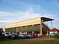
Langlade County Fairgrounds grandstands in Antigo
-
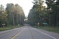
Looking south while entering Langlade County on WIS 55
-
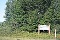
Looking north at the welcome sign for Langlade County


See also
 In Spanish: Condado de Langlade para niños
