
Forest County, Wisconsin facts for kids
Quick facts for kids
Forest County
|
|
|---|---|

Forest County Courthouse
|
|

Location within the U.S. state of Wisconsin
|
|
 Wisconsin's location within the U.S. |
|
| Country | |
| State | |
| Founded | 1885 |
| Seat | Crandon |
| Largest city | Crandon |
| Area | |
| • Total | 1,046 sq mi (2,710 km2) |
| • Land | 1,014 sq mi (2,630 km2) |
| • Water | 32 sq mi (80 km2) 3.1% |
| Population
(2020)
|
|
| • Total | 9,179 |
| • Estimate
(2023)
|
9,325 |
| • Density | 9.1/sq mi (3.5/km2) |
| Time zone | UTC−6 (Central) |
| • Summer (DST) | UTC−5 (CDT) |
| Congressional district | 7th |
Forest County is a special area called a county located in the state of Wisconsin in the United States. In 2020, about 9,179 people lived here. The main town, or county seat, is Crandon. Two important Native American groups, the Forest County Potawatomi Community and the Sokaogon Chippewa Community, also have their lands (reservations) in Forest County.
Contents
History of Forest County
Forest County was officially created in 1885. The government of Wisconsin decided to form it from parts of two nearby counties: Langlade and Oconto. It got its name, 'Forest County,' because of the many beautiful forests found within its borders.
Geography of Forest County
Forest County covers a total area of about 1,046 square miles. Most of this area, about 1,014 square miles, is land. The remaining 32 square miles, or 3.1%, is water. One of the highest points in Wisconsin, Sugarbush hill, is located right here in Forest County.
Counties Nearby
Forest County shares its borders with several other counties:
- Florence County to the northeast
- Marinette County to the east
- Oconto County to the southeast
- Langlade County to the southwest
- Oneida County to the west
- Vilas County to the northwest
- Iron County, Michigan to the north (in Michigan)
Main Roads in Forest County
These are the most important highways that run through Forest County:
|
|
Railroads and Airport
- Watco operates a railroad line in the county.
- The main airport is Y55 - Crandon Municipal Airport.
Protected Natural Areas
A part of the large Nicolet National Forest is located within Forest County. This area helps protect nature and offers places for outdoor activities.
People of Forest County
In 2020, the population of Forest County was 9,179 people. This means there were about 9.1 people living in each square mile.
When looking at the different groups of people in the county:
- About 80.7% were White.
- About 13.4% were Native American.
- Smaller groups included Black or African American (0.3%), Asian (0.2%), and Pacific Islander (0.1%).
- About 5.1% of people identified with two or more races.
- About 1.7% of the population was Hispanic or Latino.
Communities in Forest County

City
- Crandon is the only city and the county seat.
Towns
Census-Designated Places
These are areas that are like towns but are not officially incorporated as cities or villages:
Unincorporated Communities
These are smaller communities that are not part of a city or town government:
- Alvin
- Armstrong Creek
- Atkins
- Blackwell
- Blackwell Junction
- Bonneval
- Carter
- Cavour
- Hiles
- Laona Junction
- Nashville
- Nelma
- Padus
- Popple River
- Soperton
- Wisconsin Junction
- Woodlawn
Ghost Towns or Old Neighborhoods
These are places that used to be communities but are now mostly abandoned:
Images for kids
-
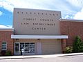
Law Enforcement Center
-
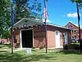
Forest County Veterans Memorial


See also
 In Spanish: Condado de Forest (Wisconsin) para niños
