
Vilas County, Wisconsin facts for kids
Quick facts for kids
Vilas County
|
|
|---|---|

Vilas County Courthouse
|
|

Location within the U.S. state of Wisconsin
|
|
 Wisconsin's location within the U.S. |
|
| Country | |
| State | |
| Founded | April 12, 1893 |
| Named for | William Freeman Vilas |
| Seat | Eagle River |
| Largest city | Eagle River |
| Area | |
| • Total | 1,018 sq mi (2,640 km2) |
| • Land | 857 sq mi (2,220 km2) |
| • Water | 161 sq mi (420 km2) 16%% |
| Population
(2020)
|
|
| • Total | 23,047 |
| • Estimate
(2023)
|
23,855 |
| • Density | 22.639/sq mi (8.741/km2) |
| Time zone | UTC−6 (Central) |
| • Summer (DST) | UTC−5 (CDT) |
| Congressional district | 7th |
Vilas County is a county in the state of Wisconsin, United States. As of the 2020 census, about 23,047 people lived there. Its main city and government center is Eagle River. Part of the county is also home to the Lac du Flambeau Band of Lake Superior Chippewa reservation.
Contents
History of Vilas County
Early Native American Life
Native Americans have lived in the area now known as Vilas County for thousands of years. Scientists have found old sites from the prehistoric Woodland period here. In the 1700s, the Dakota and Ojibwe people had disagreements over the land.
Oral stories say that the Ojibwe won a big battle on Strawberry Island in Flambeau Lake around 1745. Ojibwe people have lived in the area ever since. They secured their land, known as the Lac du Flambeau Indian Reservation, with the 1854 Treaty of La Pointe.
First Settlers and County Formation
The first known white settler was a man named Ashman. He started a trading post in Lac du Flambeau in 1818.
In the 1850s, people from New England, mostly Vermont and Connecticut, built roads and trails through Vilas County. These included the Ontonagan Mail Trail.
Vilas County was officially created from Oneida County on April 12, 1893. It was named after William Freeman Vilas. He was from Vermont and served as a senator for Wisconsin from 1891 to 1897.
The Logging Era
Logging, which is cutting down trees for wood, began in the late 1850s. Loggers came from states like New York, New Hampshire, Vermont, and Maine. Many dams were built across the county's rivers. These dams helped loggers float their timber downstream to sawmills and paper mills.
After the county was founded in 1893, logging became less important. People then moved to Vilas County looking for other jobs. These new immigrants mostly came from Germany, Ireland, and Poland.
Geography and Nature

Vilas County covers about 1,018 square miles. About 857 square miles are land, and 161 square miles (16%) are water. The county is famous for its many lakes. There are 1,318 lakes here!
Much of Vilas County is covered by large forests. These include parts of the Chequamegon-Nicolet National Forest and the Northern Highland-American Legion State Forest. The county also has its own large forest lands.
The waters in Vilas County flow into three major bodies of water: Lake Superior, Lake Michigan, and the Mississippi River. Important rivers like the Wisconsin, Flambeau, and Presque Isle River all start in Vilas County.
Neighboring Counties
- Forest County - southeast
- Iron County - west
- Oneida County - south
- Price County - southwest
- Gogebic County, Michigan - north
- Iron County, Michigan - northeast
Main Roads
 U.S. Highway 45
 U.S. Highway 51
 Highway 17 (Wisconsin)
 Highway 32 (Wisconsin)
 Highway 47 (Wisconsin)
 Highway 70 (Wisconsin)
 Highway 155 (Wisconsin)
Airports
- KARV - Lakeland Airport / Noble F. Lee Memorial Field
- KEGV - Eagle River Union Airport
- KLNL - Kings Land O' Lakes Airport
- D25 - Manitowish Waters Airport
Protected Natural Areas
Vilas County includes parts of two important national forests:
- Chequamegon National Forest (part)
- Nicolet National Forest (part)
These two forests are now managed together as the Chequamegon-Nicolet National Forest.
Population and People
| Historical population | |||
|---|---|---|---|
| Census | Pop. | %± | |
| 1900 | 4,929 | — | |
| 1910 | 6,019 | 22.1% | |
| 1920 | 5,649 | −6.1% | |
| 1930 | 7,294 | 29.1% | |
| 1940 | 8,894 | 21.9% | |
| 1950 | 9,363 | 5.3% | |
| 1960 | 9,332 | −0.3% | |
| 1970 | 10,958 | 17.4% | |
| 1980 | 16,535 | 50.9% | |
| 1990 | 17,707 | 7.1% | |
| 2000 | 21,033 | 18.8% | |
| 2010 | 21,430 | 1.9% | |
| 2020 | 23,047 | 7.5% | |
| U.S. Decennial Census 1790–1960 1900–1990 1990–2000 2010 2020 |
|||
2020 Census Information
In 2020, the population of Vilas County was 23,047 people. This means there were about 26.9 people living in each square mile.
Most people in the county, about 85.5%, were White. About 9.8% were Native American. Smaller groups included Black or African American (0.3%) and Asian (0.3%). About 2.0% of the population was Hispanic or Latino.
Economy and Jobs
The main part of Vilas County's economy is tourism. This is because of its many lakes and forests. In the fall, hunting and sport fishing are very popular. In the winter, ice fishing and especially snowmobiling bring many visitors.
Other important jobs in the area include logging, forestry, construction, and government work.
Cities, Towns, and Communities
Here are the different places where people live in Vilas County:
City
- Eagle River – 1,398 people (This is the county seat)
Towns
- Arbor Vitae – 3,316
- Boulder Junction – 933
- Cloverland – 1,029
- Conover – 1,235
- Lac du Flambeau – 3,441
- Land O' Lakes – 861
- Lincoln – 2,423
- Manitowish Waters – 566
- Phelps – 1,200
- Plum Lake – 491
- Presque Isle – 618
- St. Germain – 2,085
- Washington – 1,451
- Winchester – 383
Census-Designated Places
These are areas that are like towns but are not officially incorporated as cities or towns.
- Boulder Junction – 183
- Lac du Flambeau – 1,969
- Sayner – 207
Other Small Communities
Notable People from Vilas County
- Herman Finger was the Treasurer of Vilas County in the 1890s. He also helped run the Gerry Lumber Company.
- Screenwriter Winifred Dunn was born in Vilas County.
Images for kids
-
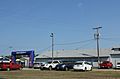
Cars parked by the entrance to the Vilas County Fairgrounds during the 2015 fair
-
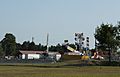
Rides during the 2015 county fair
-
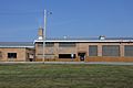
The Vilas County Highway Department near Eagle River


See also
 In Spanish: Condado de Vilas para niños
