Winchester, Vilas County, Wisconsin facts for kids
Quick facts for kids
Winchester, Wisconsin
|
|
|---|---|

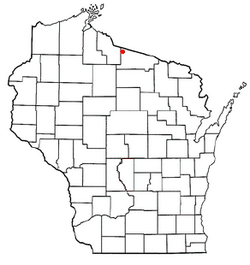
Location of Winchester, Vilas County, Wisconsin
|
|
| Country | |
| State | |
| County | Vilas |
| Area | |
| • Total | 53.6 sq mi (138.8 km2) |
| • Land | 48.1 sq mi (124.7 km2) |
| • Water | 5.5 sq mi (14.2 km2) |
| Elevation | 1,654 ft (504 m) |
| Population
(2010)
|
|
| • Total | 383 |
| • Density | 9.4/sq mi (3.6/km2) |
| Time zone | UTC-6 (Central (CST)) |
| • Summer (DST) | UTC-5 (CDT) |
| Area code(s) | 715 & 534 |
| FIPS code | 55-87600 |
| GNIS feature ID | 1584451 |
Winchester is a town in Vilas County, Wisconsin, United States. It is a small community located in the northern part of the state. In 2010, the town had a population of 383 people. There is also a smaller community within the town, also called Winchester, which locals sometimes call the "Winchester Townsite."
What is Winchester, Wisconsin Like?
Winchester is a town known for its beautiful natural surroundings. It is located in the northwest corner of Vilas County, Wisconsin. The town is filled with many lakes and is a great place for outdoor activities.
Lakes and Rivers in Winchester
Winchester has many lakes, making it a popular spot for fishing and boating. Some of the main lakes include:
- North Turtle Lake
- South Turtle Lake
- Rock Lake
These three lakes are part of what is called the Turtle Chain. Other lakes in the area include Birch, Harris, Pardee, Circle Lily, and Papoose Lakes. The Turtle River starts in this area. This river is part of the larger Flambeau River system.
How Big is Winchester?
The town of Winchester covers a total area of about 53.6 square miles (138.8 square kilometers). Most of this area, about 48.1 square miles (124.7 square kilometers), is land. The rest, about 5.5 square miles (14.2 square kilometers), is water. This means that over 10% of the town's area is covered by water!
How Do People Get Around in Winchester?
Winchester has several main roads that help people travel to and from the town. These roads are called Vilas County Trunk Highways.
Main Roads in Winchester
- CTH W: This is the main road that goes through Winchester. It runs east towards Presque Isle, where it connects with CTH B. It also goes south to Manitowish Waters, connecting to USH 51.
- CTH J: This road goes west from Winchester to Mercer in Iron County. It also connects to USH 51.
- CTH O: This road goes north from Winchester all the way to the Michigan state line. There, it connects to Gogebic County Highway 519 in Gogebic County, which then leads to US 2 at Wakefield, Michigan.
Accessing the Winchester Community
The smaller community of Winchester, sometimes called the "Winchester Townsite," can be reached using local town roads. These include Old County O and Townsite Road.
Where is Winchester Located?
Winchester is located in a beautiful part of northern Wisconsin. It shares its borders with several other towns and townships.
 |
Town of Oma | Bessemer Township | Marenisco Township |  |
| Town of Mercer | Town of Presque Isle | |||
| Town of Manitowish Waters | Town of Boulder Junction |
See also
 In Spanish: Winchester (condado de Vilas, Wisconsin) para niños
 | Aurelia Browder |
 | Nannie Helen Burroughs |
 | Michelle Alexander |

