Elcho, Wisconsin facts for kids
Quick facts for kids
Elcho, Wisconsin
|
|
|---|---|

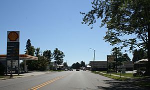
Downtown in unincorporated Elcho
|
|

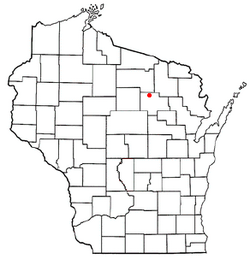
Location of Elcho, Wisconsin
|
|
| Country | |
| State | |
| County | Langlade |
| Area | |
| • Total | 75.2 sq mi (194.8 km2) |
| • Land | 71.0 sq mi (183.8 km2) |
| • Water | 4 sq mi (11 km2) |
| Elevation | 1,608 ft (490 m) |
| Population
(2010)
|
|
| • Total | 1,233 |
| • Density | 17/sq mi (6.7/km2) |
| Time zone | UTC-6 (Central (CST)) |
| • Summer (DST) | UTC-5 (CDT) |
| ZIP Codes |
54428 (Elcho
54485 (Summit Lake) |
| Area code(s) | 715 & 534 |
| FIPS code | 55-23050 |
| GNIS feature ID | 1583142 |
Elcho is a small town located in Langlade County, Wisconsin, United States. In 2010, about 1,233 people lived there. Some smaller communities, like Elcho, Post Lake, and part of Summit Lake, are also found within the town.
The Elcho Fire and Rescue Department helps keep the area safe.
History of Elcho
A post office opened in Elcho way back in 1887. The town's name, Elcho, comes from a place in Scotland.
For many years, a Boy Scout camp called Camp Mach-Kin-O-Siew (also known as Camp Mach) was located in Elcho. It was a popular spot for scouts.
Geography of Elcho
Elcho is located in the northern part of Langlade County. It shares a border with Oneida County to the north. This area is part of a larger region in Wisconsin known as the Northern Highland.
The main community of Elcho is in the center of the town. You can find Post Lake to the east and Summit Lake along the southern border.
Lakes and Rivers in Elcho
Elcho has a total area of about 194.8 square kilometers (about 75 square miles). A good portion of this area, about 11 square kilometers (4.2 square miles), is covered by water.
- Upper and Lower Post Lake: These lakes are in the northeast part of town. They are connected to the Wolf River.
- Hunting River: This river starts at Otter Lake in the northern part of town, near the community of Elcho. It flows southeast and joins the Wolf River.
- Prairie River: This river drains the western side of Elcho. It is a branch of the larger Wisconsin River.
- Enterprise Lake: In the northwest corner, Enterprise Lake feeds Enterprise Creek. This creek flows north towards the Pelican River, which also connects to the Wisconsin River.
Population and People
In 2000, there were 1,317 people living in Elcho. The town had 613 households. Many people lived alone or with their families.
The average age of people in Elcho was 51 years old. About 18% of the population was under 18 years old.
 | Sharif Bey |
 | Hale Woodruff |
 | Richmond Barthé |
 | Purvis Young |

