
Greenleaf, Wisconsin facts for kids
Quick facts for kids
Greenleaf, Wisconsin
|
|
|---|---|

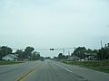
Looking north at the north side of Greenleaf on Wisconsin highways 32 and 57
|
|

Location in Brown County and the state of Wisconsin.
|
|
| Country | United States |
| State | Wisconsin |
| County | Brown |
| Town | Wrightstown |
| Area | |
| • Total | 1.042 sq mi (2.70 km2) |
| • Land | 1.042 sq mi (2.70 km2) |
| • Water | 0 sq mi (0 km2) |
| Elevation | 712 ft (217 m) |
| Population
(2010)
|
|
| • Total | 607 |
| • Density | 582.5/sq mi (224.92/km2) |
| Time zone | UTC-6 (Central (CST)) |
| • Summer (DST) | UTC-5 (CDT) |
| Area code(s) | 920 |
| GNIS feature ID | 1565848 |
Greenleaf is a small village located in Brown County, Wisconsin, in the United States. It's part of the larger area known as the town of Wrightstown.
History of Greenleaf
In 2010, a count of people living in the area showed that 607 people called Greenleaf home. The village got its name from Emery B. Greenleaf. He was the general manager of the Milwaukee & Northern railroad when the Greenleaf post office first opened in 1873.
Becoming a Village
In 2020, about 800 people living in the Greenleaf community asked the state of Wisconsin to officially make their area a village. Becoming a village means the community can have its own local government and make more decisions for itself.
However, the Wisconsin Incorporation Review Board said "no" to their first request. This was because the proposed village area included two separate parts. One part was near a roundabout where state highways WIS 57 and Wisconsin Highway 96 meet. The other part was a separate area located to the east of the Niagara Escarpment, which is a long cliff or ridge. These two areas were separated by the escarpment, a rock quarry, and empty land.
A new plan for the village was then created. This revised proposal was approved on April 13, 2022, allowing Greenleaf to officially become a village.
Greenleaf Geography
Greenleaf is located where several important Wisconsin highways meet: 57, 32, and 96. The area uses the ZIP code 54126 for mail. Greenleaf covers an area of about 1.042 square miles (2.7 square kilometers), and all of this area is land. The community is also considered part of the larger Green Bay area.
Images for kids
-
Looking north at the intersection of Wisconsin Highways 57/32 and 96 in Greenleaf
-
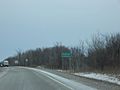
The sign for Greenleaf
-
Greenleaf Post office
-
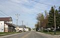
Looking east at Greenleaf along WIS 96
-
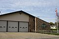
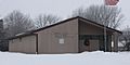
Greenleaf Fire department


See also
 In Spanish: Greenleaf (Wisconsin) para niños
