
Kewaunee County, Wisconsin facts for kids
Quick facts for kids
Kewaunee County
|
|
|---|---|

Kewaunee County Courthouse
|
|

Location within the U.S. state of Wisconsin
|
|
 Wisconsin's location within the U.S. |
|
| Country | |
| State | |
| Founded | 1859 |
| Seat | Kewaunee |
| Largest city | Algoma |
| Area | |
| • Total | 1,084 sq mi (2,810 km2) |
| • Land | 343 sq mi (890 km2) |
| • Water | 742 sq mi (1,920 km2) 68% |
| Population
(2020)
|
|
| • Total | 20,563 |
| • Estimate
(2023)
|
20,690 |
| • Density | 60.0/sq mi (23.2/km2) |
| Time zone | UTC−6 (Central) |
| • Summer (DST) | UTC−5 (CDT) |
| Congressional district | 8th |
Kewaunee County is a county located in the U.S. state of Wisconsin. In 2020, about 20,563 people lived there. The main town, called the county seat, is Kewaunee. The county was officially started in 1852 and organized in 1859. Its name comes from the Menominee word Kewāneh, which is an old name for a type of duck. Kewaunee County is part of the larger Green Bay area.
Contents
- Fun with Fishing and Boating
- Parks and Places to Explore
- Nature and Wildlife
- Farming and Animals
- Arts and Creativity
- Important Crops
- Geography of Kewaunee County
- Getting Around Kewaunee County
- Population and People
- Radio Stations
- Towns and Villages
- A Look at History
- Images for kids
- Famous People
- See also
Fun with Fishing and Boating
Kewaunee County is a great place for fishing! In 2018, it was the top county in Wisconsin for catching Chinook salmon. Fishermen caught 26,557 of these big fish here. Many tourists come to Kewaunee County just for these exciting fishing trips.
The biggest rainbow trout ever caught in Wisconsin came from Lake Michigan, near Kewaunee County. It was caught in 1997 and weighed 27 pounds, 2 ounces, and was 42.5 inches long! Other state records for fish like pink salmon and white perch were also set in Kewaunee County waters.
Since 1964, different types of salmon and trout have been added to Lake Michigan. The C.D. "Buzz" Besadny Anadromous Fish Facility helps raise young fish and collect eggs. This facility is also a fun place for people to visit and learn about fish.
Many people enjoy fishing for "suckers" in March and April. You can catch them with nets, and it's also cool to watch them swim. The "smelt run" is another popular time for fishermen.
There are 11 public places where you can launch a boat in the county. Kewaunee County also has 14 inland lakes or ponds. In 2012, over 2,250 boats were registered here. Two lighthouses, Algoma Light and Kewaunee Pierhead Light, help guide boats safely.
You can even explore shipwrecks! The Daniel Lyons shipwreck near Algoma is a popular spot for divers. The Tug Ludington in Kewaunee is an old tugboat that is now a museum you can visit.
Parks and Places to Explore
Kewaunee County has eight parks that are open to everyone. One of these is Winter Park, where the childhood home of a famous person, Ransom Asa Moore, was moved. Near the state-owned C.D. Buzz Besadny Fish Hatchery, you'll find Bruemmer Park and Zoo. The county also has two state parks: Mashek Creek Public Access and Brusky Wildlife Area. Plus, the cities of Algoma and Kewaunee, and the Village of Luxembourg, have 27 local parks.
There are four public beaches in the county. Three of them are checked regularly to make sure the water is clean and safe for swimming. You can enjoy boardwalks along the beach in Algoma and at the Kewaunee Marshland Walk. In total, there are ten places to get to Lake Michigan and Green Bay.
At the Bruemmer Park and Zoo, you can see old stone structures called limestone kilns. These were used long ago to make lime. Even though lime isn't made here anymore, there are still many places that dig up sand and gravel for building roads and other projects.
A large area of private land, about 279 acres, is open to the public for activities like hunting, fishing, hiking, and cross-country skiing. This is part of a special program called the Managed Forest Program.
Nature and Wildlife
Kewaunee County is home to many different plants and animals. The county has four important coastal wetlands: the Kewaunee River Wetland Complex, the Black Ash Swamp Area, the Ahnapee River Wetlands, and the Duvall Swamp. These wetlands are special natural areas.
Plant Life
In 2016, experts found 586 different types of plants in the county, not including mosses or liverworts. Later, in 2020, they listed 33 types of mosses and 125 types of fungi, including lichens.
Snail Species
Between 1996 and 2001, scientists found 48 different kinds of snails in Kewaunee County. This was a good number, but nearby Door and Brown counties had even more.
Bird Species and History
As of 2020, 103 different bird species have been confirmed to lay their eggs and raise their young in Kewaunee County.
A long time ago, in 1911, passenger pigeons were seen in the Black Ash Swamp. This was one of the very last times these birds were reported in Wisconsin before they sadly disappeared forever.
Farming and Animals
Kewaunee County has a lot of farms and animals. In 2018, hunters caught 3,527 deer during all the deer hunting seasons. Kewaunee County and Door County have about the same number of deer compared to the number of people living there.
Kewaunee County also has many cows! It has the third-highest number of cows compared to people in Wisconsin. In 2018, there were an estimated 97,000 cows in the county.
Arts and Creativity
Tourism in Kewaunee County helps support a local arts community. This includes people who create art like papermaking, sculptures, and paintings.
Important Crops
Farming is a big part of Kewaunee County. In 2017, the most important crops grown were hay and haylage, which covered almost 49,000 acres. Other major crops included corn (for silage and grain), soybeans, wheat, oats, and barley.
The cost to buy or rent farmland here is higher than the average for other Wisconsin counties. The soil in Kewaunee County is mostly a type called Hortonville–Symco. This soil is good for farming, but its organic matter has decreased over time due to farming.
Geography of Kewaunee County
Kewaunee County covers a total area of about 1,084 square miles. About 343 square miles of this is land, and a large part, 742 square miles (or 68%), is water. The northern part of the county is on the Door Peninsula, which is a piece of land between Green Bay and Lake Michigan. The northern end of the Kettle Moraine, a hilly area formed by glaciers, also reaches into Kewaunee County.
Neighboring Counties
- Door County – to the north
- Manitowoc County – to the south
- Brown County – to the west
- Benzie County, Michigan – across Lake Michigan to the northeast
- Manistee County, Michigan – across Lake Michigan to the southeast
Getting Around Kewaunee County
Main Roads
 Highway 29 (Wisconsin)
 Highway 42 (Wisconsin)
 Highway 54 (Wisconsin)
 Highway 57 (Wisconsin)
Special Roads and Trails
Kewaunee County has one rustic road, which is a scenic, less-traveled route. There is also a quilt trail that started in 2009, where you can see colorful quilt patterns painted on barns along the roadsides.
Railroads
- Watco
Trails for Walking and Biking
- The Ahnapee State Trail is a path that connects Kewaunee to Sturgeon Bay. Part of the famous Ice Age Trail also follows the Ahnapee State Trail in Kewaunee County. In winter, if there's enough snow, you can use snowmobiles on some trails.
- Highways 42 and 57 are part of the Lake Michigan Circle Tour, a route that goes around Lake Michigan.
- Riverview ATV Park has special trails for mountain biking that are separate from the ATV trails. It's open from May to November.
Airports
- The Rio Creek airport (also called Walter's Agri-center Airport) is privately owned but open to the public and has a campground.
- The closest international airport is the Green Bay–Austin Straubel International Airport.
Underwater Sanctuary
The Wisconsin Shipwreck Coast National Marine Sanctuary was created in 2021 in the waters of Lake Michigan. A small part of this sanctuary is off the coast of Kewaunee County. This special underwater area protects many important shipwrecks from history.
Population and People
| Historical population | |||
|---|---|---|---|
| Census | Pop. | %± | |
| 1860 | 5,530 | — | |
| 1870 | 10,128 | 83.1% | |
| 1880 | 15,807 | 56.1% | |
| 1890 | 16,153 | 2.2% | |
| 1900 | 17,212 | 6.6% | |
| 1910 | 16,784 | −2.5% | |
| 1920 | 16,091 | −4.1% | |
| 1930 | 16,037 | −0.3% | |
| 1940 | 16,680 | 4.0% | |
| 1950 | 17,366 | 4.1% | |
| 1960 | 18,282 | 5.3% | |
| 1970 | 18,961 | 3.7% | |
| 1980 | 19,539 | 3.0% | |
| 1990 | 18,878 | −3.4% | |
| 2000 | 20,187 | 6.9% | |
| 2010 | 20,574 | 1.9% | |
| 2020 | 20,563 | −0.1% | |
| U.S. Decennial Census 1790–1960 1900–1990 1990–2000 2010–2020 |
|||
Who Lives Here?
In 2020, the population of Kewaunee County was 20,563 people. Most people living here were White (93.1%). There were also smaller numbers of Native American, Asian, Black, and other racial groups. About 4.1% of the population was Hispanic or Latino.
Between 2010 and 2019, more babies were born than people passed away, which helped the population grow. Also, more people moved into the county than moved out. These two things together helped the county's population increase.
Religion in Kewaunee County
In 2010, the largest religious group in Kewaunee County was Catholics, with over 10,000 followers. They worship at St. Lawrence Catholic Church and six other churches. Other large groups included different types of Lutherans and other Christian churches. Overall, about 70% of the people in the county were part of a religious group.
Radio Stations
- WBDK (96.7 FM, Algoma)
- WRLU (FM 104.1, Algoma)
- WEZY (92.7 FM, Kewaunee)

Towns and Villages
Cities
Villages
Towns
- Ahnapee
- Carlton
- Casco
- Franklin
- Lincoln
- Luxemburg
- Montpelier
- Pierce
- Red River
- West Kewaunee
Special Places (Census-designated)
- Dyckesville (partially in Kewaunee County)
Small Communities (Unincorporated)
- Alaska
- Bay View
- Birchwood
- Bolt
- Bruemmerville
- Casco Junction
- Cherneyville
- Clyde
- Curran
- Duvall
- East Krok
- Ellisville
- Euren
- Frog Station
- Gregorville
- Kodan
- Krok
- Lincoln
- Neuren
- Norman
- Pilsen
- Rankin
- Rio Creek
- Rosiere (partially in Kewaunee County)
- Rostok
- Ryans Corner
- Slovan
- Stangelville
- Thiry Daems
- Tisch Mills (partially in Kewaunee County)
- Tonet
- Walhain
Old Communities (No Longer Exist)
A Look at History
In 1795, a person named Jacques Vieau set up a trading post in Kewaunee, but it didn't last very long.
The first Czech people arrived in the county in 1854, moving north from Milwaukee.
In the 1800s, the town of Algoma (then called Ahnapee) had some disagreements about prices and access to its piers.
In 1887, a meteorite (a rock from space) weighing almost nine pounds was found four miles west of Algoma. You can see it at the Geology Museum at UW–Madison.
In 1891, the towns of Kewaunee and Casco Junction were connected to Green Bay by a railroad. Today, part of this railroad still provides freight service to Luxembourg.
The first part of the Ahnapee and Western Railway was built in 1892.
It is believed that the first Belgian Kermiss harvest festival in the United States took place in Kewaunee County.
Images for kids
-
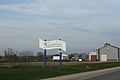
Welcome sign on WIS 54, with a farm in the background
-
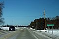
Kewaunee County sign on Highway 42, at the border with Manitowoc County
-
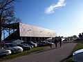
Kewaunee County fairgrounds
-
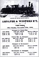
Ahnapee and Western Time Table, 1892


Famous People
To find lists of famous people from Kewaunee County, you can look at these articles:
- Luxemburg § Notable people
- Algoma § Notable people
- Kewaunee § Notable people
- Ahnapee § Notable residents
- Carlton § Notable people
- Franklin § Notable people
See also
 In Spanish: Condado de Kewaunee para niños
