
Manitowoc County, Wisconsin facts for kids
Quick facts for kids
Manitowoc County, Wisconsin
|
|||
|---|---|---|---|

Manitowoc County Courthouse
|
|||
|
|||

Map of Wisconsin showing Manitowoc County
|
|||

Wisconsin's location in the United States
|
|||
| Country | |||
| State | |||
| Incorporated | 1848 | ||
| County seat | City of Manitowoc | ||
| Incorporated Municipalities |
30 (total)
3 cities
18 towns 9 villages |
||
| Government | |||
| • Type | County | ||
| • Body | Board of Supervisors | ||
| Area | |||
| • Total | 1,494 sq mi (3,870 km2) | ||
| • Land | 589 sq mi (1,530 km2) | ||
| • Water | 905 sq mi (2,340 km2) | ||
| Area rank | 6th largest county in Wisconsin | ||
| Population
(2020)
|
|||
| • Total | 81,359 | ||
| • Estimate
(2023)
|
81,331 |
||
| • Rank | 21st largest county in Wisconsin | ||
| • Density | 138.1/sq mi (53.3/km2) | ||
| Time zone | UTC−6 (Central) | ||
| • Summer (DST) | UTC−5 (Central) | ||
| Area codes | 920 | ||
| Congressional districts | 6th | ||
| Interstates | |||
| U.S. Routes | |||
| State Routes | |||
| Airports | Manitowoc County Airport
|
||
| Waterways | Lake Michigan – Manitowoc River
|
||
| Public transit | Maritime Metro Transit | ||


Manitowoc County is a county located in the state of Wisconsin in the United States. Its name is pronounced MAN-it-ə-wok. The county seat, which is the main city where the county government is located, is Manitowoc.
The county was formed in 1836, even before Wisconsin became a state. It was officially organized in 1848. According to the 2020 census, about 81,359 people live in Manitowoc County.
Contents
Geography of Manitowoc County
Manitowoc County covers a total area of about 1,494 square miles. A large part of this area is water, specifically 905 square miles (61%). The land area is about 589 square miles.
Major Roads and Transportation
Manitowoc County has several important roads that help people travel around. These include:
- Interstate 43
- U.S. Highway 10
- U.S. Highway 151
- Highway 32 (Wisconsin)
- Highway 42 (Wisconsin)
- Highway 57 (Wisconsin)
- Highway 67 (Wisconsin)
- Highway 147 (Wisconsin)
- Highway 310 (Wisconsin)
For other ways to get around, the county also has:
- Railroads: Canadian National
- Buses: Maritime Metro Transit
- Airport: The Manitowoc County Airport serves the area.
Neighboring Counties
Manitowoc County shares borders with several other counties:
- To the northwest: Brown County
- To the northeast: Kewaunee County
- To the south: Sheboygan County
- To the west: Calumet County
- To the east and southeast (across Lake Michigan): Mason County, Michigan
- To the northeast (across Lake Michigan): Manistee County, Michigan
Wisconsin Shipwreck Coast National Marine Sanctuary
A special underwater area called the Wisconsin Shipwreck Coast National Marine Sanctuary was created in 2021. It is located in the waters of Lake Michigan, right off the coast of Manitowoc County. This sanctuary protects many old and important shipwrecks that are found there.
Climate
|
||||||||||||||||||||||||||||||||||||||||||||||||||||||||||||||||||||||||||||||||||||||||||||||||
Population and People
| Historical population | |||
|---|---|---|---|
| Census | Pop. | %± | |
| 1840 | 235 | — | |
| 1850 | 3,702 | 1,475.3% | |
| 1860 | 22,416 | 505.5% | |
| 1870 | 33,364 | 48.8% | |
| 1880 | 37,505 | 12.4% | |
| 1890 | 37,831 | 0.9% | |
| 1900 | 42,261 | 11.7% | |
| 1910 | 44,978 | 6.4% | |
| 1920 | 51,644 | 14.8% | |
| 1930 | 58,674 | 13.6% | |
| 1940 | 61,617 | 5.0% | |
| 1950 | 67,159 | 9.0% | |
| 1960 | 75,215 | 12.0% | |
| 1970 | 82,294 | 9.4% | |
| 1980 | 82,918 | 0.8% | |
| 1990 | 80,421 | −3.0% | |
| 2000 | 82,887 | 3.1% | |
| 2010 | 81,442 | −1.7% | |
| 2020 | 81,359 | −0.1% | |
| U.S. Decennial Census 1790–1960 1900–1990 1990–2000 2010–2020 |
|||
As of the 2020 census, Manitowoc County had a population of 81,359 people. This means there were about 138 people living per square mile of land. There were also 37,818 homes in the county.

In the year 2000, the county had 82,887 people living in 32,721 households. About 31.5% of these households had children under 18 living there. The average household had about 2.49 people.
The population is spread out in terms of age. About 25.5% of the people were under 18 years old. The median age, which is the middle age of all the people, was 38 years.
Communities in Manitowoc County
Manitowoc County is made up of several different types of communities:
Cities
- Kiel (partly in Calumet County)
- Manitowoc (county seat)
- Two Rivers
Villages
Towns
Census-designated places
Unincorporated communities
- Alverno
- Branch
- Cato
- Cato Falls
- Clarks Mills
- Clover
- Cooperstown
- Duveneck
- Fisherville
- Grimms
- Hickory Grove
- Kellners Corners
- Kingsbridge
- Larrabee
- Louis Corners
- Madsen
- Maple Grove
- Meeme
- Meggers (partial)
- Melnik
- Menchalville
- Millhome
- Newton
- Newtonburg
- North Grimms
- Northeim
- Osman
- Reifs Mills
- Rockville
- Rockwood
- Rosecrans
- Rube
- School Hill
- Shoto
- Spring Valley
- Steinthal
- Taus
- Tisch Mills (partial)
- Two Creeks
- Wells (partial)
- Zander
At night

In the Media
In 2017, Charlie Berens created a funny video series called Manitowoc Minute. It features a made-up news reporter who makes jokes about the culture and way of speaking in Wisconsin.
Gallery
-
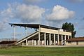
Manitowoc County Expo Grounds
-
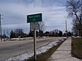
Sign marking entrance to Manitowoc County in Kiel
-
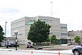
Manitowoc County Jail


See also
 In Spanish: Condado de Manitowoc para niños
