
Benzie County, Michigan facts for kids
Quick facts for kids
Benzie County
|
|
|---|---|

|
|

Location within the U.S. state of Michigan
|
|
 Michigan's location within the U.S. |
|
| Country | |
| State | |
| Founded | 1863 (created) 1869 (organized) |
| Named for | Betsie River |
| Seat | Beulah |
| Largest city | Frankfort |
| Area | |
| • Total | 860 sq mi (2,200 km2) |
| • Land | 320 sq mi (800 km2) |
| • Water | 540 sq mi (1,400 km2) 63%% |
| Population
(2020)
|
|
| • Total | 17,970 |
| • Estimate
(2023)
|
18,441 |
| • Density | 55/sq mi (21/km2) |
| Time zone | UTC−5 (Eastern) |
| • Summer (DST) | UTC−4 (EDT) |
| Congressional district | 1st |
Benzie County is a county in the U.S. state of Michigan. In 2020, about 17,970 people lived there. The main town, or county seat, is Beulah. The county was first created in 1863 and officially started working in 1869.
Benzie County is the smallest of Michigan's 83 counties by land area. It covers about 320 square miles (830 square kilometers). It is part of the larger Traverse City metropolitan area.
A big part of the beautiful Sleeping Bear Dunes National Lakeshore is in Benzie County. It is also home to Crystal Mountain, which is a popular ski resort in Michigan.
.jpg)
.jpg)

Contents
History of Benzie County
Benzie County was once part of Leelanau County. Leelanau County itself was separated from Michilimackinac County in 1840.
Later, in 1863, the northern part of Leelanau County became its own organized area. The southern part, which is now Benzie County, was then connected to Grand Traverse County. Finally, in 1869, Benzie County was officially organized as its own county.
How Benzie Got Its Name
The name "Benzie" comes from a French phrase, la rivière aux Bec-scies. This means "the river of sawbills." Sawbills are a type of duck.
Over time, Americans changed how they said the river's name, and it became known as the "Betsie River." A similar change in pronunciation led to the name "Benzie" for the county.
Geography and Nature
Benzie County is in the northwest part of Michigan's Lower Peninsula. This area is often called the "little finger" of the mitten-shaped state.
To the west, you'll find Lake Michigan. To the north are Leelanau County and the Leelanau Peninsula. Grand Traverse County is to the east. Manistee County is to the south.
The famous Sleeping Bear Dunes National Lakeshore stretches into the northwest part of the county. Crystal Lake is a very important natural feature here.
The Platte River starts in the northeast of the county. It flows into Big Platte Lake and then into Lake Michigan. The Betsie River also flows through the county. It goes through towns like Elberta and Frankfort before reaching Lake Michigan.
Parks and Forests
Parts of the Pere Marquette State Forest are in Benzie County. This forest has many trails for hiking and exploring. There are also campgrounds at Platte River and Lake Ann.
The Betsie River State Game Area is a place where wildlife is protected. About 50 miles of the Betsie River are special. They are called a "state-designated Natural River." This means the river and its surroundings are kept wild and beautiful.
The area is known for its natural beauty. Many groups work to protect the land, educate people, and offer fun outdoor activities.
Main Roads
 US 31 enters the county from the south. It goes through Benzonia and Beulah.
 M-22 runs along the western edge of the county. It offers a beautiful drive along the shore of Lake Michigan.
 M-115 comes into the county from the south. It joins US 31 for a short distance before continuing west to Frankfort.
Neighboring Counties
Benzie County shares borders with other counties:
- Leelanau County - to the north
- Grand Traverse County - to the east
- Manistee County - to the south
- Wexford County - at the southeast corner
Across Lake Michigan, Benzie County is also near:
- Door County, Wisconsin - to the northwest
- Kewaunee County, Wisconsin - to the southwest
Communities in Benzie County

City
Villages
Other Communities
There are also smaller communities and places in Benzie County, including:
- Bendon
- Crystal Downs Country Club
- Crystal Mountain
- Hardwood Acres
- Maple Grove
- Nessen City
- Pilgrim
- Crystallia
- Inland Corners
- Platte River
- Wallin
- Weldon
Townships
Benzie County is divided into several townships, which are smaller local government areas:
- Almira Township
- Benzonia Township
- Blaine Township
- Colfax Township
- Crystal Lake Township
- Gilmore Township
- Homestead Township
- Inland Township
- Joyfield Township
- Lake Township
- Platte Township
- Weldon Township
Indian Reservations
A small part of the Grand Traverse Indian Reservation is located in Benzie County. This reservation also has land in four other counties.
Population Information
| Historical population | |||
|---|---|---|---|
| Census | Pop. | %± | |
| 1870 | 2,184 | — | |
| 1880 | 3,433 | 57.2% | |
| 1890 | 5,237 | 52.5% | |
| 1900 | 9,685 | 84.9% | |
| 1910 | 10,638 | 9.8% | |
| 1920 | 6,947 | −34.7% | |
| 1930 | 6,587 | −5.2% | |
| 1940 | 7,800 | 18.4% | |
| 1950 | 8,306 | 6.5% | |
| 1960 | 7,834 | −5.7% | |
| 1970 | 8,593 | 9.7% | |
| 1980 | 11,205 | 30.4% | |
| 1990 | 12,200 | 8.9% | |
| 2000 | 15,998 | 31.1% | |
| 2010 | 17,525 | 9.5% | |
| 2020 | 17,970 | 2.5% | |
| 2023 (est.) | 18,441 | 5.2% | |
| U.S. Decennial Census 1790-1960 1900-1990 1990-2000 2010-2018 |
|||
In 2000, there were about 15,998 people living in Benzie County. By 2020, the population had grown to 17,970 people.
Education in Benzie County
The Northwest Educational Services helps students in Benzie County. They also help students in nearby counties like Antrim and Grand Traverse. This group offers special education, early childhood programs, and career training.
Benzie County has several public school districts:
- Benzie County Central Schools serves most of the county. This includes towns like Benzonia, Beulah, and Honor.
- Frankfort-Elberta Area Schools serves the western part of the county. This includes Frankfort and Elberta.
- Glen Lake Community Schools serves a small part of Platte Township.
- Traverse City Area Public Schools serves a small part of Almira Township.
There is also one private school in Benzie County, called New Covenant Christian Academy.
Images for kids
-
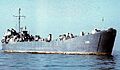
USS Benzie County LST-266

See also
 In Spanish: Condado de Benzie para niños
