Leelanau County, Michigan facts for kids
Quick facts for kids
Leelanau County
|
|||
|---|---|---|---|
|
|||
|
|||
| Nickname(s):
"Michigan's Little Finger"
|
|||
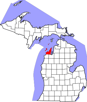
Location within the U.S. state of Michigan
|
|||
 Michigan's location within the U.S. |
|||
| Country | |||
| State | |||
| Founded | 1840 (created) 1863 (organized) |
||
| Named for | Leelanau Peninsula | ||
| Seat | Suttons Bay Township | ||
| Largest settlement | Greilickville Suttons Bay (incorporated) |
||
| Area | |||
| • Total | 2,532 sq mi (6,560 km2) | ||
| • Land | 347 sq mi (900 km2) | ||
| • Water | 2,185 sq mi (5,660 km2) 86%% | ||
| Population
(2020)
|
|||
| • Total | 22,301 | ||
| • Estimate
(2023)
|
23,019 |
||
| • Density | 63/sq mi (24/km2) | ||
| Time zone | UTC−5 (Eastern) | ||
| • Summer (DST) | UTC−4 (EDT) | ||
| Congressional district | 1st | ||
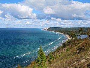
Leelanau County is a beautiful area in the state of Michigan, USA. It is known for its stunning natural beauty, especially the Sleeping Bear Dunes National Lakeshore. In 2020, about 22,301 people lived here.
The county seat, which is like the main office for the county government, is in Suttons Bay Township. This area is part of the Traverse City metropolitan area in Northern Michigan. The largest town in Leelanau County is Greilickville.
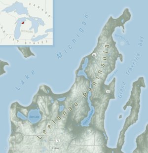
Leelanau County is located on the Leelanau Peninsula. This peninsula is shaped like a triangle and stretches about 30 miles (48 km) into Lake Michigan. To the east of the county is Grand Traverse Bay, which is also part of Lake Michigan.
In 2011, the famous Sleeping Bear Dunes National Lakeshore was voted the "Most Beautiful Place in America." This was in a poll by the morning news show Good Morning America.
Contents
What's in a Name? Leelanau's Meaning
The name "Leelanau" has an interesting story. For a long time, people thought it was a Native American word meaning "delight of life." However, this isn't quite right.
A man named Henry Schoolcraft, who studied Native American cultures, often used the name "Leelinau" for Native American women in his stories. He even made up many "fake" Native American place names in Michigan. He used sounds from different languages, even though the Ojibwa language (a Native American language) doesn't have the "L" sound.
More recently, experts found out that "Leelinau" was first used by Henry's wife, Jane Johnston Schoolcraft. She used it as a pen name for her writings in a family magazine called The Literary Voyager in the 1820s.
Jane Johnston was part Ojibwa and part Scots-Irish. She wrote in both Ojibwe and English. Even though her writings weren't officially published during her lifetime, she is now recognized as a very important Native American writer. She was the first known Native American woman writer and poet. In 2008, Jane Johnston Schoolcraft was added to the Michigan Women's Hall of Fame.
Leelanau County's Past
Leelanau County was first set up as a separate area in 1840 by the Michigan Legislature. In 1851, it was managed by Grand Traverse County. It was even called "Leelanau Township" for a short time.
In 1863, Leelanau County became its own organized county. That same year, the southern part of Leelanau County was separated to form Benzie County.
The Sleeping Bear Dunes National Lakeshore was created in 1970. This helped protect a lot of the beautiful natural scenery in the area. In 2008, the county seat moved from Leland to Suttons Bay Township. This new location is close to the town of Lake Leelanau.
Leelanau's Amazing Geography
Leelanau County covers a total area of about 2,532 square miles (6,558 km²). Most of this area, about 86%, is water! Only 347 square miles (899 km²) is land.
The county is entirely on the Leelanau Peninsula. This triangular piece of land sticks out about 30 miles (48 km) from Michigan's Lower Peninsula into Lake Michigan. The peninsula forms the western side of Grand Traverse Bay. At its widest point, it's about 20 miles (32 km) across.
Leelanau County has the second-highest amount of water area compared to its land area of any county in the United States. Lake Leelanau is the biggest inland lake in the county. It flows into Lake Michigan through the Leland River.
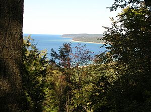
Glen Lake, which is inside the Sleeping Bear Dunes National Lakeshore, is thought to be one of the most beautiful lakes in the world. A large part of the Sleeping Bear Dunes National Lakeshore, including North Manitou and South Manitou Islands, is within the county. Leelanau has worked hard to protect its natural areas.
The very southeastern part of Leelanau County, especially parts of Elmwood Township, has more buildings and people. This is because it's close to Traverse City, which is the largest city in Northern Michigan.
Neighboring Counties
Leelanau County shares borders with other counties:
By land
- Grand Traverse County (southeast)
- Benzie County (southwest)
By water
- Schoolcraft County (north)
- Charlevoix County (northeast)
- Antrim County (east)
- Door County, Wisconsin (west)
- Delta County (northwest)
Towns and Communities
Leelanau County has several different types of communities:
Cities
- Traverse City (partially)
Villages
Charter township
- Elmwood Charter Township
Civil townships
- Bingham Township
- Centerville Township
- Cleveland Township
- Empire Township
- Glen Arbor Township
- Kasson Township
- Leelanau Township
- Leland Township
- Solon Township
- Suttons Bay Township (county seat)
Census-designated places
These are areas with a lot of people that are counted like towns for the census:
Unincorporated communities
These are smaller communities that are not officially organized as cities or villages:
- Bingham
- Burdickville
- Fouch
- Fountain Point
- Glen Haven
- Isadore
- Keswick
- Northport Point
- Peshawbestown
- Solon
Ghost towns
These are places where towns used to be, but now very few or no people live there:
- Ahgosatown
- Bodus
- Crescent
- Crystal Spring
- Good Harbor
- Hatchs
- Heimforth
- Jacktown
- Kasson
- North Unity
- Onominese
- Oviatt
- Port Oneida
- Schomberg
- Waukazooville
Indian reservation
- The Grand Traverse Band of Ottawa and Chippewa Indians has lands scattered within Suttons Bay Township.
Leelanau County's Population
| Historical population | |||
|---|---|---|---|
| Census | Pop. | %± | |
| 1860 | 2,158 | — | |
| 1870 | 4,576 | 112.0% | |
| 1880 | 6,253 | 36.6% | |
| 1890 | 7,944 | 27.0% | |
| 1900 | 10,556 | 32.9% | |
| 1910 | 10,608 | 0.5% | |
| 1920 | 9,061 | −14.6% | |
| 1930 | 8,206 | −9.4% | |
| 1940 | 8,436 | 2.8% | |
| 1950 | 8,647 | 2.5% | |
| 1960 | 9,321 | 7.8% | |
| 1970 | 10,872 | 16.6% | |
| 1980 | 14,007 | 28.8% | |
| 1990 | 16,527 | 18.0% | |
| 2000 | 21,119 | 27.8% | |
| 2010 | 21,708 | 2.8% | |
| 2020 | 22,301 | 2.7% | |
| 2023 (est.) | 23,019 | 6.0% | |
| U.S. Decennial Census 2010-2018 |
|||
In 2020, the population of Leelanau County was 22,301 people. The county has grown steadily over the years.
Culture and Wineries
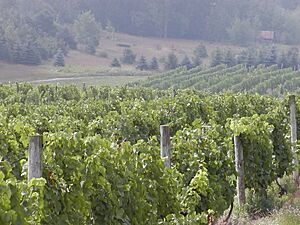
The Leelanau Peninsula is home to 26 wineries! This area is special because it sits along the 45th parallel. This line of latitude is known for growing excellent grapes for wine.
The two Grand Traverse Bays help create a perfect climate for grapes, and the soil is very rich. Northern Michigan is especially good at growing white grapes. It's famous for its Riesling wines, which grow well during the summer and late fall.
Local wineries have an annual harvest festival in October. Some Riesling grapes are left on the vines until they freeze. These frozen grapes are then used to make a special kind of wine called ice wine. These wineries are all part of the Leelanau Peninsula AVA, which means it's a recognized wine-growing region.
Education in Leelanau County
The Northwest Educational Services, located in Traverse City, helps students in Leelanau County. It also serves students in Antrim, Benzie, Grand Traverse, and Kalkaska counties.
This organization offers special education services and programs for young children. It also helps students who are learning English. Plus, it provides technical career training for students in its school districts.
Leelanau County has several public school districts:
- Glen Lake Community Schools
- Leland Public School District
- Northport Public School District
- Suttons Bay Public Schools
- Traverse City Area Public Schools
The county also has independent charter schools:
- Leelanau Montessori Public School Academy
And there are private schools too:
- St. Mary School (Roman Catholic)
- The Leelanau School (nonsectarian, boarding)
- The Pathfinder School (nonsectarian)
Getting Around Leelanau County
Major Highways

 M-22 / LMCT: This highway follows the beautiful shoreline of Lake Michigan. It enters the county near Empire and goes through towns like Glen Arbor and Leland. It then turns south through Omena and Suttons Bay before leaving the county near Traverse City.
 M-72: This highway runs east to west across the bottom of the Leelanau Peninsula. It starts at M-22 in Empire and continues for about 22 miles (35 km) before meeting M-22 again in Traverse City.
- M-109: This highway is in the northwestern part of the county. It starts at M-22 north of Empire and goes north along the west side of Glen Lake. It then turns east into Glen Arbor, where it ends back at M-22.
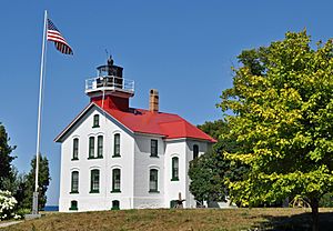
- M-201: This is a short highway in the north. It starts at M-22 south of Northport and goes into the village. It connects to other roads that lead to Leelanau State Park and the Grand Traverse Light.
- M-204: This highway connects the east and west sides of the peninsula about halfway up. It starts at M-22 south of Leland and goes east through Lake Leelanau. It passes the Leelanau County Governmental Center before ending at M-22 in Suttons Bay.
There was once another highway, M-209, which was Michigan's shortest highway until 1995.
Bicycle Route
 USBR 35: This bike route enters Leelanau County from the southwest. It follows M-22 and M-109 along the west side of the peninsula. Then it turns east along M-204 and south again along M-22 in Suttons Bay. Finally, it follows the Leelanau Trail south into Grand Traverse County.
Air Travel
The closest airport with commercial flights is Cherry Capital Airport in Traverse City. Leelanau County also has smaller local airstrips, like Woolsey Memorial Airport.
Famous People from Leelanau County
- Jim Harrison – a well-known author who lived in Leland Township for a long time.
- Kathleen Sebelius – she used to be the Secretary of US Health and Human Services and a former governor of Kansas. She vacations at a summer home in Leland that her grandfather built.
- The village of Northport and the surrounding Leelanau Township are known as a quiet place where famous people can live without being bothered. For example, Chef Mario Batali lives north of town, and actor Tim Allen used to spend summers in Northport. Financier Mark Spitznagel spends his summers in Northport Point, a fancy community near the village.
See also
 In Spanish: Condado de Leelanau para niños
 | Misty Copeland |
 | Raven Wilkinson |
 | Debra Austin |
 | Aesha Ash |


