Grand Traverse County, Michigan facts for kids
Quick facts for kids
Grand Traverse County
|
||
|---|---|---|
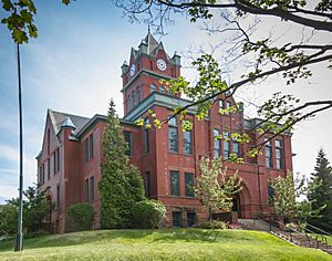
Grand Traverse County Courthouse in Traverse City
|
||
|
||
| Nickname(s):
"GTC"
|
||
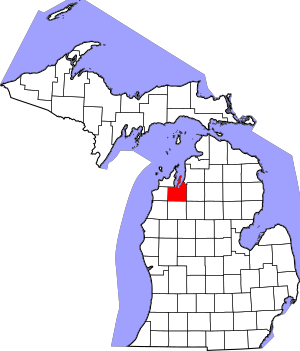
Location within the U.S. state of Michigan
|
||
 Michigan's location within the U.S. |
||
| Country | ||
| State | ||
| Founded | 1840 1851 (organized) |
|
| Named for | Grand Traverse Bay | |
| Seat | Traverse City | |
| Largest city | Traverse City | |
| Area | ||
| • Total | 601 sq mi (1,560 km2) | |
| • Land | 464 sq mi (1,200 km2) | |
| • Water | 137 sq mi (350 km2) 23% | |
| Population
(2020)
|
||
| • Total | 95,238 | |
| • Estimate
(2023)
|
96,421 |
|
| • Density | 205/sq mi (79/km2) | |
| Time zone | UTC−5 (Eastern) | |
| • Summer (DST) | UTC−4 (EDT) | |
| Congressional district | 1st | |
Grand Traverse County is a county located in the U.S. state of Michigan. As of the 2020 census, about 95,238 people lived here. This makes it the largest county in Northern Michigan by population. Its main city, or county seat, is Traverse City. The county is part of the Traverse City metropolitan area. This area also includes nearby Benzie, Kalkaska, and Leelanau counties.
For a long time, this land was part of the territory of the Council of Three Fires. These were Native American groups including the Ojibwe, Odawa, and Potawatomi people. The first European settlement in Grand Traverse County was started in 1839. The county was first created in 1840 as Omeena County. However, it was renamed Grand Traverse County in 1851. Both the county and Traverse City get their names from Grand Traverse Bay, a large bay of Lake Michigan.
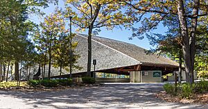
Interlochen Center for the Arts, a famous boarding school for young artists, is located in the county.
Contents
History of Grand Traverse County
Before European settlers arrived, Grand Traverse County was home to Native American groups. These included the Ojibwe, Odawa, and Potawatomi people. They were part of the Council of Three Fires. These people called the area at the head of Grand Traverse Bay gichi-wiikwedoongsing. This means 'place at the head of the great bay' in the Ojibwe language.
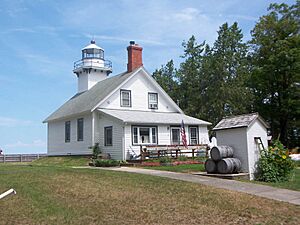
The first permanent settlement in the county was a mission. It is now known as Old Mission. It was set up in May 1839 and called "Grand Traverse." The name Grand Traverse Bay comes from French explorers in the 1700s. They called their journey across the mouth of the bay la grande traversée, which means "the long crossing."
How the County Was Formed
The Michigan Legislature created Omeena County in 1840. It was separated from part of Michilimackinac County. The name Omeena comes from an Ojibwe phrase, o-me-nah, meaning "is it so?"
On April 7, 1851, a law officially organized Omeena County. It was then renamed Grand Traverse County. The main city for the government, the county seat, was chosen as Boardman's Mills. This place later became Traverse City. Other future counties were connected to Grand Traverse County for a while. These included Antrim, Benzie, Kalkaska, Leelanau, Manistee, Missaukee, and Wexford. They later became their own counties.
However, the 1851 law did not explain how to create townships or choose election officials. So, Grand Traverse County did not have a legal government until 1858. That winter, another state law completed the county's organization. It divided the county into two first townships:
- Peninsula Township, which included the Old Mission Peninsula.
- Traverse Township, which covered the rest of the county.
Today, Grand Traverse County has thirteen townships. In 1884, an article said the Traverse Region was known for its "productive soil, healthy climate and beautiful scenery."
Historical Markers to See
There are 12 special historical markers in the county. These markers tell about important places and events. They include:
- City Opera House
- Congregation Beth El
- Dougherty Mission House
- Fife Lake–Union District No. 1 Schoolhouse
- Friends Meetinghouse
- Grand Traverse Bay
- Hannah and Lay Mercantile Building
- Hesler Log House
- Interlochen
- Ladies Library Association
- Novotny's Saloon
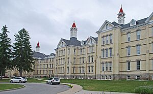
- Traverse City Regional Psychiatric Hospital
Geography of Grand Traverse County
Grand Traverse County covers about 601 square miles. About 464 square miles is land, and 137 square miles (23%) is water. It is considered part of Northern Michigan. The highest point in the county is Exodus Hill in Long Lake Township. The lowest point is Grand Traverse Bay.
The county has many important lakes. These include Arbutus Lake, Fife Lake, Green Lake, Silver Lake, and Spider Lake. Part of Elk Lake is also here. The county's biggest inland lake is Long Lake.
The Old Mission Peninsula stretches about 17 miles into Grand Traverse Bay. It is part of Grand Traverse County and mostly in Peninsula Township. Power Island, an island in Grand Traverse Bay, is also part of Peninsula Township.
Rivers in the County
- Betsie River: This river starts at Green Lake. It flows west into Benzie County and eventually reaches Lake Michigan.
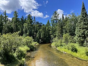
- Boardman River: This river enters from the east from Kalkaska County. It flows west and north until it reaches West Bay in Traverse City.
- Platte River: This river begins at Long Lake. It flows west to Lake DuBonnet and into Benzie County, then ends at Lake Michigan.
Neighboring Counties
Grand Traverse County shares borders with these counties:
- Antrim County (northeast)
- Kalkaska County (east)
- Missaukee County (southeast)
- Wexford County (south)
- Manistee County (southwest)
- Benzie County (west)
- Leelanau County (northwest)
Protected Natural Areas
- Pere Marquette State Forest
State Parks to Visit
- Interlochen State Park
- Keith J. Charters Traverse City State Park
- Old Mission State Park
Communities in Grand Traverse County
Cities
- Traverse City (This is the county seat, and part of it is also in Leelanau County.)
Villages
- Fife Lake
- Kingsley
Charter Townships
- East Bay Township
- Garfield Township
- Long Lake Township
Civil Townships
- Acme Township
- Blair Township
- Fife Lake Township
- Grant Township
- Green Lake Township
- Mayfield Township
- Paradise Township
- Peninsula Township
- Union Township
- Whitewater Township
Census-Designated Places
These are areas that are like towns but are not officially incorporated.
Other Small Communities
- Acme
- Brookside
- Devils Elbow
- Fivemile Corner
- Hannah
- Hilltop
- Jacks Landing
- Karlin
- Long Lake
- Mapleton
- Mayfield
- Monroe Center
- Neahtawanta
- Old Mission
- Summit City
- Walton
- Wexford Corner
- Williamsburg
- Yuba
Places That No Longer Exist (Ghost Towns)
- Angell
- Archie
- Bates
- Bartlett
- Beitner
- Cedar Run
- Diamond Park
- Duck Lake Park
- East Bay
- Hilltop
- Hodge
- Keystone
- Kratochvil's Plat
- Lakeside Resort
- Mabel
- McManus Corner
- Moffatt
- Munro
- Neal
- Ogdensburg
- Pavlovic Corner
- Peninsula Resort
- Slights
- Skegemog Point
- Traverse Point
- Westminster
- Wylie
Native American Reservation
Population Changes in Grand Traverse County
| Historical population | |||
|---|---|---|---|
| Census | Pop. | %± | |
| 1860 | 1,286 | — | |
| 1870 | 4,443 | 245.5% | |
| 1880 | 8,422 | 89.6% | |
| 1890 | 13,355 | 58.6% | |
| 1900 | 20,479 | 53.3% | |
| 1910 | 23,784 | 16.1% | |
| 1920 | 19,518 | −17.9% | |
| 1930 | 20,011 | 2.5% | |
| 1940 | 23,390 | 16.9% | |
| 1950 | 28,598 | 22.3% | |
| 1960 | 33,490 | 17.1% | |
| 1970 | 39,175 | 17.0% | |
| 1980 | 54,899 | 40.1% | |
| 1990 | 64,273 | 17.1% | |
| 2000 | 77,654 | 20.8% | |
| 2010 | 86,986 | 12.0% | |
| 2020 | 95,238 | 9.5% | |
| 2023 (est.) | 96,421 | 10.8% | |
| U.S. Decennial Census 1790-1960 1900-1990 1990-2000 2010-2018 |
|||
In 2000, there were 77,654 people living in Grand Traverse County. By 2020, the population had grown to 95,238 people. The county is mostly made up of White residents (96.51% in 2000). Other groups include Native American, Black or African American, and Asian people. About 1.49% of the population was Hispanic or Latino in 2000. Most people (96.4%) spoke only English at home.
In 2000, about 25.4% of the population was under 18 years old. About 13.1% were 65 years or older. The average age was 38 years.
Education in Grand Traverse County
Schools for Kids and Teens
Grand Traverse County has several public school districts:
- Benzie Central Schools (BCS) serves the very southwestern part of the county.
- Buckley Community School District (BCSD) serves the southwest.
- Elk Rapids Schools (ERS) serves the northeastern areas.
- Forest Area Community Schools (FACS) serves the southeast, including Fife Lake.
- Manton Consolidated Schools (MCS) serves a small area in the very southeastern corner.
- Kingsley Area Schools (KAS) serves the south-central part, around Kingsley.
- Traverse City Area Public Schools (TCAPS) serves most of the county, centered in Traverse City. This district has two high schools: Traverse City Central and Traverse City West.
The county also has smaller charter and private schools. Many of these are part of Grand Traverse Area Catholic Schools.
Colleges and Higher Education
Grand Traverse County is home to Northwestern Michigan College. This is a public community college located in Traverse City.

Economy and Jobs in Grand Traverse County
Many people work in Grand Traverse County. Here are some of the largest employers as of 2017:
| # | Employer | Full-time employees |
|---|---|---|
| 1 | Munson Healthcare | 3,100 |
| 2 | Traverse City Area Public Schools | 1,800 |
| 3 | Northwestern Michigan College | 750 |
| 4 | Grand Traverse Resort and Spa | 550 |
| 5 | Hagerty Insurance Agency | 500 |
| 6 | Grand Traverse County | 500 |
| 7 | Interlochen Center for the Arts | 475 |
| 8 | Grand Traverse Pavilions | 415 |
| 9 | Britten Banners | 380 |
| 10 | Tyson Foods | 300 |
Transportation in Grand Traverse County
Air Travel
Grand Traverse County has a commercial airport called Cherry Capital Airport. It is near Traverse City. This airport serves the 21 counties in Northern Michigan. It has flights to different cities across the United States all year and during certain seasons. In 2019, it was the fourth busiest airport in Michigan.
Other smaller airports in the county include:
- Acme Skyport
- Green Lake Airport
- Tramps Aerodrome
- Yuba Airport
Main Roads and Highways
 US 31: This highway goes through the county in different directions. It is one of the busiest roads in Northern Michigan, especially through Traverse City. It connects to cities like Charlevoix and Petoskey to the north. To the southwest, it connects to Ludington and Muskegon.
 US 131: This highway runs through the far southeast of the county, only in Fife Lake Township. It connects to Kalkaska and Petoskey to the north. To the south, it connects to cities like Cadillac, Grand Rapids, and Kalamazoo.
 M-22: This road starts in Traverse City. It goes northwest along the Grand Traverse Bay. It then continues into Leelanau County, following the bay shore.
 M-37: This is the longest highway in the county. It runs north-south. It enters the county near Buckley and goes north to the Old Mission Peninsula through Traverse City.
 M-72: This road goes east-west. It enters the county from the northwest and passes through Traverse City. It continues east toward Kalkaska, going through Williamsburg.
- M-113: This is an east-west road in the south of the county. It connects M-37 to US 131. It passes through Kingsley and Walton.
 M-186: This is a short road that connects M-113 directly to US 131 at Fife Lake.
Bicycle Routes
 USBR 35: This bike route runs alongside Grand Traverse Bay. It uses different roads and local trails, including parts of the TART Trails system.
See also
 In Spanish: Condado de Grand Traverse para niños
 | Precious Adams |
 | Lauren Anderson |
 | Janet Collins |


