
Buckley, Michigan facts for kids
Quick facts for kids
Buckley, Michigan
|
|
|---|---|
|
Village
|
|
| Village of Buckley | |
.jpg)
Looking west along the curve on M-37
|
|

Location within Wexford County
|
|

Buckley, Michigan
Location in Michigan

Buckley, Michigan
Location in the United States
|
|
| Country | |
| State | |
| County | Wexford |
| Founded | 1905 |
| Incorporated | 1907 |
| Government | |
| • Type | Village council |
| Area | |
| • Total | 1.89 sq mi (4.88 km2) |
| • Land | 1.82 sq mi (4.72 km2) |
| • Water | 0.07 sq mi (0.17 km2) |
| Elevation | 1,050 ft (320 m) |
| Population
(2020)
|
|
| • Total | 775 |
| • Density | 425.59/sq mi (164.28/km2) |
| Time zone | UTC-5 (Eastern (EST)) |
| • Summer (DST) | UTC-4 (EDT) |
| ZIP code(s) |
49620
|
| Area code(s) | 231 |
| FIPS code | 26-11480 |
| GNIS feature ID | 2397486 |
Buckley is a small village located in Wexford County, in the state of Michigan. In 2020, about 775 people lived there. This was more than the 697 people counted in 2010. The village is part of Hanover Township. It is just south of the Grand Traverse County border. Buckley is about 6.5 miles (10.5 km) north of Mesick. It is also about 20 miles (32 km) northwest of Cadillac. Traverse City is about 15 miles (24 km) south of Buckley.
Contents
History of Buckley
The area where Buckley is now was once part of an old path. This path was known as the Old Indian Trail. It connected the areas of Cadillac and Traverse City.
Buckley started in 1905 as a stop for trains. The Manistee and North-Eastern Railroad operated this station. The community got its name from a local business. This business was called the Buckley & Douglas Lumber Company. A post office for Buckley opened on March 31, 1906. The community officially became a village in 1907.
Geography of Buckley
Buckley covers a total area of about 1.84 square miles (4.77 square kilometers). Most of this area, about 1.78 square miles (4.61 square kilometers), is land. A small part, about 0.06 square miles (0.16 square kilometers), is water.
Main Roads
 M-37 is a major road that goes through the village. It runs from north to south.
People of Buckley
| Historical population | |||
|---|---|---|---|
| Census | Pop. | %± | |
| 1910 | 464 | — | |
| 1920 | 352 | −24.1% | |
| 1930 | 236 | −33.0% | |
| 1940 | 217 | −8.1% | |
| 1950 | 194 | −10.6% | |
| 1960 | 247 | 27.3% | |
| 1970 | 244 | −1.2% | |
| 1980 | 357 | 46.3% | |
| 1990 | 402 | 12.6% | |
| 2000 | 550 | 36.8% | |
| 2010 | 697 | 26.7% | |
| 2020 | 775 | 11.2% | |
| U.S. Decennial Census | |||
Buckley in 2010
In 2010, the village of Buckley had 697 people living there. There were 246 households and 175 families. The village had about 392 people per square mile (151 people per square kilometer). There were 300 homes in total.
Most of the people in Buckley were White (95.3%). Some residents were African American, Native American, or Asian. About 2.0% of the population identified as Hispanic or Latino.
About 42.7% of households had children under 18 living with them. More than half (51.6%) were married couples. The average household had 2.83 people. The average family had 3.23 people.
The average age of people in the village was 30.2 years. About 31.3% of residents were under 18 years old. About 7.2% were 65 years or older.
Images for kids
-
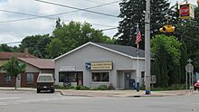
U.S. Post Office in Buckley -
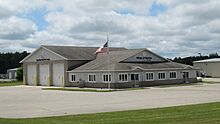
Village offices and fire department


See also
 In Spanish: Buckley (Míchigan) para niños
