
Wexford County, Michigan facts for kids
Quick facts for kids
Wexford County
|
|||
|---|---|---|---|
.jpg)
Wexford County Courthouse in Cadillac
|
|||
|
|||
| Nickname(s):
"Wex"
|
|||

Location within the U.S. state of Michigan
|
|||
 Michigan's location within the U.S. |
|||
| Country | |||
| State | |||
| Founded | 1840 (created) 1869 (organized) |
||
| Named for | County Wexford, Ireland | ||
| Seat | Cadillac | ||
| Largest city | Cadillac | ||
| Area | |||
| • Total | 575.46 sq mi (1,490.4 km2) | ||
| • Land | 565.00 sq mi (1,463.3 km2) | ||
| • Water | 10.46 sq mi (27.1 km2) 1.8%% | ||
| Population
(2020)
|
|||
| • Total | 33,673 | ||
| • Density | 59.2/sq mi (22.9/km2) | ||
| Time zone | UTC−5 (Eastern) | ||
| • Summer (DST) | UTC−4 (EDT) | ||
| Congressional districts | 1st, 2nd | ||


Wexford County is a county located in the northern part of Michigan, a state in the United States. In 2020, about 33,673 people lived here. The main city and county seat is Cadillac. It is also the biggest city in Wexford County.
Much of Wexford County is covered by the Manistee National Forest. This means it has many trees and woodlands. The Manistee River flows through the northern part of the county. Briar Hill, the highest point in Michigan's Lower Peninsula, is also found here. It stands about 1,706 feet (520 meters) tall.
Wexford County is also famous for something mysterious! It is where the first known sighting of the Michigan Dogman was reported in 1887.
Contents
History of Wexford County

The Michigan Legislature created this county in 1840. It was first called Kautawaubet County. This name came from a Potawatomi phrase meaning "broken tooth." It was also the name of a local Potawatomi chief.
In 1843, lawmakers changed the county's name to Wexford. They named it after County Wexford in Ireland. The county was officially set up and started working in 1869.
Geography and Nature
The United States Census Bureau says Wexford County covers about 575 square miles. Most of this area, about 565 square miles, is land. The rest, about 10 square miles, is water.
Main Roads
Several important roads pass through Wexford County. These roads help people travel around the county and connect to other areas.
 US 131


Bus. US 131
Bus. US 131 M-37
M-37 M-42
M-42 M-55
M-55 M-115
M-115
Neighboring Counties
Wexford County shares borders with several other counties:
- Grand Traverse County - to the north
- Kalkaska County - to the northeast
- Missaukee County - to the east
- Osceola County - to the southeast
- Lake County - to the southwest
- Manistee County - to the west
- Benzie County - to the northwest
Protected Natural Areas
A part of the Manistee National Forest is located within Wexford County. This forest is a protected area. It offers many chances for outdoor activities.
Communities in Wexford County
Wexford County has several towns and villages. These are places where people live and work.
Cities
Villages
Census-Designated Places
These are areas that look like towns but are not officially incorporated as cities or villages.
Other Unincorporated Communities
These are smaller communities that are not officially part of a city or village.
Townships
Wexford County is divided into several townships. These are smaller local government areas.
- Antioch Township
- Boon Township
- Cedar Creek Township
- Cherry Grove Township
- Clam Lake Township
- Colfax Township
- Greenwood Township
- Hanover Township
- Haring Township
- Henderson Township
- Liberty Township
- Selma Township
- Slagle Township
- South Branch Township
- Springville Township
- Wexford Township
Population Changes Over Time
| Historical population | |||
|---|---|---|---|
| Census | Pop. | %± | |
| 1870 | 650 | — | |
| 1880 | 6,815 | 948.5% | |
| 1890 | 11,278 | 65.5% | |
| 1900 | 16,845 | 49.4% | |
| 1910 | 20,769 | 23.3% | |
| 1920 | 18,207 | −12.3% | |
| 1930 | 16,827 | −7.6% | |
| 1940 | 17,976 | 6.8% | |
| 1950 | 18,628 | 3.6% | |
| 1960 | 18,466 | −0.9% | |
| 1970 | 19,717 | 6.8% | |
| 1980 | 25,102 | 27.3% | |
| 1990 | 26,360 | 5.0% | |
| 2000 | 30,484 | 15.6% | |
| 2010 | 32,735 | 7.4% | |
| 2020 | 33,673 | 2.9% | |
| 2023 (est.) | 34,122 | 4.2% | |
| US Decennial Census 1790–1960 1900–1990 1990–2000 2010–2018 |
|||
The population of Wexford County has grown a lot since 1870. In 2020, the county had 33,673 people. This shows how the area has developed over many years.
Fun Things to Do in Wexford County
Wexford County has many exciting places to visit and activities to enjoy.
- The Manistee National Forest is a great spot for outdoor fun.
- The Manistee River is popular for fishing, kayaking, and canoeing.
- There are many lakes, with Cadillac and Mitchell being the largest.
- Over 200 miles of snowmobile trails are kept ready by a volunteer group.
- You can find at least eight golf courses near Cadillac.
- Several museums near Cadillac teach about the area's history.
- The Wexford Civic Center is a large place for events. It has an arena for hockey and buildings for agricultural shows.
Schools and Learning
The Wexford–Missaukee Intermediate School District helps schools in the county. It offers special education and career programs.
Here are the public school districts in Wexford County:
- Buckley Community Schools
- Cadillac Area Public Schools
- Manton Consolidated Schools
- Mesick Consolidated Schools
The county also has one charter school:
- Highpoint Virtual Academy of Michigan
There are also private schools in Wexford County:
- Cadillac Heritage Christian School
- Northview Adventist School (part of the Seventh-day Adventist Church)
- St. Ann School (a Catholic school)
Historical Markers

Wexford County has several places with special historical markers. These markers tell important stories about the county's past.
- Battle of Manton
- Caberfae Ski Resort
- Cadillac Carnegie Library
- Charles T. Mitchell House
- Clam Lake Canal
- Cobbs & Mitchell Building
- Cobbs and Mitchell Mill No.1
- First Wexford County Courthouse
- Greenwood Disciples of Christ Church
- Shay Locomotive
Images for kids
-

Wexford County Courthouse in Cadillac
-

Flag of Wexford County, Michigan
-

Seal of Wexford County, Michigan
-
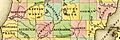
A map from 1842 showing Wexford County as "Kawtawwabet."
-

The Charles T. Mitchell House in Cadillac, a recognized historical site.
See also
 In Spanish: Condado de Wexford (Míchigan) para niños
