Manistee National Forest facts for kids
Quick facts for kids Manistee National Forest |
|
|---|---|
|
IUCN Category VI (Managed Resource Protected Area)
|
|
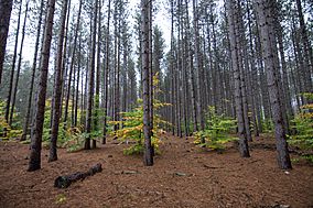
Red Pine plantation in the Manistee National Forest
|
|
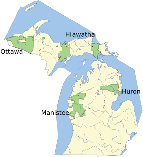
Map showing National Forests in Michigan
|
|
| Location | Lower Peninsula, Michigan |
| Area | Total - 978,906 acres (3,960 km2) Huron - 438,584 acres (1,770 km2) Manistee - 540,322 acres (2,190 km2) |
| Established | 1938 |
| Governing body | U.S. Forest Service |
| Website | Huron-Manistee National Forests |
The Manistee National Forest is a large national forest located in the Lower Peninsula of Michigan. It covers about 540,187 acres (2,186 km2) of land. This forest was created in 1938. Later, in 1945, it joined with the Huron National Forest for management. Together, they are known as the Huron-Manistee National Forests. Even though they are managed together, they are two separate forest areas. They are not connected to each other.
People love visiting the Manistee National Forest for many outdoor activities. You can go hiking, fishing, and camping here. Boating, snowmobiling, and cross-country skiing are also popular. Many people also enjoy hunting in the forest. The famous North Country Trail runs through it. This trail connects with the 11-mile Manistee River Trail. Together, they form a fun 23-mile loop for hikers. The highest point in Michigan's Lower Peninsula, Briar Hill, is found here. It stands at 1,706 feet (520 meters) tall. The Manistee National Forest is not one big block of land. Instead, it's like a "mosaic" with private properties and towns mixed in. The main office for the forest is in Cadillac, Michigan.
Contents
Forest History
The Manistee National Forest has a special history. It was created from lands that people gave up because of taxes. It also included lands bought after the big logging era ended. After many trees were cut down, the land was not good for farming. Much of the forest had also burned. By the 1930s, new trees had not yet grown back.
In the 1920s, people in Michigan started caring more about planting trees and protecting nature. Across the United States, there was a big push to save forests and wildlife. President Theodore Roosevelt was a leader in this movement. In 1938, President Franklin D. Roosevelt officially created the Manistee National Forest. One of his main goals was to replant all the areas where trees had been cut. His new program, the Civilian Conservation Corps (CCC), helped with this. Young men worked for the CCC during the Great Depression. They replanted most of Michigan's empty lands.
Forest Geography
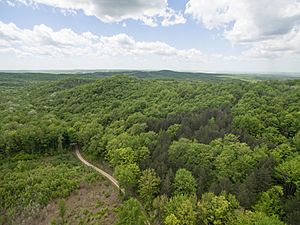
The land in the Manistee National Forest is mostly forest. Underneath are layers of sedimentary rocks. These are covered by a thick layer of glacial drift, which can be up to 1,000 feet (305 meters) deep. You can often see hills made by glaciers, flat plains, and old shorelines. The soil in these areas is mostly sand. There are also many underground water sources called aquifers. These feed thousands of miles of cold water streams. The streams flow at a steady rate all year.
The forest has a mix of different trees. You will find both hardwoods and pines. The most common tree is the red pine (Pinus resinosa). A special sight in all Michigan National Forests is the long, straight rows of planted red pines. The Civilian Conservation Corps planted these trees in the 1930s. Today, many of these trees are over 75 feet (23 meters) tall. They are an important source of wood for timber sales. The largest continuous red pine plantation in North America is in the Manistee National Forest. It is called the Kellog Plantation.
The Manistee National Forest spreads across several counties in Michigan. These include Lake, Newaygo, Wexford, Manistee, Mason, Oceana, Muskegon, Mecosta, and Montcalm counties. You can find local ranger offices in Baldwin and Manistee.
The Lumberjack 100 is a challenging 100-mile mountain bike race. It takes place in the forest every year. If you want to camp freely on National Forest lands, you can! This is called dispersed camping. You just need to follow the rules on the USFS website. Some simple campgrounds might need a reservation or a small fee. If you want to cut firewood, you need a special permit. This permit works only for the Manistee National Forest.
Special Features
Nordhouse Dunes Wilderness
The Nordhouse Dunes Wilderness is a very special part of the Manistee National Forest. This area is about 3,450 acres (14 km2) in size. It sits on the eastern shore of Lake Michigan. It is one of the few wilderness areas in the U.S. with many lake shore dunes. Most of these dunes are very old, about 3,500 to 4,000 years old. Some dunes stand about 140 feet (43 meters) higher than the lake. The Nordhouse Dunes have trees and plants mixed in, like juniper, jack pine, and hemlock. There are also many small ponds and wet areas. Dune grass covers many of the dunes. The beach here is wide and sandy.
Briar Hill
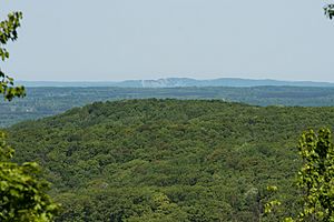
Briar Hill is the second highest point in the Lower Peninsula of Michigan. It is 1,706 feet (520 meters) tall. This hill was formed by glaciers. It is mostly covered with hardwood trees that have grown back. There are no marked trails to the very top. The views from the summit are not very wide. You can still see the old foundations of a steel fire tower. There is also a survey marker from the U.S. Geological Survey. Interestingly, it spells the hill's name as "Brier Hill."
Caberfae Peaks Ski & Golf Resort
The Caberfae Peaks Ski & Golf Resort is located within the Manistee National Forest. It is in the Caberfae Hills region. This area gets a lot of lake-effect snow from Lake Michigan. The resort first opened in January 1938. This makes it one of the oldest ski resorts in the United States.
Rivers and Trails
Several important rivers flow through the forest. The most well-known are the Manistee, Pere-Marquette, Pine, Muskegon, and the Little Manistee. These rivers were very important for moving logs to sawmills long ago. Today, they are popular places for canoeing, fishing, hunting, and hiking.
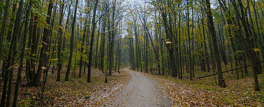
One popular hiking spot is a 23-mile loop trail. It is made up of the Manistee River Trail and the North Country Scenic Trail. You can start this loop from different access points. These include the Red Bridge and Seaton Creek (for the Manistee River Trail). You can also use the Marilla and Upper River Road Trailheads (for the North Country Scenic Trail). Many backpackers plan to hike the whole loop in 2 to 3 days. They set up campsites in the backcountry overnight.
 | Percy Lavon Julian |
 | Katherine Johnson |
 | George Washington Carver |
 | Annie Easley |


