Huron–Manistee National Forests facts for kids
Quick facts for kids Huron–Manistee National Forests |
|
|---|---|
|
IUCN Category VI (Managed Resource Protected Area)
|
|

|
|

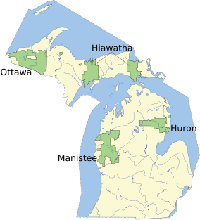
Map showing National Forests in Michigan.
|
|
| Location | Lower Peninsula, Michigan |
| Area | Total - 978,906 acres (3,960 km2) Huron - 438,584 acres (1,770 km2) Manistee - 540,322 acres (2,190 km2) |
| Established | Huron - 1909 Manistee - 1938 |
| Governing body | U.S. Forest Service |
| Website | Huron–Manistee National Forests |
Imagine a huge outdoor playground in Michigan! That's what the Huron–Manistee National Forests are like. They are actually two big national forests, the Huron National Forest and the Manistee National Forest, that work together. They cover almost a million acres of land in the northern part of Michigan, including lots of wetlands.
These forests are super important! They give us clean air and water, and they're amazing places for fun activities. They also provide homes for many animals and plants. Plus, they offer resources like wood for local businesses. The forests are managed by the U.S. Forest Service from their main office in Cadillac, Michigan.
Contents
A Look Back: How the Forests Started
The Huron National Forest was created in 1909. Later, the Manistee National Forest was established in 1938. In 1945, these two forests started working together under one management team. Even though they are managed together, they are not right next to each other. The Manistee Forest is a bit larger, making up about 55% of the total area.
The Huron National Forest sometimes has natural forest fires. This happens because of the types of trees there, especially the jack pine. Their needles catch fire easily. The sandy soil, left behind by glaciers, also plays a role. Sometimes, fires are even part of managing the forest to help a special bird called the Kirtland's warbler. This bird needs young jack pine trees to nest, which can be very prone to wildfires.
In 2010, a big fire called the Meridian Boundary Fire burned over 8,500 acres in the Huron National Forest area. It sadly destroyed or damaged many homes and other buildings.
Exploring the Forests: What You Can See and Do

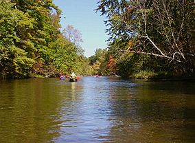
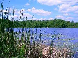
The Huron–Manistee National Forests have tons of water! There are over 1,800 miles of rivers and 17,000 acres of lakes. These waterways are perfect homes for many different fish and wildlife. They also offer lots of chances for outdoor fun. Some of the important rivers here include the Pine, Manistee, Pere Marquette, and Au Sable rivers. These rivers are famous for canoeing and fishing. You can also find over 330 miles of trails for hiking.
There are so many activities to do in the Huron-Manistee National Forests! You can go hiking, camping, hunting, and fishing. People also love picnicking, snowmobiling, and taking scenic drives. If you like off-road vehicles, there are special trails for that too. You can even gather some natural resources, like firewood, with a permit.
The forests have many developed spots for visitors. These include campgrounds, picnic areas, and places to enjoy scenic views. Most campgrounds have restrooms, fire rings, and picnic tables. You might need to make a reservation and pay a small fee to use these spots. If you prefer a more rustic experience, you can often camp in other areas for free, as long as there are no special rules against it.
The Manistee National Forest Section
The Manistee National Forest is in the northwest part of lower Michigan. It has sandy land covered with many trees. You'll find lots of lakes and even parts that touch Lake Michigan. This area is very popular for fishing, camping, boating, snowmobiling, cross-country skiing, and hunting. The famous North Country Trail also runs through it.
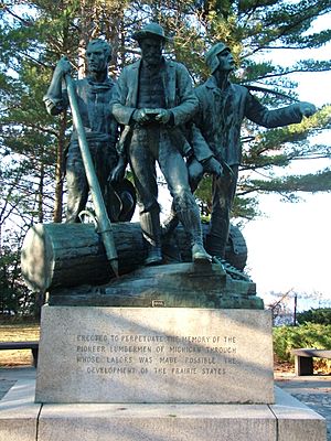
The Manistee Forest is not one big block of land. It has private properties and towns mixed in. Much of this land was left behind by logging companies many years ago. An exciting 100-mile mountain bike race, the Lumberjack 100, happens here every year.
A special place in the Manistee Forest is the Nordhouse Dunes Wilderness. This area is about 3,450 acres and sits on the eastern shore of Lake Michigan. It's one of only two designated wilderness areas in Michigan. It has amazing dunes that are 3,500 to 4,000 years old. Some dunes are about 140 feet taller than the lake! These dunes have plants like juniper and jack pine growing on them. You can also find small ponds and marshes. The beach here is wide and sandy. You can get to the Nordhouse Dunes from the north at the Lake Michigan Recreation Site or from the south off Nurmberg Road.
The Huron National Forest Section
The Huron National Forest is in the northeast part of lower Michigan. It covers about 438,538 acres. You can find local ranger offices in Mio and Oscoda.
Off-Road Vehicle Trails
The Huron-Manistee National Forests have about 6,997 miles of primitive scenic roads. They also have 3,730 miles of forest system roads for off-road vehicle (ORV) use. The Manistee part of the forest has four special ORV trail systems:
- The Cedar Creek Motorsport Trail is 24 miles long and designed for ORV use. It runs along Pine Creek.
- The Holton Motorcycle Trail is 28 miles long and goes through thick oak-pine forests.
- The Horseshoe Motorcycle Trail is 32 miles long and is surrounded by oak trees and ferns.
- The Michigan Cross-Country Cycle Trail is a huge 177-mile trail that goes through many parts of the Manistee Forest.
The Bull Gap ORV Trail is located in the Huron part of the forests. It has 115 miles of ORV trails.
Amazing Animals and Plants
The Huron-Manistee National Forests are home to five species that are protected by law because they are threatened or endangered. These include the majestic Bald Eagle, the Indiana bat, the beautiful Karner blue butterfly, and the unique Pitcher's thistle. The threatened Kirtland's warbler bird also nests here. You can even take tours to see these special birds, but only at certain times of the year.
See also
 | Laphonza Butler |
 | Daisy Bates |
 | Elizabeth Piper Ensley |


