Lake County, Michigan facts for kids
Quick facts for kids
Lake County
|
|
|---|---|

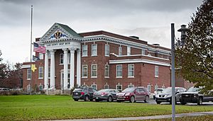
Lake County Courthouse
|
|

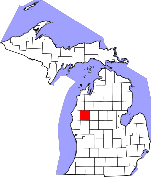
Location within the U.S. state of Michigan
|
|
 Michigan's location within the U.S. |
|
| Country | |
| State | |
| Founded | 1840, organized 1871. |
| Seat | Baldwin |
| Largest village | Baldwin |
| Area | |
| • Total | 574 sq mi (1,490 km2) |
| • Land | 567 sq mi (1,470 km2) |
| • Water | 6.9 sq mi (18 km2) 1.2%% |
| Population
(2020)
|
|
| • Total | 12,096 |
| • Density | 20/sq mi (8/km2) |
| Time zone | UTC−5 (Eastern) |
| • Summer (DST) | UTC−4 (EDT) |
| Congressional district | 2nd |
Lake County is a county located in the state of Michigan. It used to be known as Aishcum County. The main town, or county seat, is Baldwin. In 2020, about 12,096 people lived in Lake County.
Contents
History of Lake County
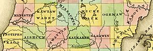
Lake County was first created by the Michigan government in 1840. Back then, it was called Aishcum County. A few years later, in 1843, its name was changed to Lake County. This new name was chosen because the area has many beautiful lakes. The county officially started its own local government in 1871.
Geography and Nature
Lake County covers a total area of 574 square miles. Most of this area, about 567 square miles, is land. The rest, about 6.9 square miles, is water.
Main Roads in Lake County
- US 10 comes into Lake County from Mason County. It goes through Baldwin and then continues east into Osceola County.
- M-37 enters Lake County from Newaygo County. It also passes through Baldwin and then goes north towards Wexford County.
Protected Natural Areas
A part of the Manistee National Forest is located within Lake County. This is a large area of protected land with forests and natural beauty.
Neighboring Counties
Lake County shares its borders with several other counties:
- To the east: Osceola County
- To the southwest: Oceana County
- To the northeast: Wexford County
- To the west: Mason County
- To the northwest: Manistee County
- To the south: Newaygo County
- To the southeast: Mecosta County
Population of Lake County
| Historical population | |||
|---|---|---|---|
| Census | Pop. | %± | |
| 1870 | 548 | — | |
| 1880 | 3,233 | 490.0% | |
| 1890 | 6,505 | 101.2% | |
| 1900 | 4,957 | −23.8% | |
| 1910 | 4,939 | −0.4% | |
| 1920 | 4,437 | −10.2% | |
| 1930 | 4,066 | −8.4% | |
| 1940 | 4,798 | 18.0% | |
| 1950 | 5,257 | 9.6% | |
| 1960 | 5,338 | 1.5% | |
| 1970 | 5,661 | 6.1% | |
| 1980 | 7,711 | 36.2% | |
| 1990 | 8,583 | 11.3% | |
| 2000 | 11,333 | 32.0% | |
| 2010 | 11,539 | 1.8% | |
| 2020 | 12,096 | 4.8% | |
| 2023 (est.) | 12,734 | 10.4% | |
| U.S. Decennial Census 1790-1960 1900-1990 1990-2000 2010-2018 |
|||
In 2000, there were 11,333 people living in Lake County. The population was spread out, with about 21.9% of people being under 18 years old. About 19.7% of the population was 65 years or older. The average age in the county was 43 years old.
Communities in Lake County
Villages
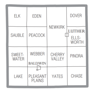
Townships
- Chase Township
- Cherry Valley Township
- Dover Township
- Eden Township
- Elk Township
- Ellsworth Township
- Lake Township
- Newkirk Township
- Peacock Township
- Pinora Township
- Pleasant Plains Township
- Sauble Township
- Sweetwater Township
- Webber Township
- Yates Township
Other Small Communities
Education in Lake County
The West Shore Educational Service District helps schools in Lake County. This district is based in Ludington. It provides special education services and career programs for students.
Lake County has one main public school district, which is called Baldwin Community Schools.
See also
 In Spanish: Condado de Lake (Míchigan) para niños
 | Precious Adams |
 | Lauren Anderson |
 | Janet Collins |


