
Mecosta County, Michigan facts for kids
Quick facts for kids
Mecosta County
|
|
|---|---|

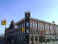
Nisbett Building, senior housing building in Big Rapids.
|
|

Location within the U.S. state of Michigan
|
|
 Michigan's location within the U.S. |
|
| Country | |
| State | |
| Founded | April 1, 1840; organized February 11, 1859 |
| Named for | Mecosta |
| Seat | Big Rapids |
| Largest city | Big Rapids |
| Area | |
| • Total | 571 sq mi (1,480 km2) |
| • Land | 555 sq mi (1,440 km2) |
| • Water | 16 sq mi (40 km2) 2.8%% |
| Population
(2020)
|
|
| • Total | 39,714 |
| • Density | 77/sq mi (30/km2) |
| Time zone | UTC−5 (Eastern) |
| • Summer (DST) | UTC−4 (EDT) |
| Congressional district | 2nd |
Mecosta County (pronounced mə-KOSS-tə) is a county located in the U.S. state of Michigan. In 2020, about 39,714 people lived there. The main city and county seat is Big Rapids.
The county gets its name from Chief Mecosta. He was a leader of the Potawatomi Native American tribe. His people used to travel the local rivers and lakes to find fish and game. Chief Mecosta was one of the people who signed the Treaty of Washington in 1836.
The many easy-to-use waterways helped the lumber industry grow quickly. Workers started settling in the area in 1851. The county was officially set up with its own government in 1859. Mecosta County has over 100 lakes, rivers, and streams. The Muskegon River flows through Big Rapids, which was first called Leonard.
Mecosta County was first created on April 1, 1840. For a while, it was managed by Kent County. Later, in 1857, it was connected to Newaygo County. The county government officially started on February 11, 1859. The village of Leonard became its main city.
Mecosta County is part of the Big Rapids, MI, Micropolitan Statistical Area. It is also included in the larger Grand Rapids-Wyoming-Muskegon, MI, Combined Statistical Area.
Contents
Exploring Mecosta County's Past
The boundaries for Mecosta County were set on April 1, 1840. This happened after a survey was approved on February 22, 1839.
In 1852, John Davis bought 160 acres (0.65 km²) in Mecosta Township. John Parish bought 57 acres (0.23 km²) in Big Rapids. They were the first people to live in the county permanently. On July 20, 1852, the first family, William and Margaret Brockway and their two children, moved into a logging cabin. On February 12, 1853, their daughter, Alice Victoria Brockway, was born. She was the first white child born in the county.
In March 1854, Zerah and George French moved to the area with their family. They are known as the co-founders of Big Rapids. In 1855, James and Laura Montague became the third family to settle. They had a 160-acre (0.65 km²) farm in Green Township.
In February 1858, Leonard (Big Rapids) Township and Green Township were officially organized. The first township elections were held on April 5, 1858. On February 11, 1859, Mecosta County was officially organized. The Village of Leonard was chosen as the county seat. The first county officials were elected on April 4. The population of Mecosta County was 671 people in 1860.
The first newspaper, the Big Rapids Pioneer, was printed on April 17, 1862. It was owned by Charlie Gay and Ceylon C. Fuller. The paper has been published for over 140 years.
The plan for the Village of Big Rapids was recorded on November 3, 1859. The city of Big Rapids was officially made a city in April 1869. The first city elections were held on April 19, 1869. By 1870, Mecosta County had 5,642 residents.
The Grand Rapids and Indiana Railroad was the first train line to enter Mecosta County. In June 1869, it crossed the Little Muskegon River, and the Village of Morley was created. The railroad reached Big Rapids on June 20, 1870.
Early county prisoners were kept in the sheriff's house or other nearby jails. The first county jail was built in 1868. The current county jail was finished in 1965 and has been updated since.
By 1880, Mecosta County had 13,973 people. In 1883, voters approved building a county courthouse. Construction started in 1885 and finished in 1886. The current Mecosta County Building was completed in 1970.
In the early 1900s, water power from dams helped make furniture and other wood products. Mining for oil, gas, sand, and gravel also became important. While logging was big early on, health services and education have become very important to the community. Mecosta County has grown to over 42,000 people. It offers many chances in industry, education, and small-town living.
African Americans first settled in Mecosta County in the 1860s. James Guy got 160 acres (0.65 km²) in Wheatland Township. His land deed was signed by Abraham Lincoln. The Homestead Act of 1862 allowed settlers to claim 160 acres. This led to African Americans owning 1,392 acres (5.63 km²) in the area where Remus is today. They were woodsmen and farmers who built schools and churches. These "Old Settlers" are celebrated every year with a reunion in the Remus area.
Woodbridge N. Ferris started the Ferris Industrial School in 1884 in Big Rapids. He later became a Michigan governor. This school grew into Ferris Institute, then Ferris State College, and is now Ferris State University. By 1928, Ferris had taught 50,000 students. Today, it is home to the Bulldogs and is a major university.
Tourism has grown steadily in Mecosta County. It is now an important way the county earns money. With its many lakes, streams, and rivers, there are endless opportunities for water sports and fishing. There are also golf courses, bike trails, and other outdoor activities.
The Ice Mountain Bottling Plant
In 2009, a group called Michigan Citizens for Water Conservation won a big case against Nestle Waters North America. This case started in 1999. The Ice Mountain bottling plant in Stanwood, Mecosta County, began taking groundwater in 2002. This water is considered "spring water."
The citizens were worried because the Michigan Department for Environmental Quality (MDEQ) was not closely watching the bottling plant. They formed their own group to protect Michigan's water. In 2003, the MDEQ said the plant had "a measurable impact on certain waters and wetlands."
In 2009, they reached an agreement. Nestle/Ice Mountain had to reduce how much water they pumped by almost half. They also agreed to pump less water in the spring during fish spawning season. They would continue low pumping in the summer to protect the streams and lakes.
Geography of Mecosta County
The U.S. Census Bureau says Mecosta County covers 571 square miles (1,479 km²). About 555 square miles (1,437 km²) is land, and 16 square miles (41 km²) (2.8%) is covered by water.
Protected Natural Areas
- Manistee National Forest (part of it is in Mecosta County)
Neighboring Counties
- Osceola County (north)
- Lake County (northwest)
- Clare County (northeast)
- Isabella County (east)
- Montcalm County (south & southeast)
- Newaygo County (west & southwest)
Mecosta County Population Over Time
| Historical population | |||
|---|---|---|---|
| Census | Pop. | %± | |
| 1860 | 970 | — | |
| 1870 | 5,642 | 481.6% | |
| 1880 | 13,973 | 147.7% | |
| 1890 | 19,697 | 41.0% | |
| 1900 | 20,693 | 5.1% | |
| 1910 | 19,466 | −5.9% | |
| 1920 | 17,765 | −8.7% | |
| 1930 | 15,738 | −11.4% | |
| 1940 | 16,902 | 7.4% | |
| 1950 | 18,968 | 12.2% | |
| 1960 | 21,051 | 11.0% | |
| 1970 | 27,992 | 33.0% | |
| 1980 | 36,961 | 32.0% | |
| 1990 | 37,308 | 0.9% | |
| 2000 | 40,553 | 8.7% | |
| 2010 | 42,798 | 5.5% | |
| 2020 | 39,714 | −7.2% | |
| 2023 (est.) | 41,099 | −4.0% | |
| U.S. Decennial Census 1790-1960 1900-1990 1990-2000 2010-2018 |
|||
In 2000, there were 40,553 people living in Mecosta County. The population density was about 73 people per square mile (28 people/km²). Most people (92.68%) were White. About 3.60% were Black or African American.
About 29.10% of households had children under 18. The average household had 2.49 people. The average family had 2.95 people.
The median age in the county was 32 years old. This means half the people were younger than 32 and half were older. For every 100 females, there were about 102.8 males.
The median income for a household was $33,849. For a family, it was $40,465. About 16.1% of the population lived below the poverty line. This included 16.6% of those under 18.
Getting Around Mecosta County
Bus Services
- MOTA
- Dial-a-Ride
Main Highways
 US 131


Bus. US 131 M-20
M-20 M-66
M-66
County Roads
 B-96
B-96
Key Employers in Mecosta County
Some of the biggest employers in the county are:
- Ferris State University, in Big Rapids
- Haworth, in Big Rapids
- Spectrum Health, in Big Rapids
- Wolverine Worldwide, in Big Rapids
Communities of Mecosta County
Cities
- Big Rapids (This is the county seat)
Villages
Census-Designated Place
Smaller Unincorporated Communities
Townships
- Aetna Township
- Austin Township
- Big Rapids Township
- Chippewa Township
- Colfax Township
- Deerfield Township
- Fork Township
- Grant Township
- Green Charter Township
- Hinton Township
- Martiny Township
- Mecosta Township
- Millbrook Township
- Morton Township
- Sheridan Township
- Wheatland Township
Education in Mecosta County
The Mecosta–Osceola Intermediate School District is based in Big Rapids. It helps school districts in the county. This district offers special education services and programs for students who need extra support. It also has technical career programs.
Mecosta County has these public school districts:
- Big Rapids Public Schools
- Chippewa Hills School District
- Morley Stanwood Community Schools
The county also has one charter school:
- Crossroads Charter Academy
Mecosta County has these private schools:
- Brockway Christian Academy (Methodist)
- St. Michael Elementary School (Catholic)
- St. Peters Lutheran School (Lutheran)
Images for kids
-
Nisbett Building, senior housing building in Big Rapids.
See also
 In Spanish: Condado de Mecosta para niños
