
Kent County, Michigan facts for kids
Quick facts for kids
Kent County
|
|||
|---|---|---|---|

Kent County Courthouse
|
|||
|
|||

Location within the U.S. state of Michigan
|
|||
 Michigan's location within the U.S. |
|||
| Country | |||
| State | |||
| Founded | March 2, 1831 (created) 1836 (organized) |
||
| Named for | James Kent | ||
| Seat | Grand Rapids | ||
| Largest city | Grand Rapids | ||
| Area | |||
| • Total | 872 sq mi (2,260 km2) | ||
| • Land | 847 sq mi (2,190 km2) | ||
| • Water | 25 sq mi (60 km2) 2.9%% | ||
| Population
(2020)
|
|||
| • Total | 657,974 | ||
| • Estimate
(2023)
|
661,354 |
||
| • Density | 766/sq mi (296/km2) | ||
| Time zone | UTC−5 (Eastern) | ||
| • Summer (DST) | UTC−4 (EDT) | ||
| Congressional districts | 2nd, 3rd | ||


Kent County is a county in the U.S. state of Michigan. In 2020, over 657,000 people lived here. This makes it the fourth most populated county in Michigan. It is also the largest county outside the Detroit area.
The main city and county seat of Kent County is Grand Rapids. The county was officially created in 1831 and fully organized in 1836. It is named after James Kent, a famous judge from New York.
Kent County is part of the Grand Rapids–Kentwood Metropolitan Area. It is a major center for business and making things in West Michigan. The Frederik Meijer Gardens are a popular cultural spot here. The Gerald R. Ford International Airport is the main airport for the county.
Contents
History of Kent County
The Grand River flows through Kent County. Long ago, the Hopewell people lived along its west bank. They left behind burial mounds. Later, in the 1700s, the Odawa people moved to this area. They built many villages along the Grand River valley. By the 1800s, there were more than 1,000 Odawa people living here.
The fur trade became very important in the early 1800s. Traders like Rix Robinson and Louis Campau were among the first in the area. In 1826, Campau set up a trading post in Grand Rapids. He bought land and planned out the town in 1831. Many people see Campau as the "father" of Grand Rapids.
Another person, Lucius Lyon, bought land north of Campau's property. Campau planned his part of the town using Native American trails. Lyon planned his part using a straight grid pattern. This meant there were two towns next to each other with different layouts! Later, Campau combined them under the name Grand Rapids.
In 1831, Kent County was separated from Kalamazoo County. Grand Rapids became the county's first official village in 1838. By the end of the 1800s, many sawmills were built. This helped the area grow into a big center for farming, logging, and making furniture.
Exploring Kent County's Geography
.jpeg)
Kent County covers about 872 square miles. Most of this (847 square miles) is land, and 25 square miles (2.9%) is water. The highest point in Kent County is Fisk Knob Park. It is in Solon Township and stands at 1048 feet high.
Rivers Flowing Through Kent County
- Grand River: This big river flows through the county from east to west. It eventually empties into Lake Michigan.
- Flat River: This river enters the county from the east. It joins the Grand River in Lowell.
- Thornapple River: This river comes into the county from the south. It meets the Grand River in Ada.
- Rogue River: This river enters from the north. It joins the Grand River in Belmont.
Fun Trails for Hiking and Biking
Kent County has many trails for outdoor fun:
- North Country Trail: This trail runs north to south through the whole county. It passes through Cedar Springs and Lowell. Lowell is actually the halfway point of this national trail!
- Thornapple Trail: This trail starts in Kentwood. It goes southeast through Dutton and Caledonia.
- White Pine Trail: This trail begins in Comstock Park. It heads northeast through Rockford and Cedar Springs.
- Kent Trails: This trail runs north to south from John Ball Park in Grand Rapids. It also has a part that goes east/west along 76th Street.
- Frederik Meijer Trail: This trail is still being finished. It will connect the Kent Trails and the Thornapple Trail.
- Cannon Township Trail: This trail is in the eastern part of the county. It runs through Cannon Township.
Neighboring Counties
.jpeg)
Kent County shares borders with these counties:
- Newaygo County - to the north
- Montcalm County - to the northeast
- Muskegon County - to the northwest
- Ionia County - to the east
- Ottawa County - to the west
- Allegan County - to the southwest
- Barry County - to the southeast
People of Kent County
| Historical population | |||
|---|---|---|---|
| Census | Pop. | %± | |
| 1840 | 2,587 | — | |
| 1850 | 12,016 | 364.5% | |
| 1860 | 30,716 | 155.6% | |
| 1870 | 50,403 | 64.1% | |
| 1880 | 73,253 | 45.3% | |
| 1890 | 109,922 | 50.1% | |
| 1900 | 129,714 | 18.0% | |
| 1910 | 159,145 | 22.7% | |
| 1920 | 183,041 | 15.0% | |
| 1930 | 240,511 | 31.4% | |
| 1940 | 246,338 | 2.4% | |
| 1950 | 288,292 | 17.0% | |
| 1960 | 363,187 | 26.0% | |
| 1970 | 411,044 | 13.2% | |
| 1980 | 444,506 | 8.1% | |
| 1990 | 500,631 | 12.6% | |
| 2000 | 574,335 | 14.7% | |
| 2010 | 602,622 | 4.9% | |
| 2020 | 657,974 | 9.2% | |
| 2023 (est.) | 661,354 | 9.7% | |
| U.S. Decennial Census 1790–1960 1900–1990 1990–2000 2010–2019 |
|||

In 2020, there were 657,977 people living in Kent County.
- About 72% were White.
- About 11% were Black or African American.
- About 3.5% were Asian.
- About 0.7% were Native American.
- About 3.3% were of two or more races.
- About 11% of the people were Hispanic or Latino.
Most people in Kent County (90%) speak English at home. About 6% speak Spanish.
Getting Around: Transportation in Kent County
Air Travel
You can fly in and out of Grand Rapids from Gerald R. Ford International Airport (GRR). This airport has a special place in history. It was the first airport in the U.S. to have regular airline service. This started on July 31, 1926, with flights between Grand Rapids and Detroit.
Bus Service
The Rapid is the public bus system in Kent County. It serves nine different towns. The Rapid has 23 bus routes, including special services like the Silver Line.
Train Service
Amtrak offers train service to Chicago from the passenger station. This train is called the Pere Marquette. For moving goods, freight trains are run by CN and CSX Transportation. There is also a local train line called the Grand Rapids Eastern Railroad.
Major Roads and Highways
Many important roads run through Kent County:
 I-96
I-96 I-196 (Gerald R. Ford Freeway)
 I-296 (which runs with US 131)
 US 131
 M-6 (Paul B. Henry Freeway)
 M-11
M-11 M-21
M-21 M-37
M-37 M-44
M-44 M-45 (Lake Michigan Drive)
 M-46
M-46 M-50
M-50 M-57
M-57- M-121
Businesses and Economy
Many companies have their main offices in Kent County. Here are some of them:
- Acrisure in Grand Rapids
- Amway in Ada
- American Seating in Grand Rapids
- Bissell Homecare in Walker
- Buell Motorcycle Company in Cascade Township
- Gordon Food Service in Wyoming
- Founders Brewing Company in Grand Rapids
- Meijer in Walker
- Old Orchard in Sparta
- Perrigo in Grand Rapids
- Steelcase in Grand Rapids
- Wolverine Worldwide in Rockford
- X-Rite in Kentwood
- Zondervan in Cascade Township
Towns and Communities

Cities in Kent County
- Cedar Springs
- East Grand Rapids
- Grand Rapids (the county seat)
- Grandville
- Kentwood
- Lowell
- Rockford
- Walker
- Wyoming
Villages in Kent County
Townships in Kent County
- Ada Township
- Algoma Township
- Alpine Township
- Bowne Township
- Byron Township
- Caledonia Charter Township
- Cannon Township
- Cascade Charter Township
- Courtland Township
- Gaines Charter Township
- Grand Rapids Charter Township
- Grattan Township
- Lowell Charter Township
- Nelson Township
- Oakfield Township
- Plainfield Charter Township
- Solon Township
- Sparta Township
- Spencer Township
- Tyrone Township
- Vergennes Township
Other Communities
- Byron Center
- Cannonsburg
- Comstock Park
- Cutlerville
- Forest Hills
- Northview
- Ada
- Alaska
- Alto
- Belmont
- Cascade
- Dutton
Images for kids
-
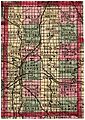
A map of Kent County from 1885, showing its townships.

See also
 In Spanish: Condado de Kent (Míchigan) para niños
