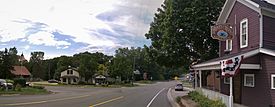
Cannonsburg, Michigan facts for kids
Quick facts for kids
Cannonsburg, Michigan
|
|
|---|---|

Intersection of Cannonsburg and Honey Creek
|
|
| Country | United States |
| State | Michigan |
| County | Kent |
| Township | Cannon |
| Settled | 1842 |
| Area | |
| • Total | 0.42 sq mi (1.10 km2) |
| • Land | 0.42 sq mi (1.09 km2) |
| • Water | 0.00 sq mi (0.01 km2) |
| Elevation | 781 ft (238 m) |
| Population
(2020)
|
|
| • Total | 203 |
| • Density | 482.19/sq mi (186.02/km2) |
| Time zone | UTC-5 (Eastern (EST)) |
| • Summer (DST) | UTC-4 (EDT) |
| ZIP code(s) | |
| Area code(s) | 616 |
| GNIS feature ID | 1617970 |
Cannonsburg is a small community in Kent County, Michigan. It's called an unincorporated community because it doesn't have its own local government, like a city or town does. It's also a census-designated place (CDP), which means the government counts its population for statistics. Cannonsburg is located inside Cannon Township, about 10 miles (16 km) northeast of the big city of Grand Rapids.
Contents
History of Cannonsburg
Cannonsburg started as a settlement in 1842. This area was once part of Plainfield Township. The first settlers built it on an old trail used by Native American tribes. The Chippewa and Ottawa people lived here before European settlers arrived.
Early Development
In 1844 and 1845, Edwin B. Bostwick built mills in the area. H.T. Judson worked as the architect for these buildings. To encourage more people to move there, the community was officially mapped out in 1848. Some records say this happened in 1845.
Bostwick was a business agent for LeGrand Cannon, who was a rich man from New York. Cannon invested in railroads and steamboats. He told Bostwick to give a piece of land to anyone who wanted to settle there and didn't already have a place. Twenty-five lots were given away for free. The town was named "Cannonsburg" to honor LeGrand Cannon. He thanked them by sending a small cannon engraved with his name and the date.
Township Formation
The first official record of the area being a separate township was on April 6, 1846. The Michigan Legislature (the state's law-making body) had organized the town. It was first called "Churchtown" in the spring of 1846, or 1845 according to some sources. Soon after, the name was changed to "Cannon" because Cannonsburg was the largest settlement there.
Post Office and Growth
A post office opened in Cannonsburg on May 7, 1844. At first, the name was spelled "Cannonsburgh." The spelling changed to "Cannonsburg" on February 5, 1894. Today, the Cannonsburg ZIP code 49317 is only for P.O. Box services. Cannonsburg was important for township business for a long time. However, by the end of the 1900s, the township offices moved to a new spot about 2 miles north, near the M-44 road.
Recent Changes
For the 2020 census, Cannonsburg was listed as a new census-designated place. This means it's included for counting people and gathering statistics. However, Cannonsburg is still an unincorporated community. It does not have its own local government or laws.
Population Information
| Historical population | |||
|---|---|---|---|
| Census | Pop. | %± | |
| 2020 | 203 | — | |
| U.S. Decennial Census | |||
In 2020, the U.S. Census counted 203 people living in Cannonsburg.
 | Laphonza Butler |
 | Daisy Bates |
 | Elizabeth Piper Ensley |


