Ionia County, Michigan facts for kids
Quick facts for kids
Ionia County
|
||
|---|---|---|

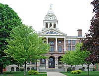
Ionia County Courthouse in Ionia
|
||
|
||

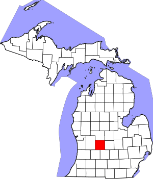
Location within the U.S. state of Michigan
|
||
 Michigan's location within the U.S. |
||
| Country | ||
| State | ||
| Founded | March 2, 1831 (created) 1837 (organized) |
|
| Named for | Ionia | |
| Seat | Ionia | |
| Largest city | Ionia | |
| Area | ||
| • Total | 580 sq mi (1,500 km2) | |
| • Land | 571 sq mi (1,480 km2) | |
| • Water | 8.7 sq mi (23 km2) 1.5%% | |
| Population
(2020)
|
||
| • Total | 66,804 | |
| • Density | 112/sq mi (43/km2) | |
| Time zone | UTC−5 (Eastern) | |
| • Summer (DST) | UTC−4 (EDT) | |
| Congressional district | 2nd | |
Ionia County (pronounced eye-OH-nyuh) is a cool place in the state of Michigan, USA. It's home to over 66,000 people, according to the 2020 census. The main town, or county seat, is called Ionia. The beautiful Ionia County Courthouse was designed by a famous architect named Claire Allen.
Ionia County is also part of the larger Grand Rapids-Kentwood area, which is a big group of cities and towns connected together.
Contents
History of Ionia County
Ionia County gets its name from Ionia, a very old and historic area in Greece. It was first created in 1831 and officially organized in 1837.
Geography of Ionia County
Ionia County covers a total area of about 580 square miles. Most of this area, about 571 square miles, is land. The rest, about 8.7 square miles, is water. That's about 1.5% of the county's total area.
Neighboring Counties
Ionia County shares its borders with several other counties:
- Gratiot County to the northeast
- Montcalm County to the north
- Clinton County to the east
- Kent County to the west
- Eaton County to the southeast
- Barry County to the southwest
Major Roads and Highways
Several important roads run through Ionia County, making it easy to travel around.
 I-96 is a major freeway that goes from east to west right through the middle of Ionia County. You can use it to reach big cities like Grand Rapids to the west, and Lansing and Detroit to the east.
 M-21 is another east-west highway that runs north of I-96. It goes right through the city of Ionia.
 M-44 is an east-west highway in the northwest part of Ionia County. It helps you get to places like Belding.
 M-50 is a highway in the southwest of Ionia County. It mostly runs east to west and passes through Lake Odessa.
 M-66 is the main north-south road in Ionia County. It goes through the center of the county and right through downtown Ionia. M-66 is one of Michigan's longest state highways, stretching from the Indiana border all the way to Charlevoix on Lake Michigan.
 M-91 is a highway in the northwest of Ionia County. It starts near M-44 in Belding and goes north towards Greenville.
 US 16 was an old US Route that used to travel east-west in Ionia County. It's now known as Grand River Avenue. This old highway was replaced by I-96 in 1962.
People of Ionia County
| Historical population | |||
|---|---|---|---|
| Census | Pop. | %± | |
| 1840 | 1,923 | — | |
| 1850 | 7,597 | 295.1% | |
| 1860 | 16,682 | 119.6% | |
| 1870 | 27,681 | 65.9% | |
| 1880 | 33,872 | 22.4% | |
| 1890 | 32,801 | −3.2% | |
| 1900 | 34,329 | 4.7% | |
| 1910 | 33,550 | −2.3% | |
| 1920 | 33,087 | −1.4% | |
| 1930 | 35,093 | 6.1% | |
| 1940 | 35,710 | 1.8% | |
| 1950 | 38,158 | 6.9% | |
| 1960 | 43,132 | 13.0% | |
| 1970 | 45,848 | 6.3% | |
| 1980 | 51,815 | 13.0% | |
| 1990 | 57,024 | 10.1% | |
| 2000 | 61,518 | 7.9% | |
| 2010 | 63,905 | 3.9% | |
| 2020 | 66,804 | 4.5% | |
| 2023 (est.) | 66,262 | 3.7% | |
| US Decennial Census 1790–1960 1900–1990 1990–2000 2010–2018 |
|||
In 2000, there were about 61,518 people living in Ionia County. The population density was about 107 people per square mile. Many families lived here, with about 38% of households having kids under 18.
The people in Ionia County come from many different backgrounds. Most residents speak English, but some also speak Spanish. The average age of people in the county was 33 years old.
Education in Ionia County
Ionia County has many public school districts that serve its students. These schools help kids learn and grow.
- Belding Area Schools
- Carson City-Crystal Area Schools
- Central Montcalm Public Schools
- Grand Ledge Public Schools
- Greenville Public Schools
- Ionia Public Schools
- Lakewood Public Schools
- Lowell Area Schools
- Pewamo-Westphalia Community Schools
- Portland Public Schools
- Saranac Community Schools
- Thornapple Kellogg Schools
Communities in Ionia County
Ionia County is made up of several different types of communities:
Cities
Villages
- Clarksville
- Hubbardston (partly in another county)
- Lake Odessa
- Lyons
- Muir
- Pewamo
- Saranac
Townships
- Berlin Township
- Boston Township
- Campbell Township
- Danby Township
- Easton Township
- Ionia Township
- Keene Township
- Lyons Township
- North Plains Township
- Odessa Township
- Orange Township
- Orleans Township
- Otisco Township
- Portland Township
- Ronald Township
- Sebewa Township
Unincorporated Communities
These are smaller communities that are not officially cities or villages.
- Berlin Center
- Collins
- Cooks Corners
- Dildine
- Elmdale
- Matherton
- Orleans
- Palo
- Sebewa
- Shiloh
- Smyrna
See also
 In Spanish: Condado de Ionia para niños
 | Emma Amos |
 | Edward Mitchell Bannister |
 | Larry D. Alexander |
 | Ernie Barnes |


