Grand Rapids Charter Township, Michigan facts for kids
Quick facts for kids
Grand Rapids Township, Michigan
|
|
|---|---|
|
Charter township
|
|
| Grand Rapids Charter Township | |

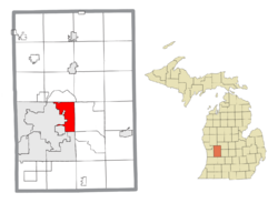
Location within Kent County
|
|
| Country | United States |
| State | Michigan |
| County | Kent |
| Established | 1834 |
| Area | |
| • Total | 15.55 sq mi (40.28 km2) |
| • Land | 15.33 sq mi (39.71 km2) |
| • Water | 0.22 sq mi (0.57 km2) |
| Elevation | 807 ft (246 m) |
| Population
(2020)
|
|
| • Total | 18,905 |
| • Density | 1,233.0/sq mi (476.1/km2) |
| Time zone | UTC-5 (Eastern (EST)) |
| • Summer (DST) | UTC-4 (EDT) |
| ZIP code(s) | |
| Area code(s) | 616 |
| FIPS code | 26-34020 |
| GNIS feature ID | 1626374 |
Grand Rapids Charter Township is a special kind of town called a charter township in Kent County, Michigan. It's like a small, independent community.
In 2020, about 18,905 people lived here. The township is next to the cities of Grand Rapids and East Grand Rapids. Even though it's close, Grand Rapids Charter Township manages its own affairs.
Contents
Exploring Grand Rapids Township
Grand Rapids Charter Township is home to different areas. These areas make up the community.
Local Communities
- Northview is a community that isn't officially a city. A small part of Northview is inside Grand Rapids Township. Most of Northview is actually north of here, in Plainfield Township.
The Story of Grand Rapids Township
Every place has a past! Grand Rapids Township has an interesting history.
How the Township Began
The area was first set up in 1834. Back then, it was called Kent Township. The village of Grand Rapids was part of this township.
In 1842, the state changed the name to Grand Rapids Township. Later, in 1850, the village of Grand Rapids became its own city. It separated from the township. Grand Rapids Township officially became a charter township in 1979. This gave it more local control.
Where is Grand Rapids Township?
Let's look at the geography of this area. It's important to know where places are located.
Township Size and Water
The U.S. Census Bureau says the township covers about 15.55 square miles (40.28 square kilometers). Most of this area is land. Only a small part, about 0.22 square miles (0.57 square kilometers), is water.
Main Roads and Highways
Several important roads run through Grand Rapids Township. These roads help people travel around.
- I-96 cuts across the northwest part of the township.
- M-21 goes east and west through the southern part.
- M-44 runs north and south right through the middle.
Who Lives in Grand Rapids Township?
Learning about the people who live in a place is called demographics. It helps us understand the community.
Population in 2020
According to the 2020 census, 18,905 people lived in Grand Rapids Township. Most residents, about 84.9%, were White. About 2.5% were Black or African American. Around 6.6% were Asian. A small number, 0.1%, were Native American. About 3.7% of people identified with two or more races. People of Hispanic or Latino background made up 2.8% of the population.
See also
 In Spanish: Municipio de Grand Rapids (Míchigan) para niños
 | Laphonza Butler |
 | Daisy Bates |
 | Elizabeth Piper Ensley |


