
Muskegon County, Michigan facts for kids
Quick facts for kids
Muskegon County
|
||
|---|---|---|

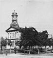
Muskegon County Courthouse
|
||
|
||

Location within the U.S. state of Michigan
|
||
 Michigan's location within the U.S. |
||
| Country | ||
| State | ||
| Founded | 1859 | |
| Named for | Muskegon River | |
| Seat | Muskegon | |
| Largest city | Norton Shores (area), Muskegon (population) | |
| Area | ||
| • Total | 1,460 sq mi (3,800 km2) | |
| • Land | 499 sq mi (1,290 km2) | |
| • Water | 961 sq mi (2,490 km2) 66%% | |
| Population
(2020)
|
||
| • Total | 175,824 | |
| • Density | 345/sq mi (133/km2) | |
| Time zone | UTC−5 (Eastern) | |
| • Summer (DST) | UTC−4 (EDT) | |
| Congressional districts | 2nd, 3rd | |

Muskegon County is a county located in the state of Michigan, United States. It's a place where many people live, work, and go to school. As of 2020, about 175,824 people call Muskegon County home. The main city and "county seat" (where the county government is) is Muskegon.
Muskegon County is part of a larger area called the Muskegon, MI Metropolitan Statistical Area. This means it's a busy area with many towns and cities close together. It's also connected to the even bigger Grand Rapids-Kentwood-Muskegon area.
Contents
History of Muskegon County
Early Settlements and Native Americans
Around the year 1812, some of the first non-Native American settlers arrived. People like Jean Baptiste Recollect and Pierre Constant set up trading posts here. These were places where people could trade goods.
Later, in 1836, an important agreement called the Treaty of Washington was signed. Through this treaty, Native American groups gave up some of their land in Michigan to the United States. This included the area that would become Muskegon County. After this, more European Americans moved into the area. They started to build farms and new communities.
How Muskegon County Was Formed
Before 1859, most of what is now Muskegon County was part of Ottawa County. The city of Grand Haven was the main government center for that larger county.
Muskegon County officially became its own county in 1859. It was named after the Muskegon River. This river flows through the county and into Muskegon Lake, then finally into Lake Michigan. The word "Muskegon" comes from an Ojibwa/Chippewa word, mashkig. This word means "marsh" or "swamp," which describes some of the land in the area.
Geography and Waterways
Muskegon County covers a total area of about 1,460 square miles. But a large part of that is water! About 499 square miles is land, and 961 square miles (which is 66%) is water.
Important Rivers and Lakes
Michigan's second-longest river, the Muskegon River, flows right through the county. It has both a north and south branch. These branches empty into Muskegon Lake. From there, the water flows into Lake Michigan through the Muskegon Channel. Muskegon Lake is special because it's Michigan's only "deep water port" on Lake Michigan. This means large ships can easily use it.
In the northern part of the county, the White River flows into White Lake. Then it also connects to Lake Michigan. To the south, Black Creek flows into Mona Lake, which also leads to Lake Michigan. These three lakes (Muskegon, White, and Mona) are great for boats. They make Muskegon County one of the easiest places in Michigan to get to Lake Michigan by boat.
Other Bodies of Water
Muskegon County has many other beautiful lakes and rivers, including:
- Mona Lake
- Little Black Lake
- Little Blue Lake
- Wolf Lake
- Fox Lake
- Big Blue Lake
- Bear Lake
- Duck Lake
- Twin Lake
Protected Natural Areas
Part of the Manistee National Forest is located in Muskegon County. This is a large protected area where you can find forests and wildlife.
Transportation in the County
You can get around Muskegon County using different types of transportation:
- Muskegon Area Transit System: This is the local bus system.
- Lake Express: This is a ferry service that can take you across Lake Michigan.
Main Roads and Highways
Several major roads help people travel through Muskegon County:
 I-96
I-96 US 31
US 31 M-37
M-37 M-46
M-46- M-120
People of Muskegon County
Population Over Time
Muskegon County has grown a lot over the years. Here's how the population has changed:
| Historical population | |||
|---|---|---|---|
| Census | Pop. | %± | |
| 1860 | 3,947 | — | |
| 1870 | 14,894 | 277.3% | |
| 1880 | 26,586 | 78.5% | |
| 1890 | 40,013 | 50.5% | |
| 1900 | 37,036 | −7.4% | |
| 1910 | 40,577 | 9.6% | |
| 1920 | 62,362 | 53.7% | |
| 1930 | 84,630 | 35.7% | |
| 1940 | 94,501 | 11.7% | |
| 1950 | 121,545 | 28.6% | |
| 1960 | 129,943 | 6.9% | |
| 1970 | 157,426 | 21.2% | |
| 1980 | 157,589 | 0.1% | |
| 1990 | 158,983 | 0.9% | |
| 2000 | 170,200 | 7.1% | |
| 2010 | 172,188 | 1.2% | |
| 2020 | 175,824 | 2.1% | |
| 2023 (est.) | 176,564 | 2.5% | |
| U.S. Decennial Census 1790-1960 1900-1990 1990-2000 2010-2019 |
|||
Who Lives Here?
According to the 2010 United States Census, there were 172,188 people living in Muskegon County. Most people were White (77.4%), followed by Black or African American (14.6%). There were also smaller groups of Asian, Native American, and people of two or more races. About 4.8% of the population was Hispanic or Latino.
Many families live in Muskegon County. In 2000, about 34.6% of households had children under 18 living with them. The average age of people in the county was 36 years old.
Education in Muskegon County
Muskegon County has many schools for students of all ages.
Public School Districts
Here are some of the public school districts in the county:
- Fruitport Community Schools
- Holton Public Schools
- Mona Shores Public Schools
- Montague Area Public Schools
- Muskegon Public Schools
- Muskegon Heights Public Schools
- North Muskegon Public Schools
- Orchard View Schools
- Oakridge Public Schools
- Ravenna Public Schools
- Reeths-Puffer School District
- Whitehall District Schools
Private Schools
There are also private schools available:
- Broadway Baptist School
- Fruitport Calvary Christian
- Muskegon Catholic Central
- West Michigan Christian
Colleges and Universities
For students who want to continue their education after high school, there are several colleges:
- Baker College
- Muskegon Community College
- Ross Medical Education Center - Muskegon
Historical Markers and Landmarks
Muskegon County has many places with special historical markers. These markers tell stories about important events and people from the past. There are twenty-three recognized historical markers in the county, including:
- Bluffton Actors' Colony / Buster Keaton
- Central United Methodist Church [Muskegon]
- Hackley House
- Hackley Public Library
- Jean Baptiste Recollect Trading Post
- Lumbering on White Lake
- Marsh Field
- Mouth Cemetery
- Muskegon Business College
- Muskegon Log Booming Company
- Union Depot (Muskegon)
- White Lake Yacht Club
Communities in Muskegon County
Muskegon County is made up of several cities, villages, and townships.
Cities
- Montague
- Muskegon Heights
- Muskegon (the county seat)
- North Muskegon
- Norton Shores
- Roosevelt Park
- Whitehall
Villages
Townships
Muskegon County also has many townships, which are smaller local government areas:
- Fruitport Charter Township
- Muskegon Township
- Blue Lake Township
- Casnovia Township
- Cedar Creek Township
- Dalton Township
- Egelston Township
- Fruitland Township
- Holton Township
- Laketon Township
- Montague Township
- Moorland Township
- Ravenna Township
- Sullivan Township
- White River Township
- Whitehall Township
Other Communities
- Twin Lake (a census-designated place)
- Wolf Lake (a census-designated place)
- Wabaningo (an unincorporated community)
- Brunswick (partially an unincorporated community)
Images for kids
-
Muskegon County Courthouse
See also
 In Spanish: Condado de Muskegon para niños
