
Muskegon River facts for kids
Quick facts for kids Muskegon River |
|
|---|---|

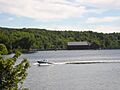
Muskegon River near Newaygo, MI in September 2012
|
|

Map of the Muskegon River
|
|
| Country | United States |
| State | Michigan |
| Cities | Evart, Big Rapids, Croton, Newaygo, Muskegon |
| Physical characteristics | |
| Main source | Houghton Lake MI 44°23′58″N 84°47′27″W / 44.39944°N 84.79083°W |
| River mouth | Muskegon Lake Muskegon, MI 43°15′41″N 86°14′53″W / 43.26139°N 86.24806°W |
| Length | 216 mi (348 km) |
| Basin features | |
| Basin size | 2,350 sq mi (6,100 km2) |
The Muskegon River is a long river in the western part of Michigan, a state in the United States. It starts at Houghton Lake in Roscommon County. From there, it flows through several counties, including Missaukee, Clare, Osceola, Mecosta, Newaygo, and Muskegon.
The river generally flows southwest until it reaches Muskegon Lake in Muskegon, Michigan. Muskegon Lake then connects to Lake Michigan through a channel about a mile long. The Muskegon River has important branches like the Hersey River, Cedar Creek, and Little Muskegon River. The main river is about 216 miles (348 km) (348 km) long. It drains an area of about 2,350 square miles (6,100 km2) (6,086 sq km).
In 2002, a magazine called National Geographic wrote about a company called Nestle Waters North America. This company was allowed to bottle a lot of water from an underground water source that helps fill the Muskegon River. This deal caused some discussion.
Contents
River History: Logging and Railroads
The Muskegon River was very important for moving logs during the 1880s and 1890s. This was a time when the logging industry was booming in Michigan. Even today, if you look closely at the river bottom, you might see old logs left over from those days.
A person named Winfield Scott Gerrish helped change how logging was done in Michigan. He built a seven-mile-long railroad just for moving logs. This railroad went from Lake George to the Muskegon River. However, other logging railroads were already in use in Michigan before his. For example, the Blendon Lumber Company had a seven-mile railroad in 1857. It was the first in Michigan to use a steam engine.
Where Does the Muskegon River Flow?
The Muskegon River begins at the north end of Houghton Lake. It flows northwest under US Route 127, winding through marshy areas. The river then goes south, forming the Dead Stream Flooding State Wildlife Management Area. It continues south towards Michigan Route (M-55) near the Ben D. Jeffs River Park.
River Journey Through Towns
- Evart: At Evart, the river flows under US Route 10. It passes near downtown Evart and the Evart Airport. Downstream from Evart, more homes are built along the riverbanks as it gets wider.
- Big Rapids: Near US Route 131, the river flows through Big Rapids. Here, the riverbanks are more developed, with two bridges crossing the river in the city. The river then continues south to the Rogers Dam Pond. This pond is created by Rogers Dam.
- Newaygo: After passing under Michigan Route 20, the river widens into a reservoir formed by Hardy Dam. Downstream from there is Croton Dam. Both of these dams create electricity and are owned by Consumers Energy. This part of the river is popular for fun activities like tubing, kayaking, and canoeing. At Newaygo, the river goes under Michigan Route 37. It then continues southwest through wooded areas and farmlands.
- Muskegon: The river soon enters Muskegon County. Here, the river becomes wider and flatter. This area is part of the Muskegon State Game Area. You can find deer, geese, ducks, and other birds here. The marshy area upstream of the US Route 31 causeway is a favorite spot for fishing. After flowing under the Michigan Route 120 bridges, the river empties into Muskegon Lake. This lake is a natural opening to Lake Michigan.
Wildlife Along the River
The Muskegon River is home to many animals. You can see otters, different kinds of waterfowl (like ducks and geese), white-tailed deer, and eagles. Even though some areas are being developed, the upper parts of the river are still wild and natural. Much of the land around these areas is owned by the state.
The Muskegon State Game Area is a large piece of land, about 8,411 acres. It covers the Muskegon River between Maple Island Road and US Route 31. This area is open for licensed hunters. You can get permits to hunt whitetail deer and waterfowl here. The Muskegon State Game Area is located in both Muskegon County and Newaygo County.
Fun Activities on the River
The Muskegon River is a great place for outdoor activities.
- Fishing: In recent years, the river has become famous for fishing. Many large steelhead, brown trout, and Chinook Salmon swim here.
- Paddling: People also love to paddle down the river in a kayak or canoe. It is Michigan's second-largest river, after the Grand River. It flows surprisingly slowly, which makes it perfect for beginners.
- Wildlife Viewing: Because the river is so peaceful, it offers many chances to see wildlife. This brings tourists from all over.
- Camping: Camping is another popular activity. There are several parks and campgrounds along the river's edge. You can also find inns and cabins for rent if you want to stay for a night, a week, or even a month.
- Hunting: Hunting is popular in the nearby forests on public hunting land.
Dams on the Muskegon River
There are three main dams on the Muskegon River: Rogers, Hardy, and Croton. These dams create about 45,600 kilowatts of electricity. About 30,000 of those kilowatts come from Hardy Dam. This is enough electricity to power a community of almost 23,000 homes! A smaller dam, called Reedsburg Dam, is located closer to where the Muskegon River starts.
| Name | Height | Purpose(s) | Capacity (MW) | Year | Owner name | Reservoir name | Coordinates | Comments |
|---|---|---|---|---|---|---|---|---|
| Croton | 40 ft (12.2 m) | Hydroelectric | 8.85 | 1907 | Consumers Energy | Croton Dam Pond | 43°26′14″N 85°39′50″W / 43.43714°N 85.66382°W | |
| Hardy | 106 ft (32.3 m) | Hydroelectric | 30 | 1931 | Consumers Energy | Hardy Dam Pond | 43°29′12″N 85°37′47″W / 43.48656°N 85.6296°W | |
| Reedsburg | N/A | Flood control | N/A | 1940 | Michigan DNR | Dead Stream Flooding | 44°21′22″N 84°51′33″W / 44.35612°N 84.8593°W | |
| Rogers | 43 ft (13.1 m) | Hydroelectric | 6.75 | 1906 | Consumers Energy | Rogers Dam Pond | 43°36′48″N 85°28′44″W / 43.61320°N 85.47894°W | |
| Total | 45.6 |
Cities and Towns Along the River
- Houghton Lake, Michigan
- Leota, Michigan
- Evart, Michigan
- Hersey, Michigan
- Big Rapids, Michigan
- Newaygo, Michigan
- Muskegon, Michigan
Images for kids
-
Boater on Croton Dam Pond

