Thornapple River facts for kids
Quick facts for kids Thornapple River |
|
|---|---|

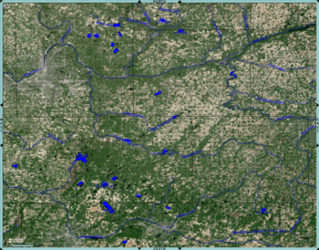
Enhanced USGS Satellite Image, Thornapple River drainage basin.
|
|
| Native name | Tomba-Signe (or "river with the forked stream") |
| Country | United States |
| State | Michigan |
| Counties | Drainage basin covers portions of Barry, Eaton, Ionia, and Kent Counties in Central Michigan |
| Physical characteristics | |
| Main source | S of Boody Lake, Eaton Township, Eaton County, Michigan |
| River mouth | Grand River, Ada Township, Kent County, Michigan 617 ft (188 m) |
| Length | 88 mi (142 km) |
The Thornapple River is a long river in Michigan. It flows for about 88 miles (142 km). This river is a tributary (a smaller river that flows into a larger one) of the Grand River. The Grand River is the longest river in Michigan.
The Thornapple River starts in Eaton County, Michigan. It flows through mostly farmland in Central Michigan. The river then joins the Grand River in Ada, Michigan. This spot is about 10 miles (16 km) east of Grand Rapids.
Contents
About the Thornapple River
The Thornapple River is a main branch of the Grand River. It begins about 7 miles (11 km) east of Charlotte, Michigan. This is in Eaton Township, Eaton County. The river flows west and then north. It goes through Eaton and Barry counties. Finally, it enters Kent County to join the Grand River.
The Grand River then flows into Lake Michigan. This happens at Grand Haven, about 70 miles (113 km) downstream. People describe the Thornapple as a "calm river that winds through low woodlands" in southwest Michigan. The Coldwater River is a major tributary of the Thornapple. The Thornapple River is the only large river that joins the Grand River from its left side.
History of the Thornapple River
How the River Formed
The big rivers and streams in the Grand River area formed a long time ago. This happened during the Pleistocene Ice Age. Huge sheets of ice moved across the land and then melted. This process ended about 6,000 to 8,000 years ago. Before Europeans settled here, the Thornapple River area had many types of trees. It was home to Native American tribes. These included the Ottawa and Potawatomi people. They called the river Tomba-Signe. This name means "river with the forked stream."
Early Settlements and Trade
In the early days of Michigan, a man named Rix Robinson was the first permanent settler in Kent County. In 1821, he set up a fur trading post. He worked with John Jacob Astor's American Fur Company. This post was at the mouth of the Thornapple River. He traded with the Potawatomi people.
By 1837, the fur trade was slowing down. Robinson helped make a treaty between the local tribes and the U.S. government. This agreement opened up much of the area. This included the Thornapple River basin, for white settlers.
River's Role in Industry
Like many rivers in the 1800s and early 1900s, the Thornapple River was busy. There was a lot of logging (cutting down trees). There were also mills for grinding grain and sawmills for wood. Many factories were built along the river.
For example, by 1862, the town of Ada had many businesses. These included general stores, a flour mill, and a sawmill. There were also hotels, a blacksmith, and a carriage maker. Later, a basket factory was built next to the mills on the Thornapple River.
Flooding and Dams
The river sometimes had big floods. The flood in 1904-1905 was the "worst flooding in Ada history." Because of this, several dams were built in the early 1900s. These dams helped control floods and create power.
In 1957, the mouth of the Thornapple River was moved. This happened during a project to replace a bridge on M-21. The river's lower part was moved about 500 feet upstream. The land where Robinson's first home and trading post once stood was then covered by water.
Modern Uses of the River
Today, the Thornapple River is not used for big ships. There is no commercial transport on it. The main use of the river now is for fun activities.
Recreational Activities
Many people enjoy the Thornapple River for recreation. It is popular for rafting, kayaking, tubing, and canoeing. Several businesses offer canoes for rent.
The upper part of the river, from Eaton County to Thornapple Lake, is narrow. It has lots of plants, making it hard to pass through easily. The lower part of the river has several reservoirs created by dams. These areas are very developed. However, a 14-mile (23 km) stretch from Thornapple Lake to the first dam is great for family trips.
Fishing and Wildlife
The river is also a good place to fish. Many types of fish live here. These include:
- Sunfishes: largemouth bass, smallmouth bass, rock bass, bluegill, crappie, pumpkinseed, and warmouth.
- Other fish: bowfin, brown bullhead, common carp, chub, dace, shiner, white sucker, redhorse, yellow perch, walleye, darter, brook stickleback, northern pike, longnose gar, brown trout, brook trout, rainbow trout, and lampreys.
The Thornapple River is known as a great place for smallmouth bass. There are usually many of them in the free-flowing parts of the river. These are between Nashville and where the Coldwater River joins. It's easy to access the river for fishing. You can wade or float in most free-flowing areas during summer. Many county road crossings also offer good access.
Besides fish, the river is home to other animals. You might see osprey, bald eagles, herons, and different kinds of ducks. Some ducks even stay in Michigan for the winter. People enjoy watching these animals while using the river for fun.
Boating and Dams
On the lower parts of the river, especially in the areas behind the dams, many people use boats. This includes powered boats, sailboats, and personal watercraft. However, there are no special clearances under bridges for tall boats. Also, the dams do not have locks. This means you have to take your boat out of the water and move it around the dam to get to another part of the river.
Thornapple River Watershed
Land Cover in the Watershed
The Thornapple River Watershed is a large area. It covers over 857 square miles (2,220 km²). This area includes parts of Barry, Eaton, Ionia, and Kent Counties in Central Michigan. About 324 miles (521 km) of streams and rivers in this watershed flow into the Lower Grand River.
The land in the watershed is used for different things:
- 52.1% is farmland
- 38.7% is forest
- 1.5% is wetland (swampy areas)
- 1.6% is water
- 6.1% is developed (buildings, roads)
- 0.03% is barren (empty land)
Rivers and Streams that Feed the Thornapple
Many smaller rivers and streams flow into the Thornapple River. These are called its tributaries. Some of them include: Butternut Creek, Coldwater River, Mud Creek, Cedar Creek, and Shanty Creek. There are also many others like Fish Creek, Lacey Creek, and Quaker Brook.
Towns Along the River
The Thornapple River flows through or near several towns and villages:
- Charlotte
- Nashville
- Hastings
- Middleville
- Alaska (North Brownsville)
River Crossings

Many roads and railroads cross the Thornapple River. Several state highways also cross it:
 I-69, south of Potterville
 M-50, northwest of Charlotte
 M-66, in Nashville
 M-43, in Hastings
 I-96 (with the
  M-6 interchange), in Cascade Township
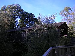
The Ada Covered Bridge also crosses the river in Ada. This bridge is only for people walking or biking.
Dams on the Thornapple River
There are six main dams along the Thornapple River. They are listed from the start of the river to its mouth:
| Location | What it's like | Image |
|---|---|---|
| Nashville | This dam was closest to the river's start. It was very small and did not make power. It only helped control the water flow. This dam was removed in September 2009 to help fish move more easily. |  |
| Irving | This dam is downstream from Thornapple Lake. It's actually three different dams. One makes power, and two control water flow. One of the flow control dams is old and not used anymore. Commonwealth Power Company runs these dams. |  |
| Middleville | This dam is in the village of Middleville. Commonwealth Power Company also runs this one. | see CPC images |
| Labarge (Caledonia) | This dam is near the 84th street crossing. Commonwealth Power also runs this dam. |  |
| Cascade | This dam is near the Grand Rapids airport. It makes 1.4 megawatts of electricity. Cascade Township owns it, and STS Hydropower Ltd. operates it. |  |
| Ada | This dam is just upstream from the Ada Covered Bridge. It's less than 1 mile (1.6 km) from where the river joins the Grand River. It makes 1.6 megawatts of electricity. The Thornapple Association owns it, and STS Hydropower Ltd. operates it. |  |
 | Calvin Brent |
 | Walter T. Bailey |
 | Martha Cassell Thompson |
 | Alberta Jeannette Cassell |


