
Manton, Michigan facts for kids
Quick facts for kids
Manton, Michigan
|
|
|---|---|
| City of Manton | |
.jpg)
Looking west along Main Street (Bus. US 131)
|
|

Location within Wexford County
|
|

Manton, Michigan
Location in Michigan

Manton, Michigan
Location in the United States
|
|
| Country | |
| State | |
| County | Wexford |
| Settled | 1872 |
| Incorporated | 1877 (village) 1923 (city) |
| Government | |
| • Type | City commission |
| Area | |
| • Total | 1.61 sq mi (4.18 km2) |
| • Land | 1.56 sq mi (4.04 km2) |
| • Water | 0.05 sq mi (0.14 km2) |
| Elevation | 1,132 ft (345 m) |
| Population
(2020)
|
|
| • Total | 1,258 |
| • Density | 805.89/sq mi (311.14/km2) |
| Time zone | UTC-5 (Eastern (EST)) |
| • Summer (DST) | UTC-4 (EDT) |
| ZIP code(s) |
49663
|
| Area code(s) | 231 |
| FIPS code | 26-50880 |
| GNIS feature ID | 1620691 |

Manton is a city in Wexford County, Michigan, in the United States. It is located in the northeastern part of Wexford County, which is in Northern Michigan. In 2020, the city had a population of 1,258 people.
Contents
Manton's Early History
Manton began in 1872. Three men, Ezra Harger, George Manton, and William Mears, bought the land. They cleared it to make way for a new railroad line. People first called the area "Cedar Creek." However, the railroad decided to name its new station "Manton" after George Manton, who was the first postmaster there.
Manton used to be the main town, or "county seat," for Wexford County. This means it was where the county government offices were located. However, the county seat was later moved to Cadillac. This move happened after a disagreement known as the "Battle of Manton."
The Amish Community in Manton
In 1993, a group of Old Order Amish people started a community near Manton. Many of them came from other Amish areas in Michigan. This community is known for being more welcoming to "seekers." These are people who want to learn about and possibly join the Amish way of life. This community is connected to an Amish group in Smyrna, Maine.
Manton's Location and Size
Manton is a small city. According to the U.S. Census Bureau, the city covers about 1.61 square miles (4.18 square kilometers). Most of this area is land, with a small part being water.
The city of Manton is surrounded by Cedar Creek Township. Even though the township surrounds the city, they are managed as separate local governments.
Main Roads in Manton
Several important roads pass near or through Manton:
 US 131 is a major highway that goes around the east side of the city. It has an exit (exit 191) that connects to other local roads. North of Manton, this highway becomes a two-lane road.


Bus. US 131 is a special business route of US 131. It goes through the center of Manton. This route starts near the main US 131 highway and then goes north out of town before rejoining US 131. M-42 runs alongside Bus. US 131 for about a mile into Manton. It then ends at an intersection with 7th Street and Main Street.
Manton's Population Over Time
| Historical population | |||
|---|---|---|---|
| Census | Pop. | %± | |
| 1880 | 214 | — | |
| 1890 | 661 | 208.9% | |
| 1900 | 895 | 35.4% | |
| 1910 | 1,069 | 19.4% | |
| 1920 | 793 | −25.8% | |
| 1930 | 1,008 | 27.1% | |
| 1940 | 1,006 | −0.2% | |
| 1950 | 1,085 | 7.9% | |
| 1960 | 1,050 | −3.2% | |
| 1970 | 1,107 | 5.4% | |
| 1980 | 1,212 | 9.5% | |
| 1990 | 1,161 | −4.2% | |
| 2000 | 1,221 | 5.2% | |
| 2010 | 1,287 | 5.4% | |
| 2020 | 1,258 | −2.3% | |
| U.S. Decennial Census | |||
Manton's Population in 2010
In 2010, the city of Manton had 1,287 people living there. There were 504 households, which means 504 different homes where people lived. Out of these, 327 were families. The city had about 825 people per square mile. There were also 577 housing units, which are places where people can live.
Most of the people in Manton were White (96.3%). A small number were African American (0.5%), Native American (0.9%), or from other backgrounds. About 2.3% of the population identified as Hispanic or Latino.
In 37.3% of the households, there were children under 18 years old. About 37.1% of households were married couples living together. Some households had a female head of the house without a husband (20.8%), or a male head of the house without a wife (6.9%). About 35.1% of households were not families.
The average age of people in Manton was 31.9 years old. About 30% of residents were under 18. About 14.4% of residents were 65 years old or older. The population was almost evenly split between males (47.5%) and females (52.5%).
Images for kids
-
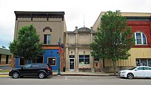
U.S. Post Office in Manton -
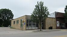
City of Manton Office -
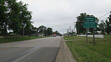
Road signage along Bus. US 131


See also
 In Spanish: Manton (Míchigan) para niños
