
Traverse County, Minnesota facts for kids
Quick facts for kids
Traverse County
|
|
|---|---|

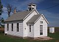
Old District No. 44 School
|
|

Location within the U.S. state of Minnesota
|
|
 Minnesota's location within the U.S. |
|
| Country | |
| State | |
| Founded | February 20, 1862 (created) 1881 (organized) |
| Named for | Lake Traverse |
| Seat | Wheaton |
| Largest city | Wheaton |
| Area | |
| • Total | 586 sq mi (1,520 km2) |
| • Land | 574 sq mi (1,490 km2) |
| • Water | 12 sq mi (30 km2) 2.0%% |
| Population
(2020)
|
|
| • Total | 3,360 |
| • Estimate
(2023)
|
3,136 |
| • Density | 5.9/sq mi (2.3/km2) |
| Time zone | UTC−6 (Central) |
| • Summer (DST) | UTC−5 (CDT) |
| Congressional district | 7th |
Traverse County (locally /ˈtrævərs/ TRAV-ərss) is a county located in the state of Minnesota in the United States. A county is like a smaller area within a state, often with its own local government. In 2020, about 3,360 people lived here, making it the county with the fewest people in Minnesota. The main town and county seat is Wheaton. Traverse County was created in 1862 and officially started its government in 1881.
Contents
Geography of Traverse County
Traverse County is found on the western side of Minnesota. Its western border touches the states of North Dakota and South Dakota. The Red River flows north along the county's western edge. The Mustinka River also flows through the northern part of the county, emptying into Lake Traverse.
The land in Traverse County has gentle, rolling hills. Most of the land is used for farming, except for areas where towns and buildings are located. The land slopes down towards the west and north. The highest point in the county is in the southeastern corner, which is about 1,119 feet (341 meters) above sea level. The county covers a total area of 586 square miles (1,518 square kilometers). Of this, 574 square miles (1,487 square kilometers) is land, and 12 square miles (31 square kilometers) is water.
Main Roads in Traverse County
 U.S. Route 75
 Minnesota State Highway 9
 Minnesota State Highway 27
 Minnesota State Highway 28
 Minnesota State Highway 117
Neighboring Counties
Traverse County shares its borders with several other counties:
- Wilkin County - to the north
- Grant County - to the northeast
- Stevens County - to the southeast
- Big Stone County - to the south
- Roberts County, South Dakota - to the southwest
- Richland County, North Dakota - to the northwest
Protected Natural Areas
These areas help protect wildlife and nature:
- Reservation Dam State Wildlife Management Area
- White Rock Dam State Wildlife Management Area
Lakes in Traverse County
- Lake Traverse (part of the lake is in the county)
- Mud Lake (part of the lake is in the county)
- Saint Marys Lake
- Wet Lake
People of Traverse County (Demographics)
Demographics is the study of populations, like how many people live somewhere, their ages, and their backgrounds.
| Historical population | |||
|---|---|---|---|
| Census | Pop. | %± | |
| 1870 | 13 | — | |
| 1880 | 1,507 | 11,492.3% | |
| 1890 | 4,516 | 199.7% | |
| 1900 | 7,573 | 67.7% | |
| 1910 | 8,049 | 6.3% | |
| 1920 | 7,943 | −1.3% | |
| 1930 | 7,938 | −0.1% | |
| 1940 | 8,283 | 4.3% | |
| 1950 | 8,053 | −2.8% | |
| 1960 | 7,503 | −6.8% | |
| 1970 | 6,254 | −16.6% | |
| 1980 | 5,542 | −11.4% | |
| 1990 | 4,463 | −19.5% | |
| 2000 | 4,134 | −7.4% | |
| 2010 | 3,558 | −13.9% | |
| 2020 | 3,360 | −5.6% | |
| 2023 (est.) | 3,136 | −11.9% | |
| U.S. Decennial Census 1790-1960 1900-1990 1990-2000 2010-2020 |
|||
2020 Census Information
The 2020 Census counted the number of people living in Traverse County and their backgrounds. Here's a look at the different groups:
| Race | Number of People | Percentage |
|---|---|---|
| White (not Hispanic) | 2,851 | 84.85% |
| Black or African American (not Hispanic) | 21 | 0.63% |
| Native American (not Hispanic) | 183 | 5.45% |
| Asian (not Hispanic) | 0 | 0% |
| Pacific Islander (not Hispanic) | 0 | 0% |
| Other/Mixed (not Hispanic) | 108 | 3.21% |
| Hispanic or Latino | 197 | 5.86% |
Towns and Communities
Traverse County has several towns and smaller communities where people live.
Cities
These are the main towns in the county:
- Browns Valley
- Dumont
- Tintah
- Wheaton (This is the county seat, where the main government offices are)
Unincorporated Communities
These are smaller places that are not officially cities:
- Boisberg
- Charlesville (part of it)
- Collis
- Dakomin
Townships
Townships are smaller areas of land, often with their own local governments, especially in rural areas:
- Arthur Township
- Clifton Township
- Croke Township
- Dollymount Township
- Folsom Township
- Lake Valley Township
- Leonardsville Township
- Monson Township
- Parnell Township
- Redpath Township
- Tara Township
- Taylor Township
- Tintah Township
- Walls Township
- Windsor Township
Images for kids
-
Old District No. 44 School
See also
 In Spanish: Condado de Traverse para niños
