Lake Traverse facts for kids
Quick facts for kids Lake Traverse |
|
|---|---|

The continental divide of Lake Traverse
|
|
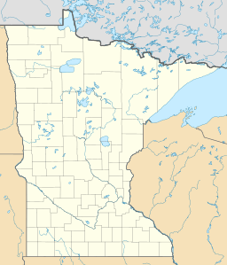
| Location | Traverse County, Minnesota / Roberts County, South Dakota, United States |
| Coordinates | 45°46′09″N 96°38′20″W / 45.76917°N 96.63889°W |
| Primary inflows | Mustinka River |
| Primary outflows | Bois de Sioux River |
| Basin countries | United States |
| Surface elevation | 976 ft (297 m) |
Lake Traverse is a long, narrow lake that sits right on the border between the states of Minnesota and South Dakota in the United States. It's a very important lake because it's the southernmost body of water in North America that sends its water all the way to Hudson Bay in Canada!
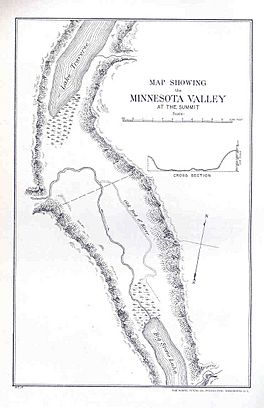
Just a short distance from Lake Traverse, you'll find Big Stone Lake. These two lakes are very close to each other. They are separated by a low area of land called a continental divide. This divide means that water from Lake Traverse flows north, while water from Big Stone Lake flows south into the Mississippi River System.
What's in a Name?
The name Lake Traverse comes from the French language. Early French explorers called it Lac Traverse. This means "across the lake" in French. It's a simple name that describes its shape or location.
How Lake Traverse Was Formed
Long, long ago, during the Ice Age, a giant ice sheet covered much of North America. As the ice melted, it formed a huge ancient lake called Lake Agassiz.
The southern end of Lake Traverse was once the main way water flowed out of this massive glacial Lake Agassiz. This rushing water carved out a huge valley. Today, that valley is where the Minnesota River flows. It's pretty cool to think about how powerful ancient rivers were!
How the Lake Drains
Water from Lake Traverse flows out from its northern end. This water forms the beginning of the Bois de Sioux River. The Bois de Sioux River then flows north and eventually joins the Red River of the North. The Red River continues north and eventually empties into Hudson Bay.
There is a dam at the northern end of Lake Traverse. This dam was built by the United States Army Corps of Engineers. It helps control the lake's water level. Another river, the Mustinka River, flows into Lake Traverse just before the dam.
 | Bayard Rustin |
 | Jeannette Carter |
 | Jeremiah A. Brown |


