Stevens County, Minnesota facts for kids
Quick facts for kids
Stevens County
|
|
|---|---|
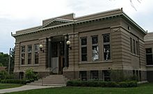
Carnegie Library in Morris.
|
|
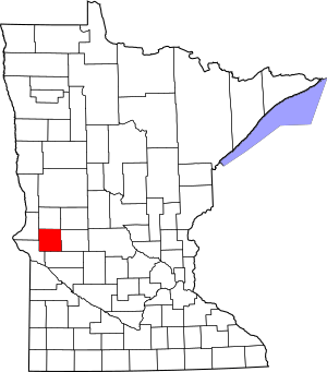
Location within the U.S. state of Minnesota
|
|
 Minnesota's location within the U.S. |
|
| Country | |
| State | |
| Founded | February 20, 1862 |
| Named for | Isaac Ingalls Stevens |
| Seat | Morris |
| Largest city | Morris |
| Area | |
| • Total | 575 sq mi (1,490 km2) |
| • Land | 564 sq mi (1,460 km2) |
| • Water | 12 sq mi (30 km2) 2.0%% |
| Population
(2020)
|
|
| • Total | 9,671 |
| • Estimate
(2023)
|
9,728 |
| • Density | 17.1/sq mi (6.6/km2) |
| Time zone | UTC−6 (Central) |
| • Summer (DST) | UTC−5 (CDT) |
| Congressional district | 7th |
Stevens County is a county located in the state of Minnesota, United States. In 2020, about 9,671 people lived there. The county's main town and government center is Morris. As of 2023, the population is estimated to be around 9,728 people.
Contents
History of Stevens County
How Stevens County Was Formed
Stevens County was officially created on February 20, 1862, by the Minnesota government. At first, it didn't have its own local government or a main town.
The county was named after Isaac Stevens. He was an important person who explored Minnesota in 1853. He helped people across the country learn more about the Minnesota Territory.
Naming the County
The government wanted to name a county after Isaac Stevens in 1855. But there was a mistake, and another county was accidentally named Stearns.
The mistake was fixed in 1862 when Stevens County was created. Isaac Stevens was a general in the American Civil War at that time. He sadly died later that same year.
Setting Up the Government
The local government for Stevens County officially started in 1872. The town of Morris, which was planned out in 1869, was chosen as the county seat. This means Morris became the center for the county's government.
Education in Morris
The University of Minnesota Morris is located in Morris. It started in the early 1900s. Before that, it was a school called the Morris Industrial School for Indians. This school opened in 1887. It was run by the Roman Catholic Sisters of Mercy under a contract with the United States government.
Local Events
In 1975, a small earthquake happened in Stevens County.
Geography of Stevens County
Rivers and Land
The Pomme de Terre River flows through the middle of Stevens County. It travels south and eventually joins the Minnesota River.
The land in the county has gentle rolling hills. Most of the area is used for farming. The land generally slopes downwards towards the south. However, some parts in the northeast and southwest are higher than the center of the county.
Highest Point
The highest point in Stevens County is on the eastern part of its northern border. It is about 1,250 feet (381 meters) above sea level.
County Size
Stevens County covers a total area of about 575 square miles (1,490 square kilometers). Out of this, 564 square miles (1,460 square kilometers) is land. The remaining 12 square miles (31 square kilometers), or 2.0%, is water.
Main Roads and Highways
These are the major roads that help people travel through Stevens County:
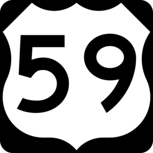
- U.S. Highway 59
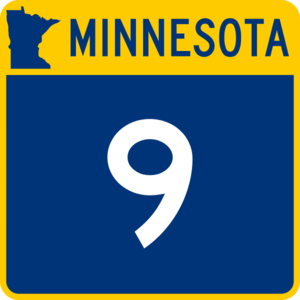
- Minnesota State Highway 9
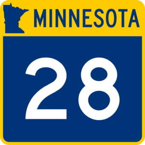
- Minnesota State Highway 28
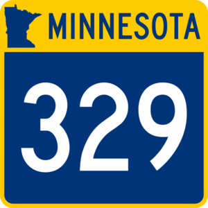
- Minnesota State Highway 329
Neighboring Counties
Stevens County shares its borders with these other counties:
- Grant County to the north
- Douglas County to the northeast
- Pope County to the east
- Swift County to the south
- Big Stone County to the southwest
- Traverse County to the northwest
Protected Natural Areas
Stevens County has several protected areas. These places help keep nature safe and are important for wildlife:
- Alberta Marsh State Wildlife Management Area
- Boekholt Grove State Wildlife Management Area
- Bruillet State Wildlife Management Area
- Cin State Wildlife Management Area
- Dablow State Wildlife Management Area
- Dolven State Wildlife Management Area
- Everglade State Wildlife Management Area
- Klason State Wildlife Management Area
- Kline State Wildlife Management Area
- Mathison State Wildlife Management Area
- Muddy Creek State Wildlife Management Area
- Reimers State Wildlife Management Area
- Robertson State Wildlife Management Area
- Selk State Wildlife Management Area
- Thedin State Wildlife Management Area
- Verlyn Marth Memorial Prairie Scientific and Natural Area
People of Stevens County
Population Changes Over Time
The number of people living in Stevens County has changed over many years. Here's how the population has grown and shrunk:
| Historical population | |||
|---|---|---|---|
| Census | Pop. | %± | |
| 1870 | 174 | — | |
| 1880 | 3,911 | 2,147.7% | |
| 1890 | 5,251 | 34.3% | |
| 1900 | 8,721 | 66.1% | |
| 1910 | 8,293 | −4.9% | |
| 1920 | 9,778 | 17.9% | |
| 1930 | 10,185 | 4.2% | |
| 1940 | 11,039 | 8.4% | |
| 1950 | 11,106 | 0.6% | |
| 1960 | 11,262 | 1.4% | |
| 1970 | 11,218 | −0.4% | |
| 1980 | 11,322 | 0.9% | |
| 1990 | 10,634 | −6.1% | |
| 2000 | 10,053 | −5.5% | |
| 2010 | 9,726 | −3.3% | |
| 2020 | 9,671 | −0.6% | |
| 2023 (est.) | 9,728 | 0.0% | |
| U.S. Decennial Census 1790-1960 1900-1990 1990-2000 2010-2020 |
|||
Who Lives in Stevens County?
The 2020 Census looked at the different groups of people living in Stevens County. Here's a quick look at the main groups:
| Race | Number of People | Percentage |
|---|---|---|
| White (not Hispanic) | 8,093 | 83.7% |
| Black or African American (not Hispanic) | 84 | 0.9% |
| Native American (not Hispanic) | 110 | 1.14% |
| Asian (not Hispanic) | 68 | 0.7% |
| Pacific Islander (not Hispanic) | 1 | 0.01% |
| Other/Mixed (not Hispanic) | 329 | 3.4% |
| Hispanic or Latino | 986 | 10.2% |
Towns and Areas in Stevens County
Cities in Stevens County
These are the cities located within Stevens County:
- Alberta
- Chokio
- Donnelly
- Hancock
- Morris (This is the county seat, where the main government offices are.)
Townships in Stevens County
Townships are smaller local areas that help manage land and services. Here are the townships in Stevens County:
- Baker Township
- Darnen Township
- Donnelly Township
- Eldorado Township
- Everglade Township
- Framnas Township
- Hodges Township
- Horton Township
- Moore Township
- Morris Township
- Pepperton Township
- Rendsville Township
- Scott Township
- Stevens Township
- Swan Lake Township
- Synnes Township
See also
 In Spanish: Condado de Stevens (Minnesota) para niños
 | James B. Knighten |
 | Azellia White |
 | Willa Brown |


