
Pope County, Minnesota facts for kids
Quick facts for kids
Pope County
|
|
|---|---|

The 1930 Beaux-Arts, Pope County Courthouse is listed on the National Register of Historic Places.
|
|

Location within the U.S. state of Minnesota
|
|
 Minnesota's location within the U.S. |
|
| Country | |
| State | |
| Founded | February 20, 1862 (created) 1866 (organized) |
| Named for | John Pope |
| Seat | Glenwood |
| Largest city | Glenwood |
| Area | |
| • Total | 717 sq mi (1,860 km2) |
| • Land | 670 sq mi (1,700 km2) |
| • Water | 47 sq mi (120 km2) 6.6%% |
| Population
(2020)
|
|
| • Total | 11,308 |
| • Estimate
(2023)
|
11,400 |
| • Density | 16.9/sq mi (6.5/km2) |
| Time zone | UTC−6 (Central) |
| • Summer (DST) | UTC−5 (CDT) |
| Congressional district | 7th |
Pope County is a county in the state of Minnesota, United States. In 2020, about 11,308 people lived here. Its county seat is Glenwood. The county was officially created in 1862 and started operating in 1866.
Contents
History of Pope County
Pope County was named after John Pope. He was a general in the Union Army during the American Civil War. Before the war, he worked as a surveyor in this area. The state government officially recognized the county in 1862. It began its operations in 1866.
In the 1970s, some people in Pope County had concerns about a powerline project. They held protests to share their opinions.
Geography of Pope County
Pope County has many natural features. The Chippewa River flows south through the western part of the county. The Little Chippewa River also flows south through the middle. It joins the Chippewa River near Cyrus. The East Branch Chippewa River flows through the eastern part. It eventually joins the Chippewa River in a nearby county.
The land in Pope County has gentle, rolling hills. There are many rivers, streams, lakes, and ponds. Most of the land is used for farming. The highest point in the county is about 1,388 feet (423 meters) above sea level. This is near the northeast corner. The county covers about 717 square miles (1,857 square kilometers). About 670 square miles (1,735 square kilometers) is land, and 47 square miles (122 square kilometers) is water.
Main Roads in Pope County
 Minnesota State Highway 9
 Minnesota State Highway 28
 Minnesota State Highway 29
 Minnesota State Highway 55
 Minnesota State Highway 104
 Minnesota State Highway 114
Airports in Pope County
- Glenwood Municipal Airport (D32)
- Starbuck Municipal Airport (GHW)
Neighboring Counties
Pope County shares borders with several other counties:
- Douglas County - to the north
- Stearns County - to the east
- Kandiyohi County - to the southeast
- Swift County - to the south
- Stevens County - to the west
- Grant County - to the northwest
Protected Natural Areas
Pope County has several protected areas. These places help keep nature safe.
- Bruce Hitman Heron Rookery Scientific and Natural Area
- Farwell State Wildlife Management Area
- Glacial Lakes State Park
- Langhei Scientific and Natural Area
- Little Jo State Wildlife Management Area
- Lowry State Wildlife Management Area
- New Prairie State Wildlife Management Area
- Noordmans State Wildlife Management Area
- Skarpness State Wildlife Management Area
- Van Luik State Wildlife Management Area
- Wade State Wildlife Management Area
Major Lakes in Pope County
Many lakes are found in Pope County. Some of the biggest ones include:
- Amelia Lake
- Goose Lake
- Lake Emily
- Lake Johanna
- Lake Minnewaska
- Lake Reno (part)
- Lake Simon
- Pelican Lake
- Pike Lake
- Scandinavian Lake
Population of Pope County
| Historical population | |||
|---|---|---|---|
| Census | Pop. | %± | |
| 1870 | 2,691 | — | |
| 1880 | 5,874 | 118.3% | |
| 1890 | 10,032 | 70.8% | |
| 1900 | 12,577 | 25.4% | |
| 1910 | 12,746 | 1.3% | |
| 1920 | 13,631 | 6.9% | |
| 1930 | 13,085 | −4.0% | |
| 1940 | 13,544 | 3.5% | |
| 1950 | 12,862 | −5.0% | |
| 1960 | 11,914 | −7.4% | |
| 1970 | 11,107 | −6.8% | |
| 1980 | 11,657 | 5.0% | |
| 1990 | 10,745 | −7.8% | |
| 2000 | 11,236 | 4.6% | |
| 2010 | 10,995 | −2.1% | |
| 2020 | 11,308 | 2.8% | |
| 2023 (est.) | 11,400 | 3.7% | |
| U.S. Decennial Census 1790-1960 1900-1990 1990-2000 2010-2020 |
|||
The population of Pope County has changed over the years. The table above shows how many people lived there during different census years.
2020 Census Information
The 2020 census counted 11,308 people in Pope County. Here is a breakdown of the different groups of people living there:
| Race | Number | Percentage |
|---|---|---|
| White (Not Hispanic) | 10,751 | 95.1% |
| Black or African American (Not Hispanic) | 34 | 0.3% |
| Native American (Not Hispanic) | 27 | 0.24% |
| Asian (Not Hispanic) | 50 | 0.44% |
| Pacific Islander (Not Hispanic) | 0 | 0% |
| Other/Mixed (Not Hispanic) | 255 | 2.3% |
| Hispanic or Latino | 191 | 1.7% |
Communities in Pope County
Pope County has several cities and smaller communities.
Cities in Pope County
- Brooten (part)
- Cyrus
- Farwell
- Glenwood (This is the county seat)
- Long Beach
- Lowry
- Sedan
- Starbuck
- Villard
- Westport
Unincorporated Communities
These are smaller places that are not officially cities.
- Grove Lake
- Terrace
Ghost Town
Townships in Pope County
Townships are smaller local government areas.
- Bangor Township
- Barsness Township
- Ben Wade Township
- Blue Mounds Township
- Chippewa Falls Township
- Gilchrist Township
- Glenwood Township
- Grove Lake Township
- Hoff Township
- Lake Johanna Township
- Langhei Township
- Leven Township
- Minnewaska Township
- New Prairie Township
- Nora Township
- Reno Township
- Rolling Forks Township
- Walden Township
- Westport Township
- White Bear Lake Township
Images for kids
-
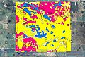
Soils of Glacial Lakes State Park area
-

A farm in Chippewa Falls Township


See also
 In Spanish: Condado de Pope (Minnesota) para niños
