Kandiyohi County, Minnesota facts for kids
Quick facts for kids
Kandiyohi County
|
|
|---|---|

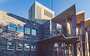
Kandiyohi County Courthouse
|
|

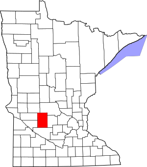
Location within the U.S. state of Minnesota
|
|
 Minnesota's location within the U.S. |
|
| Country | |
| State | |
| Founded | March 20, 1858 |
| Named for | "where buffalo fish come" (Dakota) |
| Seat | Willmar |
| Largest city | Willmar |
| Area | |
| • Total | 862 sq mi (2,230 km2) |
| • Land | 797 sq mi (2,060 km2) |
| • Water | 66 sq mi (170 km2) 7.6%% |
| Population
(2020)
|
|
| • Total | 43,732 |
| • Estimate
(2023)
|
43,813 |
| • Density | 54.9/sq mi (21.2/km2) |
| Time zone | UTC−6 (Central) |
| • Summer (DST) | UTC−5 (CDT) |
| Congressional district | 7th |
Kandiyohi County (KAN-dee-YOH-hy) is a county in the U.S. state of Minnesota. In 2020, about 43,732 people lived there. The main town, called the county seat, is Willmar. It has been the county seat since 1871.
Kandiyohi County is also part of the "Willmar, MN Micropolitan Statistical Area". This is a way the government groups nearby towns and cities for statistics.
Contents
History of Kandiyohi County
The name 'Kandiyohi' comes from the Dakota language. It means "where the buffalo fish come".
The county was officially created on March 20, 1858. At first, the town of Kandiyohi (then called Kandiyohi Station) was chosen as the county seat in 1870. The county was much smaller back then, only covering the southern half of its current size.
Things grew slowly. In 1870, the state government decided that Monongalia County should join with Kandiyohi. By November 21, 1871, they agreed to make Willmar the new county seat. Willmar was chosen because it was more centrally located.
Geography of Kandiyohi County
Kandiyohi County has rolling hills. Some areas have trees, but most of the land is used for farming. The land gently slopes toward the south and west. The highest point is in the northeastern part, about 1,306 feet (398 meters) above sea level.
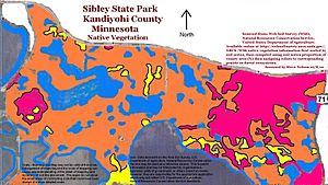
The county covers a total area of 862 square miles (2,233 square kilometers). About 797 square miles (2,064 square kilometers) are land, and 66 square miles (171 square kilometers) are covered by water. This means about 7.6% of the county is water. Kandiyohi County is one of seven counties in southern Minnesota that do not have forest soils. Instead, it has prairie ecosystems, which include savannas and open grasslands.
Lakes in Kandiyohi County
There are almost 70 named lakes in Kandiyohi County. Some of the well-known ones include:
- Big Kandiyohi Lake
- Green Lake
- Little Kandiyohi Lake
- Long Lake (Dovre Township)
- Long Lake: (Irving and Roseville townships)
- Nest Lake
- Swan Lake (Colfax and Lake Andrew townships)
- Swan Lake: (Dovre and Willmar townships)
- Swan Lake: (Kandiyohi Township)
- Swan Lake: (Mamre Township)
- Woodcock Lake (Green Lake Township)
- Woodcock Lake: (New London and Green Lake townships)
Major Highways in Kandiyohi County
Many important roads pass through Kandiyohi County, connecting it to other parts of Minnesota and beyond.
Counties Nearby
Kandiyohi County shares its borders with several other counties:
- Stearns County (north)
- Meeker County (east)
- Renville County (south)
- Chippewa County (southwest)
- Swift County (west)
- Pope County (northwest)
Protected Natural Areas
Kandiyohi County has several areas set aside to protect nature and wildlife. These are called State Wildlife Management Areas or State Parks.
- Burbank State Wildlife Management Area
- Dietrich Lange State Wildlife Management Area
- Oleander State Wildlife Management Area
- Ringo-Nest State Wildlife Management Area
- Roseville State Wildlife Management Area
- Sibley State Park
- Sunburg State Wildlife Management Area
- Yohi State Wildlife Management Area
Population of Kandiyohi County
The population of Kandiyohi County has grown steadily over the years. Here's how the number of people living there has changed:
| Historical population | |||
|---|---|---|---|
| Census | Pop. | %± | |
| 1860 | 76 | — | |
| 1870 | 1,760 | 2,215.8% | |
| 1880 | 10,159 | 477.2% | |
| 1890 | 13,997 | 37.8% | |
| 1900 | 18,416 | 31.6% | |
| 1910 | 18,969 | 3.0% | |
| 1920 | 22,060 | 16.3% | |
| 1930 | 23,574 | 6.9% | |
| 1940 | 26,524 | 12.5% | |
| 1950 | 28,644 | 8.0% | |
| 1960 | 29,987 | 4.7% | |
| 1970 | 30,548 | 1.9% | |
| 1980 | 36,763 | 20.3% | |
| 1990 | 38,761 | 5.4% | |
| 2000 | 41,203 | 6.3% | |
| 2010 | 42,239 | 2.5% | |
| 2020 | 43,732 | 3.5% | |
| 2023 (est.) | 43,813 | 3.7% | |
| U.S. Decennial Census 1790-1960 1900-1990 1990-2000 2010-2020 |
|||
In 2020, the United States Census counted 43,732 people living in Kandiyohi County. Most residents are White, but the county is becoming more diverse. There are growing numbers of Black or African American, Asian, and Hispanic or Latino residents.
Communities in Kandiyohi County
Kandiyohi County is home to several cities, small towns, and townships.
Cities in Kandiyohi County
Unincorporated Communities
These are smaller communities that are not officially organized as cities or towns.
Townships in Kandiyohi County
Townships are local government areas that often include rural land and smaller communities.
- Arctander Township
- Burbank Township
- Colfax Township
- Dovre Township
- East Lake Lillian Township
- Edwards Township
- Fahlun Township
- Gennessee Township
- Green Lake Township
- Harrison Township
- Holland Township
- Irving Township
- Kandiyohi Township
- Lake Andrew Township
- Lake Elizabeth Township
- Lake Lillian Township
- Mamre Township
- New London Township
- Norway Lake Township
- Roseland Township
- Roseville Township
- St. Johns Township
- Whitefield Township
- Willmar Township
See also
 In Spanish: Condado de Kandiyohi para niños
 | Audre Lorde |
 | John Berry Meachum |
 | Ferdinand Lee Barnett |


