Brooten, Minnesota facts for kids
Quick facts for kids
Brooten, Minnesota
|
|
|---|---|

Businesses on Brooten's Central Avenue
|
|
| Motto(s):
"Heart Of The Bonanza Valley"
|
|

|
|
| Country | United States |
| State | Minnesota |
| Counties | Stearns, Pope |
| Laid out | 1886 |
| Incorporated | February 16, 1892 |
| Area | |
| • Total | 1.587 sq mi (4.111 km2) |
| • Land | 1.587 sq mi (4.111 km2) |
| • Water | 0.000 sq mi (0.000 km2) |
| Elevation | 1,303 ft (397 m) |
| Population
(2020)
|
|
| • Total | 626 |
| • Estimate
(2022)
|
641 |
| • Density | 394.45/sq mi (152.27/km2) |
| Time zone | UTC–6 (Central (CST)) |
| • Summer (DST) | UTC–5 (CDT) |
| ZIP Code |
56316
|
| Area code(s) | 320 |
| FIPS code | 27-08092 |
| GNIS feature ID | 2393435 |
| Sales tax | 7.125% |
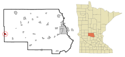
Brooten is a small city in the state of Minnesota, United States. It is located mostly in Stearns County, with a small part in Pope County. In 2020, about 626 people lived there. Brooten is known as the "Heart Of The Bonanza Valley."
Contents
History of Brooten
Brooten was first planned out in 1886. This happened when the Soo Railroad line was extended to this area. The city got its name from the LiaBraaten family, who were early settlers in the region. A post office has been open in Brooten since 1886, helping the community stay connected.
Geography and Location
Brooten covers a total area of about 1.587 square miles (4.111 square kilometers). All of this area is land, meaning there are no large lakes or rivers within the city limits.
Population and People
How Many People Live Here?
The number of people living in Brooten has changed over the years. In 1900, there were 259 residents. The population grew to 743 people by 2010. In the most recent count in 2020, the population was 626.
Who Lives in Brooten?
According to the 2010 census, there were 743 people living in Brooten. Most residents were White. About 23% of the people were under 18 years old. Around 28% of the population was 65 years old or older. The city had a fairly even number of males and females.
Fun Events and Culture
Bonanza Valley Days Celebration
Brooten hosts a special community event every year called Bonanza Valley Days. It takes place on the second weekend of July. The celebration starts with a dance on Friday evening. It finishes with an Ice Cream Social on Sunday. Many fun activities happen during the weekend. These include a bike rally, fireworks, and a pageant. There are also parades for kids and a grand parade for everyone.
Schools in Brooten
Brooten is home to the Belgrade–Brooten–Elrosa Elementary School. This school is part of the Belgrade-Brooten-Elrosa School District. It serves students from Brooten and nearby towns.
Getting Around Brooten
Roads and Highways
Minnesota State Highway 55 is an important road that goes through Brooten. It helps people travel to and from the community.
Brooten Municipal Airport
Brooten also has its own airport, called the Brooten Municipal Airport. It is located about one mile southeast of the city. The airport has a paved runway that is 3,500 feet long.
Images for kids
See also
 In Spanish: Brooten (Minnesota) para niños
 | William M. Jackson |
 | Juan E. Gilbert |
 | Neil deGrasse Tyson |


