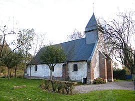
Bacouel-sur-Selle facts for kids
Quick facts for kids
Bacouel-sur-Selle
|
||
|---|---|---|
 |
||
|
||
| Country | France | |
| Region | Hauts-de-France | |
| Department | Somme | |
| Arrondissement | Amiens | |
| Canton | Conty | |
| Area
1
|
6.24 km2 (2.41 sq mi) | |
| Population
(2010)
|
474 | |
| • Density | 75.96/km2 (196.7/sq mi) | |
| Time zone | UTC+01:00 (CET) | |
| • Summer (DST) | UTC+02:00 (CEST) | |
| INSEE/Postal code |
80050 /80480
|
|
| Elevation | 36–121 m (118–397 ft) (avg. 38 m or 125 ft) |
|
| 1 French Land Register data, which excludes lakes, ponds, glaciers > 1 km2 (0.386 sq mi or 247 acres) and river estuaries. | ||
Bacouel-sur-Selle is a small and charming commune (which is like a town or village) located in northern France. It is part of the Somme department, which is a region known for its history. This commune is also found within the larger Hauts-de-France area.
In 2010, about 474 people lived in Bacouel-sur-Selle. It's a quiet place where people live and work.
Contents
What is Bacouel-sur-Selle?
Bacouel-sur-Selle is a commune in France. A commune is the smallest type of administrative area in France. Think of it like a small town or village with its own local government. It helps manage local services for the people who live there.
Where is Bacouel-sur-Selle located?
This commune is in the Somme department. The Somme department is in the Hauts-de-France region. This region is in the northern part of France. It is known for its green landscapes and historical sites.
What is the population of Bacouel-sur-Selle?
In 2010, the population of Bacouel-sur-Selle was 474 people. This makes it a small community. Small communities often have a close-knit feel.
Geography of Bacouel-sur-Selle
Bacouel-sur-Selle is located near the Selle River. This river gives the commune part of its name. Rivers are important for many communities. They can provide water and help shape the land.
How big is Bacouel-sur-Selle?
The area of Bacouel-sur-Selle is about 6.24 square kilometers. This is a relatively small area. It means the commune is quite compact.
What is the elevation of Bacouel-sur-Selle?
The land in Bacouel-sur-Selle has different heights. The lowest point is 36 meters above sea level. The highest point is 121 meters. The average height is 38 meters. This shows the land is not completely flat.
Local Government and Administration
Like all communes in France, Bacouel-sur-Selle has a local government. This government helps run the commune. It makes decisions about local services.
What is an Arrondissement?
Bacouel-sur-Selle is part of the Amiens arrondissement. An arrondissement is a larger administrative area. It groups several communes together. It helps organize services for a wider area.
What is a Canton?
The commune is also part of the Conty canton. A canton is another type of administrative division. It is used for elections and some local services.
See also
 In Spanish: Bacouel-sur-Selle para niños
 | William L. Dawson |
 | W. E. B. Du Bois |
 | Harry Belafonte |


