Baileyville, Kansas facts for kids
Quick facts for kids
Baileyville, Kansas
|
|
|---|---|

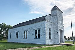
Historical Marion Hall in Baileyville (2021)
|
|

|
|
| Country | United States |
| State | Kansas |
| County | Nemaha |
| Named for | Willis J. Bailey |
| Elevation | 1,309 ft (399 m) |
| Population
(2020)
|
|
| • Total | 182 |
| Time zone | UTC-6 (CST) |
| • Summer (DST) | UTC-5 (CDT) |
| Area code | 785 |
| FIPS code | 20-03675 |
| GNIS ID | 2629152 |
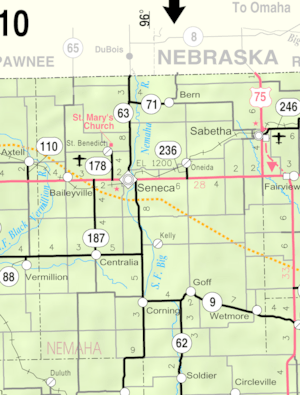
Baileyville is a small community in western Nemaha County, Kansas, United States. It is called a census-designated place (CDP) because the U.S. Census Bureau collects information about it. In 2020, 182 people lived there. You can find Baileyville about six miles west of Seneca on U.S. Route 36.
Contents
History of Baileyville
The community was first known as Haytown. Later, it was renamed Baileyville by Willis J. Bailey and his father. Willis J. Bailey became an important person in Kansas. In 1903, he became the 16th Governor of Kansas. The first post office in Baileyville opened in 1880.
Who Lives in Baileyville?
| Historical population | |||
|---|---|---|---|
| Census | Pop. | %± | |
| 2020 | 182 | — | |
| U.S. Decennial Census | |||
The 2020 United States census counted 182 people living in Baileyville. There were 79 households and 55 families. Most people living here were white.
About 25% of the people were under 18 years old. Around 26% were 65 years or older. The average age in Baileyville was 53 years.
Schools and Learning
Local Schools
Students in Baileyville attend schools in the Nemaha Central USD 115 public school district. Nemaha Central High School is located in Seneca. Their school mascot is the Thunder.
There used to be a school called B&B High School in Baileyville. Its mascot was the Falcons. This school closed in 2014 when school districts combined.
Higher Education
For students looking to continue their education, Highland Community College opened a campus in Baileyville in June 2014.
Getting Around Baileyville
The community has access to transportation. The Union Pacific Railroad runs through Baileyville. Also, U.S. Route 36 is a major highway that serves the area.
See also
 In Spanish: Baileyville (Kansas) para niños
 | Charles R. Drew |
 | Benjamin Banneker |
 | Jane C. Wright |
 | Roger Arliner Young |


