Baker, North Dakota facts for kids
Quick facts for kids
Baker, North Dakota
|
|
|---|---|
| Country | United States |
| State | North Dakota |
| County | Benson |
| Elevation | 1,644 ft (501 m) |
| Time zone | UTC-7 (Mountain (MST)) |
| • Summer (DST) | UTC-6 (MDT) |
| Area code(s) | 701 |
| GNIS feature ID | 1027787 |
Baker is a small place located in Benson County, North Dakota, in the United States. It is known as an "unincorporated community." This means it's a group of homes and buildings that doesn't have its own local government like a city or town. Instead, it's managed by the larger county it's in.
Contents
Discover Baker, North Dakota
Baker is a quiet spot in the state of North Dakota. It's not a big city, but it's part of the landscape of the United States. Understanding places like Baker helps us learn about different types of communities.
Where is Baker Located?
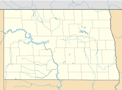
Baker is found in Benson County, which is in the northeastern part of North Dakota. Its exact location is at coordinates 48 degrees, 9 minutes, 38 seconds North and 99 degrees, 38 minutes, 51 seconds West. This helps people find it on a map!
The community sits at an elevation of about 501 meters (or 1,644 feet) above sea level. This elevation tells us how high up it is compared to the ocean.
What is an Unincorporated Community?
An unincorporated community, like Baker, is a group of homes or businesses that are not officially part of a city or town. They don't have their own mayor or city council. Instead, they are governed by the county they are located in. For Baker, that's Benson County. This setup is common in many rural areas across the United States.
Time Zone and Communication
Baker is in the Mountain Time Zone. This means its clocks are usually 7 hours behind UTC (UTC-7). During Daylight Saving Time, it shifts to MDT (Mountain Daylight Time), which is 6 hours behind UTC (UTC-6). If you wanted to call someone in Baker, you would use the 701 area code.
 | Stephanie Wilson |
 | Charles Bolden |
 | Ronald McNair |
 | Frederick D. Gregory |


