List of counties in North Dakota facts for kids
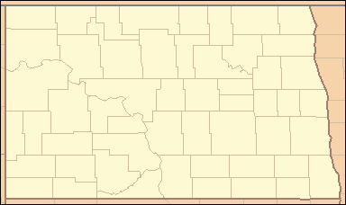
North Dakota is a state in the United States. It has 53 special areas called counties. Think of a county like a big neighborhood or district within a state. Each county has its own government that helps manage things like roads, schools, and local services for the people living there.
Quick facts for kids Counties of North Dakota |
|
|---|---|
| Location | State of North Dakota |
| Number | 53 |
| Populations | 674 (Slope) – 196,362 (Cass) |
| Areas | 632 square miles (1,640 km2) (Eddy) – 2,742 square miles (7,100 km2) (McKenzie) |
| Government | County government |
| Subdivisions | Cities, towns, townships, unincorporated communities, Indian reservations, census designated places |
Discover North Dakota's Counties
Each of North Dakota's 53 counties has its own unique story. Many are named after important people like governors, explorers, or railroad leaders. Others are named for natural features or local history.
Here is a list of all the counties in North Dakota. You can see their county seat (the main town), when they were created, and who or what they were named after.
| County |
FIPS code | County seat | Est. | Why the Name? | Population | Area | Map |
|---|---|---|---|---|---|---|---|
| Adams County | 001 | Hettinger | 1885 | Named for John Quincy Adams, a railroad agent. | 2,163 | 988 sq mi (2,559 km2) |
 |
| Barnes County | 003 | Valley City | 1875 | Named for Alanson H. Barnes, a judge. | 10,726 | 1,492 sq mi (3,864 km2) |
 |
| Benson County | 005 | Minnewaukan | 1883 | Named for Bertil W. Benson, a territorial legislator. | 5,745 | 1,389 sq mi (3,597 km2) |
 |
| Billings County | 007 | Medora | 1879 | Named for Frederick H. Billings, a railroad president. | 1,034 | 1,152 sq mi (2,984 km2) |
 |
| Bottineau County | 009 | Bottineau | 1873 | Named for Pierre Bottineau, a frontiersman. | 6,349 | 1,669 sq mi (4,323 km2) |
 |
| Bowman County | 011 | Bowman | 1883 | Named for Edward M. Bowman, a territorial legislator. | 2,867 | 1,162 sq mi (3,010 km2) |
 |
| Burke County | 013 | Bowbells | 1910 | Named for John Burke, a North Dakota Governor. | 2,134 | 1,104 sq mi (2,859 km2) |
 |
| Burleigh County | 015 | Bismarck | 1873 | Named for Walter A. Burleigh, a delegate to Congress. | 100,012 | 1,633 sq mi (4,229 km2) |
 |
| Cass County | 017 | Fargo | 1873 | Named for George Washington Cass, a railroad president. | 196,362 | 1,766 sq mi (4,574 km2) |
 |
| Cavalier County | 019 | Langdon | 1873 | Named for Charles Cavalier, an early fur trapper. | 3,596 | 1,489 sq mi (3,856 km2) |
 |
| Dickey County | 021 | Ellendale | 1881 | Named for George H. Dickey, a territorial legislator. | 4,900 | 1,131 sq mi (2,929 km2) |
 |
| Divide County | 023 | Crosby | 1910 | Named because it was created by dividing Williams County. | 2,135 | 1,259 sq mi (3,261 km2) |
 |
| Dunn County | 025 | Manning | 1883 | Named for John P. Dunn, an early leader in Bismarck. | 4,019 | 2,010 sq mi (5,206 km2) |
 |
| Eddy County | 027 | New Rockford | 1885 | Named for Ezra B. Eddy, a Fargo banker. | 2,263 | 632 sq mi (1,637 km2) |
 |
| Emmons County | 029 | Linton | 1879 | Named for James Emmons, an early businessman. | 3,224 | 1,510 sq mi (3,911 km2) |
 |
| Foster County | 031 | Carrington | 1873 | Named for James S. Foster or George I. Foster, prominent farmers. | 3,309 | 635 sq mi (1,645 km2) |
 |
| Golden Valley County | 033 | Beach | 1912 | Named for promotional reasons or a land company. | 1,743 | 1,002 sq mi (2,595 km2) |
 |
| Grand Forks County | 035 | Grand Forks | 1873 | Named for its location where two rivers meet. | 72,708 | 1,438 sq mi (3,724 km2) |
 |
| Grant County | 037 | Carson | 1916 | Named for Ulysses S. Grant, the 18th U.S. President. | 2,215 | 1,660 sq mi (4,299 km2) |
 |
| Griggs County | 039 | Cooperstown | 1881 | Named for Alexander Griggs, a steamboat captain. | 2,248 | 708 sq mi (1,834 km2) |
 |
| Hettinger County | 041 | Mott | 1883 | Named for Mathias K. Hettinger, a legislator's father-in-law. | 2,415 | 1,132 sq mi (2,932 km2) |
 |
| Kidder County | 043 | Steele | 1873 | Named for Jefferson Parrish Kidder, a territorial delegate. | 2,342 | 1,352 sq mi (3,502 km2) |
 |
| LaMoure County | 045 | LaMoure | 1873 | Named for Judson LaMoure, a territorial legislator. | 4,096 | 1,147 sq mi (2,971 km2) |
 |
| Logan County | 047 | Napoleon | 1873 | Named for John A. Logan, an Illinois U.S. Senator. | 1,869 | 993 sq mi (2,572 km2) |
 |
| McHenry County | 049 | Towner | 1873 | Named for James McHenry, an early settler. | 5,131 | 1,874 sq mi (4,854 km2) |
 |
| McIntosh County | 051 | Ashley | 1883 | Named for Edward H. McIntosh, a territorial legislator. | 2,488 | 975 sq mi (2,525 km2) |
 |
| McKenzie County | 053 | Watford City | 1905 | Named for Alexander McKenzie, a powerful political figure. | 14,252 | 2,742 sq mi (7,102 km2) |
 |
| McLean County | 055 | Washburn | 1883 | Named for John A. McLean, Bismarck's first mayor. | 9,832 | 2,110 sq mi (5,465 km2) |
 |
| Mercer County | 057 | Stanton | 1875 | Named for William Henry Harrison Mercer, an early settler. | 8,309 | 1,045 sq mi (2,707 km2) |
 |
| Morton County | 059 | Mandan | 1873 | Named for Oliver Hazard Perry Throck Morton, Governor of Indiana. | 33,895 | 1,926 sq mi (4,988 km2) |
 |
| Mountrail County | 061 | Stanley | 1873 | Named for Joseph Mountraille, an early explorer. | 9,383 | 1,824 sq mi (4,724 km2) |
 |
| Nelson County | 063 | Lakota | 1883 | Named for Nelson E. Nelson, a territorial legislator. | 2,991 | 982 sq mi (2,543 km2) |
 |
| Oliver County | 065 | Center | 1885 | Named for Harry S. Oliver, a territorial legislator. | 1,879 | 724 sq mi (1,875 km2) |
 |
| Pembina County | 067 | Cavalier | 1867 | Named for wild cranberries that grew in the area. | 6,661 | 1,119 sq mi (2,898 km2) |
 |
| Pierce County | 069 | Rugby | 1887 | Named for Gilbert Ashville Pierce, a Governor and Senator. | 3,902 | 1,018 sq mi (2,637 km2) |
 |
| Ramsey County | 071 | Devils Lake | 1873 | Named for Alexander Ramsey, a Minnesota U.S. Senator. | 11,463 | 1,186 sq mi (3,072 km2) |
 |
| Ransom County | 073 | Lisbon | 1873 | Named for Fort Ransom, a local fort. | 5,603 | 863 sq mi (2,235 km2) |
 |
| Renville County | 075 | Mohall | 1873 | Named for Joseph Renville, a missionary and interpreter. | 2,279 | 875 sq mi (2,266 km2) |
 |
| Richland County | 077 | Wahpeton | 1873 | Named for Morgan T. Rich, an early settler. | 16,558 | 1,437 sq mi (3,722 km2) |
 |
| Rolette County | 079 | Rolla | 1873 | Named for Joseph Rolette, Jr., a fur trapper and organizer. | 11,728 | 902 sq mi (2,336 km2) |
 |
| Sargent County | 081 | Forman | 1883 | Named for Homer E. Sargent, a railroad manager. | 3,776 | 859 sq mi (2,225 km2) |
 |
| Sheridan County | 083 | McClusky | 1873 | Named for Philip Henry Sheridan, a Civil War officer. | 1,266 | 972 sq mi (2,517 km2) |
 |
| Sioux County | 085 | Fort Yates | 1915 | Named for the Native American Sioux people. | 3,643 | 1,094 sq mi (2,833 km2) |
 |
| Slope County | 087 | Amidon | 1915 | Named for a local land feature called the Missouri Slope. | 674 | 1,218 sq mi (3,155 km2) |
 |
| Stark County | 089 | Dickinson | 1879 | Named for George Stark, a railroad vice president. | 33,001 | 1,338 sq mi (3,465 km2) |
 |
| Steele County | 091 | Finley | 1883 | Named for Edward H. Steele, a land company secretary. | 1,782 | 712 sq mi (1,844 km2) |
 |
| Stutsman County | 093 | Jamestown | 1873 | Named for Enos Stutsman, a territorial legislator. | 21,392 | 2,222 sq mi (5,755 km2) |
 |
| Towner County | 095 | Cando | 1883 | Named for Oscar M. Towner, a territorial legislator. | 2,030 | 1,025 sq mi (2,655 km2) |
 |
| Traill County | 097 | Hillsboro | 1875 | Named for Walter John Strickland Traill, an early settler. | 7,908 | 862 sq mi (2,233 km2) |
 |
| Walsh County | 099 | Grafton | 1881 | Named for George H. Walsh, an early settler and university founder. | 10,305 | 1,282 sq mi (3,320 km2) |
 |
| Ward County | 101 | Minot | 1888 | Named for Mark Ward, a territorial legislator. | 68,332 | 2,013 sq mi (5,214 km2) |
 |
| Wells County | 103 | Fessenden | 1873 | Named for Edward Payson Wells, a territorial legislator. | 3,876 | 1,271 sq mi (3,292 km2) |
 |
| Williams County | 105 | Williston | 1890 | Named for Erastus Appelman Williams, a territorial legislator. | 39,113 | 2,071 sq mi (5,364 km2) |
 |
See also
 In Spanish: Anexo:Condados de Dakota del Norte para niños
- Geography of North Dakota
- North Dakota Association of Counties
Black History Month on Kiddle
Famous African-American Scientists:
 | Percy Lavon Julian |
 | Katherine Johnson |
 | George Washington Carver |
 | Annie Easley |

All content from Kiddle encyclopedia articles (including the article images and facts) can be freely used under Attribution-ShareAlike license, unless stated otherwise. Cite this article:
List of counties in North Dakota Facts for Kids. Kiddle Encyclopedia.


