
Slope County, North Dakota facts for kids
Quick facts for kids
Slope County
|
|
|---|---|

Former Slope County Courthouse in Amidon
|
|

Location within the U.S. state of North Dakota
|
|
 North Dakota's location within the U.S. |
|
| Country | |
| State | |
| Founded | November 3, 1914 January 14, 1915 (organized) |
| Seat | Amidon |
| Largest city | Marmarth |
| Area | |
| • Total | 1,219 sq mi (3,160 km2) |
| • Land | 1,215 sq mi (3,150 km2) |
| • Water | 4.2 sq mi (11 km2) 0.3% |
| Population
(2020)
|
|
| • Total | 706 |
| • Estimate
(2022)
|
672 |
| • Density | 0.5792/sq mi (0.22362/km2) |
| Time zone | UTC−7 (Mountain) |
| • Summer (DST) | UTC−6 (MDT) |
| Congressional district | At-large |
Slope County is a county in the state of North Dakota. In 2020, 706 people lived there. This makes it the county with the fewest people in North Dakota. It is also the 18th-least populated county in the whole United States. The main town where the county government is located is Amidon.
Contents
History of Slope County
Slope County was created on November 3, 1914. People voted to separate it from a larger county called Billings County. This was the last time Billings County was made smaller. Before this, Bowman County was formed from it in 1883. Then, Golden Valley County was split off in 1910.
After the vote, Slope County was officially organized on January 14, 1915. The county's name comes from the "Missouri Slope." This is a special geographical area in western North Dakota. It refers to the land west of the Missouri River.
Geography of Slope County
.JPG)
Slope County is in the lower western part of North Dakota. Its western border touches the state of Montana. The Little Missouri River flows into the county from the south. It then goes north, briefly into Golden Valley County, and then turns north into Billings County. Cedar Creek drains the southeastern part, flowing south into Bowman County.
The land in Slope County has many rough hills and valleys. It also has lower hills, and some areas are used for farming. The land generally slopes down towards the east and south. The highest point, not counting special peaks like White Butte, is in the northwestern corner. It is about 3,104 feet (946 meters) above sea level.
The county covers about 1,219 square miles (3,157 square kilometers). Most of this, 1,215 square miles (3,147 square kilometers), is land. Only about 4.2 square miles (11 square kilometers) is water.
White Butte is in the southeast of Slope County. It is the highest natural point in North Dakota. Its elevation is about 3,506 feet (1,069 meters).
Main Roads in Slope County
 U.S. Highway 12
 U.S. Highway 85
 North Dakota Highway 21
 North Dakota Highway 67
Protected Natural Areas
These are special places where nature is protected:
- Little Missouri National Grassland (part of it)
- Stewart Lake National Wildlife Refuge
- White Lake National Wildlife Refuge
Counties Nearby
Slope County shares borders with these counties:
- Billings County - to the north
- Stark County - to the northeast
- Hettinger County - to the east
- Adams County - to the southeast
- Bowman County - to the south
- Fallon County, Montana - to the west
- Golden Valley County - to the northwest
Lakes in Slope County
- Cedar Lake
- White Lake
Population and People
The number of people living in Slope County has changed a lot over the years. In 1920, there were 4,940 people. By 2020, the population had dropped to 706. This is the biggest population drop from its highest point for any county in the United States. In 2022, the estimated population was 672.
What the 2010 Census Showed
In 2010, there were 727 people living in Slope County. There were 326 households, which are groups of people living together. About 22.4% of these households had children under 18. Most households (60.7%) were married couples.
The average age of people in the county was 49.2 years old. Most people (97.5%) were white. About 2.2% were American Indian. A small number (1.7%) were of Hispanic or Latino background.
Many people in Slope County have German (53.9%) or Norwegian (30.7%) family backgrounds. Other backgrounds include English, Swedish, Polish, and American.
The average income for a household was $43,625 per year. For families, it was $55,833. About 10.5% of all people in the county lived below the poverty line. This means they had a very low income.
Towns and Communities
Cities
Small Unincorporated Communities
These are small places that are not officially cities or towns:
- De Sart
- Mound
- Pierce
Education
Children in Slope County go to schools in these districts:
- Bowman County Public School District 1
- New England Public School District 9
- Scranton Public School District 33
- Marmarth Public School District 12 (This district only has elementary schools.)
Some school districts have closed or merged:
- Central Elementary Public School District 32 (Amidon Elementary School) closed in 2020. Its students now go to Bowman County School District No. 1 or New England School District No. 9.
- Sheets Public School District 14 (Cottage School) also closed.
The Amidon and Cottage schools were the last two schools left in the county before they closed.
Images for kids
-
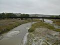
US Highway 12 bridge over the Little Missouri River
-
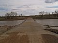
Three V Crossing across the Little Missouri River
-
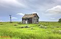
Old house
-
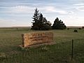
Pierce Congregational Cemetery in Woodberry Township


See also
 In Spanish: Condado de Slope para niños
