Little Missouri River (North Dakota) facts for kids
Quick facts for kids Little Missouri River |
|
|---|---|

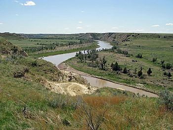
Flowing through Theodore Roosevelt National Park
|
|

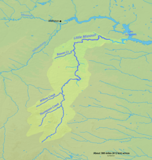
Little Missouri watershed
|
|
|
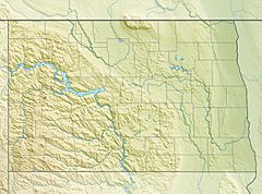
Location of the mouth of the Little Missouri River in North Dakota
|
|
| Country | United States |
| State | Wyoming, Montana, South Dakota, North Dakota |
| Physical characteristics | |
| Main source | Flatiron Butte near Oshoto, Crook County, Wyoming 4,501 ft (1,372 m) 44°32′25″N 104°59′57″W / 44.54028°N 104.99917°W |
| River mouth | Missouri River Lake Sakakawea, near Killdeer, Dunn County, North Dakota 1,860 ft (570 m) 47°36′38″N 102°52′24″W / 47.61056°N 102.87333°W |
| Length | 560 mi (900 km) |
| Basin features | |
| Basin size | 8,310 sq mi (21,500 km2) |
The Little Missouri River is a long river in the northern Great Plains of the United States. It is about 560 miles (901 km) long. This river is a branch, or tributary, of the much larger Missouri River.
Contents
Where Does the Little Missouri River Flow?
The Little Missouri River starts in northeastern Wyoming. It begins near a famous rock formation called Devils Tower. From there, it flows northeast. It crosses a small part of southeastern Montana. Then, it enters South Dakota.
In South Dakota, the river flows north through an area known as the Badlands. After that, it continues into North Dakota. Here, it travels through the Little Missouri National Grassland. It also passes through both parts of Theodore Roosevelt National Park.
Joining the Missouri River
In the northern part of Theodore Roosevelt National Park, the river turns east. It then flows into the Missouri River in Dunn County, North Dakota. This meeting point is at Lake Sakakawea. The Little Missouri River forms a long arm of this lake, about 30 miles (48 km) long. This arm is called Little Missouri Bay. The river joins the main Missouri River channel about 25 miles (40 km) northeast of Killdeer, North Dakota.
The River's Landscape and Rocks
The land around the Little Missouri River is often treeless. It includes areas of badlands. When it rains, water flows off these areas. This water carries a lot of dirt and small rocks into the river. This makes the river carry a heavy load of sediment downstream.
The ground along the river is made of different layers of rock. These layers formed a very long time ago. Most of the rocks along the river are from a time called the Paleocene epoch. This was about 66 to 56 million years ago. These rocks include siltstone, claystone, and sandstone. There is also lignite coal. These materials were laid down in a coastal plain. This happened during a period of mountain building called the Laramide orogeny.
See also
 In Spanish: Río Pequeño Misuri para niños
 | Selma Burke |
 | Pauline Powell Burns |
 | Frederick J. Brown |
 | Robert Blackburn |


