
Foster County, North Dakota facts for kids
Quick facts for kids
Foster County
|
|
|---|---|

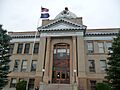
Foster County Courthouse in Carrington, North Dakota.
|
|

Location within the U.S. state of North Dakota
|
|
 North Dakota's location within the U.S. |
|
| Country | |
| State | |
| Founded | January 4, 1873 (created) October 11, 1883 (organized) |
| Seat | Carrington |
| Largest city | Carrington |
| Area | |
| • Total | 647 sq mi (1,680 km2) |
| • Land | 635 sq mi (1,640 km2) |
| • Water | 11 sq mi (30 km2) 1.8% |
| Population
(2020)
|
|
| • Total | 3,397 |
| • Estimate
(2022)
|
3,378 |
| • Density | 5.250/sq mi (2.0272/km2) |
| Time zone | UTC−6 (Central) |
| • Summer (DST) | UTC−5 (CDT) |
| Congressional district | At-large |
Foster County is a county located in the state of North Dakota in the United States. In 2020, about 3,397 people lived there. The main town and government center of the county is Carrington.
Contents
History of Foster County
How Foster County Was Formed
Foster County was created on January 4, 1873. This happened when the government of the Dakota Territory decided to use land from Pembina County to make a new county. The county was named after George I. Foster. He was an early settler and a member of the local government at the time.
Setting Up the County Government
Even though the county was created, it didn't have its own full government right away. Its borders changed a few times between 1881 and 1885. Finally, on October 11, 1883, Foster County officially set up its own government. This means it could then manage its own affairs.
Geography of Foster County
Land and Water Features
Foster County is located in the central part of North Dakota. The James River flows through the middle of the county, heading south. The land here has gentle, rolling hills. Most of this land is used for farming. The eastern part of the county has many lakes and ponds.
The land in Foster County generally slopes down towards the south and east. The highest point in the county is in its southwestern corner. It is about 1,942 feet (592 meters) above sea level. Foster County covers a total area of 647 square miles (1,676 square kilometers). Most of this is land, about 635 square miles (1,645 square kilometers). The rest, about 11 square miles (28 square kilometers), is water. This makes it one of the smaller counties in North Dakota.
Main Roads and Highways
You can travel through Foster County using several important roads:
 U.S. Highway 52
 U.S. Highway 281
 North Dakota Highway 9
 North Dakota Highway 20
 North Dakota Highway 200
Neighboring Counties
Foster County shares its borders with these other counties:
- Eddy County to the north
- Griggs County to the east
- Stutsman County to the south
- Wells County to the west
Protected Natural Areas
Part of the Arrowwood National Wildlife Refuge is located in Foster County. This is a special area set aside to protect wildlife.
Lakes in Foster County
Here are some of the lakes you can find in Foster County:
- Blue Cloud Lake
- Jack Lake
- Juanita Lake
- Lake Bonita
- Lake George
- Russell Lake
People of Foster County
Population Changes Over Time
In 1880, only 37 people lived in Foster County. The population grew quite a lot over the years, reaching its highest point in 1930 with 6,353 people. Since then, the number of people living in the county has slowly decreased. In 2020, the population was 3,397. By 2022, it was estimated to be around 3,378.
Who Lives in Foster County?
According to the 2010 census, there were 3,343 people living in Foster County. Most of the people were white (98.4%). A small number were American Indian (0.6%), Black (0.1%), or Asian (0.1%). Some people were from other races or a mix of two or more races. About 0.9% of the population was of Hispanic or Latino background.
Many people in Foster County have German (54.2%) or Norwegian (35.9%) ancestry. Other common backgrounds include Irish (9.8%), American (5.8%), and Swedish (5.1%).
Households and Families
In 2010, there were 1,495 households in the county. About 23.7% of these households had children under 18 living with them. Most households (53.4%) were married couples. The average household had about 2.20 people, and the average family had about 2.81 people. The average age of people in the county was 46.7 years old.
The average income for a household in the county was $41,066. For families, the average income was $55,278. About 7.3% of all people in the county lived below the poverty line. This included 5.2% of those under 18 and 13.4% of those aged 65 or older.
Communities in Foster County
Cities
- Carrington (This is the main town and where the county government is located.)
- Glenfield
- Grace City
- McHenry
Unincorporated Communities
These are smaller communities that are not officially organized as cities:
Images for kids
-
The Foster County Courthouse in Carrington, North Dakota.
See also
 In Spanish: Condado de Foster para niños
