Baldwin, Louisiana facts for kids
Quick facts for kids
Baldwin, Louisiana
|
|
|---|---|
|
Town
|
|

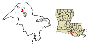
Location of Baldwin in St. Mary Parish, Louisiana.
|
|

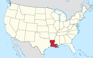
Location of Louisiana in the United States
|
|
| Country | United States |
| State | Louisiana |
| Parish | St. Mary |
| Area | |
| • Total | 3.23 sq mi (8.36 km2) |
| • Land | 3.22 sq mi (8.33 km2) |
| • Water | 0.01 sq mi (0.02 km2) |
| Elevation | 16 ft (5 m) |
| Population
(2020)
|
|
| • Total | 1,762 |
| • Density | 547.72/sq mi (211.47/km2) |
| Time zone | UTC-6 (CST) |
| • Summer (DST) | UTC-5 (CDT) |
| Area code(s) | 337 |
| FIPS code | 22-04020 |
Baldwin is a small town in St. Mary Parish, Louisiana, United States. In 2020, about 1,762 people lived there. Most of the people living in Baldwin are African American.
Contents
History of Baldwin
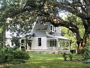
The town of Baldwin was named after John Baldwin. He was an educator from Ohio. In 1867, John Baldwin bought a very large farm in Louisiana. It was called the Darby plantation. His home there, Darby House, stayed in his family until 1937. Today, it is a special historic place.
Baldwin was also home to schools like Gilbert Academy and Industrial School. This school later became Godman Industrial School. After it closed in 1978, it became the Sager Brown campus for a group called UMCOR. A doctor and politician from Louisiana, Alvan Lafargue, lived and worked in Baldwin before 1915.
Another historic home in Baldwin is called Tillandsia. John Baldwin Sr. built this house. It is also listed as a historic place. If you like nature, Cypremort Point State Park is about 22 miles (35 km) southwest of Baldwin.
Geography of Baldwin
Baldwin is located at 29°50′10″N 91°32′56″W / 29.83611°N 91.54889°W.
The main road through Baldwin is Louisiana Highway 182. This road goes northwest to Jeanerette (about 9 miles or 14 km away). It also goes southeast to Franklin (about 5 miles or 8 km away). Franklin is the main town of St. Mary Parish.
Another road, Louisiana Highway 83, crosses LA-182. It travels southwest from Baldwin to smaller communities. These include Louisa, Glencoe, and Four Corners. Then it turns northwest to meet Louisiana Highway 14 in New Iberia.
The town of Baldwin covers about 3.2 square miles (8.3 square kilometers) of land.
People in Baldwin
| Historical population | |||
|---|---|---|---|
| Census | Pop. | %± | |
| 1920 | 964 | — | |
| 1930 | 822 | −14.7% | |
| 1940 | 984 | 19.7% | |
| 1950 | 1,138 | 15.7% | |
| 1960 | 1,548 | 36.0% | |
| 1970 | 2,117 | 36.8% | |
| 1980 | 2,644 | 24.9% | |
| 1990 | 2,379 | −10.0% | |
| 2000 | 2,497 | 5.0% | |
| 2010 | 2,436 | −2.4% | |
| 2020 | 1,762 | −27.7% | |
| U.S. Decennial Census | |||
What the 2020 Census Shows
The 2020 United States census counted 1,762 people living in Baldwin. There were 804 households and 447 families.
| Race | Number | Percentage |
|---|---|---|
| White (not Hispanic) | 513 | 29.11% |
| Black or African American (not Hispanic) | 1,105 | 62.71% |
| Native American | 21 | 1.19% |
| Asian | 9 | 0.51% |
| Pacific Islander | 1 | 0.06% |
| Other/Mixed | 77 | 4.37% |
| Hispanic or Latino | 36 | 2.04% |
Education in Baldwin
The St. Mary Parish School Board runs the public schools in Baldwin. West St. Mary High School is located near the town.
Famous Residents
- Alvan Lafargue - A doctor and politician.
See also
 In Spanish: Baldwin (Luisiana) para niños
 | Jewel Prestage |
 | Ella Baker |
 | Fannie Lou Hamer |


