Banbury Hill facts for kids
| Location | Near Sturminster Newton, Dorset |
|---|---|
| Coordinates | 50°54′23″N 2°18′01″W / 50.90639°N 2.30028°W |
| Type | Hillfort |
| Area | 1.2 hectares (3.0 acres) |
| History | |
| Periods | Iron Age |
| Designated | 14 July 1933 |
| Reference no. | 1018873 |
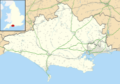
Banbury Hillfort, also known as Banbury Hill Camp, is an ancient hillfort from the Iron Age. It is located in Dorset, England. You can find it about 1.25 miles (2.0 km) south of Sturminster Newton. It's also about 1 mile (1.6 km) north-west of the village of Okeford Fitzpaine.
This historic site is protected as a Scheduled Ancient Monument. This means it's a really important place that helps us understand the past.
Contents
What Does Banbury Hillfort Look Like?
This hillfort sits on a low hill. A single earth bank forms a rough circle around an area of about 1.2 hectares (3.0 acres). That's like the size of about two football fields! Over time, farming has changed some parts of the site.
Exploring the Rampart and Ditch
Where the fort is best preserved, the main earth bank, called a rampart, is about 15 metres (49 ft) wide. It stands about 0.5 metres (1.6 ft) higher than the inside of the fort. Outside the rampart, there's a ditch. This ditch is about 8 metres (26 ft) wide and 1.5 metres (4.9 ft) deep in some places.
How Did People Enter the Fort?
The original entrance to the fort is on the west side. It was protected by another earth bank. This outer bank is 15 metres (49 ft) wide and 1 metre (3.3 ft) high. There are also signs of a ditch outside this bank. This bank branches off from the main rampart. It curves around, creating a narrow path into the fort. At one point, this path is only about 2 metres (6.6 ft) wide.
What Was Found Inside?
Archaeologists haven't found any remains of buildings or structures inside the fort. However, in 1986, during an excavation for a water pipe, they learned more about the rampart. They found it was built using local limestone. There were also pieces of flint and chert mixed in.
Images for kids


