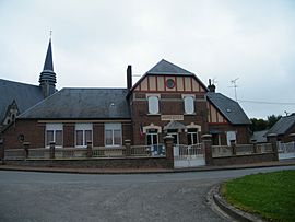
Barleux facts for kids
Quick facts for kids
Barleux
|
|
|---|---|
 |
|
| Country | France |
| Region | Hauts-de-France |
| Department | Somme |
| Arrondissement | Péronne |
| Canton | Péronne |
| Area
1
|
7.46 km2 (2.88 sq mi) |
| Population
(2010)
|
264 |
| • Density | 35.39/km2 (91.66/sq mi) |
| Time zone | UTC+01:00 (CET) |
| • Summer (DST) | UTC+02:00 (CEST) |
| INSEE/Postal code |
80054 /80200
|
| Elevation | 47–87 m (154–285 ft) (avg. 48 m or 157 ft) |
| 1 French Land Register data, which excludes lakes, ponds, glaciers > 1 km2 (0.386 sq mi or 247 acres) and river estuaries. | |
Barleux is a small commune located in northern France. It is part of the Somme department in the Hauts-de-France region. A commune is like a small town or village, and Barleux is one of many in France.
In 2010, Barleux had a population of 264 people. This makes it a very quiet and peaceful place to live.
Contents
Where is Barleux Located?
Barleux is situated in the Somme department, which is in the Hauts-de-France region. This region is in the northern part of France. The closest larger town is Péronne.
What is a Commune?
In France, a "commune" is the smallest unit of local government. It's similar to a township or a small municipality in other countries. Each commune has its own local council and a mayor who helps manage the area. Barleux is one of these many small communities that make up the French countryside.
How Many People Live in Barleux?
As of 2010, only 264 people lived in Barleux. This means it's a very small village. Small communes like Barleux often have a close-knit community feeling. The number of people living in a place is called its population.
What is the Geography Like?
Barleux covers an area of about 7.46 square kilometers (which is about 2.88 square miles). The land in Barleux is mostly flat. Its elevation, or height above sea level, ranges from 47 meters (about 154 feet) to 87 meters (about 285 feet). The average elevation is around 48 meters (about 157 feet).
See also
 In Spanish: Barleux para niños
 | Janet Taylor Pickett |
 | Synthia Saint James |
 | Howardena Pindell |
 | Faith Ringgold |


