Barnhart Town, Indiana facts for kids
Quick facts for kids
Barnhart Town, Indiana
|
|
|---|---|

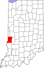
Vigo County's location in Indiana
|
|
| Country | United States |
| State | Indiana |
| County | Vigo |
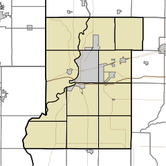
| Township | Sugar Creek |
| Elevation | 479 ft (146 m) |
| Time zone | UTC-5 (Eastern (EST)) |
| • Summer (DST) | UTC-4 (EDT) |
| ZIP code |
47885
|
| Area codes | 812, 930 |
| GNIS feature ID | 430517 |
Barnhart Town is a small place in Indiana, United States. It is known as an "unincorporated community." This means it's a group of homes or buildings that doesn't have its own local government, like a city or town would. Instead, it's governed by the larger area it's part of.
Barnhart Town is located in Sugar Creek Township, which is inside Vigo County, Indiana. It is also considered part of the Terre Haute metropolitan area. A metropolitan area is a large region that includes a city and its nearby communities.
Where is Barnhart Town?
Barnhart Town is located in the western part of Indiana. You can find it at these coordinates: 39 degrees, 30 minutes, 14 seconds North latitude and 87 degrees, 26 minutes, 8 seconds West longitude.
The community sits at an elevation of about 482 feet (or 146 meters) above sea level. This means it's nearly 500 feet higher than the ocean!
 | James Van Der Zee |
 | Alma Thomas |
 | Ellis Wilson |
 | Margaret Taylor-Burroughs |


