Baxter, Iowa facts for kids
Quick facts for kids
Baxter, Iowa
|
|
|---|---|
| Motto(s):
"Come join us"
|
|

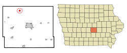
Location of Baxter, Iowa
|
|
| Country | |
| State | |
| County | Jasper |
| Area | |
| • Total | 0.65 sq mi (1.69 km2) |
| • Land | 0.65 sq mi (1.69 km2) |
| • Water | 0.00 sq mi (0.00 km2) |
| Elevation | 1,004 ft (306 m) |
| Population
(2020)
|
|
| • Total | 962 |
| • Density | 1,470.95/sq mi (568.33/km2) |
| Time zone | UTC-6 (Central (CST)) |
| • Summer (DST) | UTC-5 (CDT) |
| ZIP code |
50028
|
| Area code(s) | 641 |
| FIPS code | 19-04915 |
| GNIS feature ID | 0454391 |
Baxter is a city found in Jasper County, Iowa, United States. It is located about 33 miles (53 km) northeast of Des Moines. In 2020, the city had a population of 962 people.
Contents
History of Baxter
Baxter was officially planned and laid out in 1883. This is when the town's streets and lots were first mapped out.
Geography of Baxter
Baxter is located at specific points on a map. Its coordinates are 41.824492 degrees North and -93.150857 degrees West.
The city covers a total area of about 0.65 square miles (1.69 square kilometers). All of this area is land, meaning there are no large lakes or rivers within the city limits.
People of Baxter
| Historical populations | ||
|---|---|---|
| Year | Pop. | ±% |
| 1900 | 427 | — |
| 1910 | 527 | +23.4% |
| 1920 | 571 | +8.3% |
| 1930 | 569 | −0.4% |
| 1940 | 623 | +9.5% |
| 1950 | 618 | −0.8% |
| 1960 | 681 | +10.2% |
| 1970 | 788 | +15.7% |
| 1980 | 951 | +20.7% |
| 1990 | 938 | −1.4% |
| 2000 | 1,052 | +12.2% |
| 2010 | 1,101 | +4.7% |
| 2020 | 962 | −12.6% |
| Source: and Iowa Data Center Source: |
||
2020 Census Information
In 2020, a total of 962 people lived in Baxter. There were 404 households, which are groups of people living together. About 277 of these were families.
The city had about 1,472 people per square mile (568.3 people per square kilometer). There were 433 housing units, like houses or apartments.
Most of the people in Baxter were White (97.8%). A small number were from two or more races (1.7%). About 0.9% of the population was Hispanic or Latino.
About 33.9% of households had children under 18 living with them. The average age of people in Baxter was 37.9 years. About 27.9% of residents were under 20 years old. Also, 16.0% were 65 years or older. The population was almost evenly split between males (50.2%) and females (49.8%).
2010 Census Information
According to the 2010 census, Baxter had 1,101 people. There were 427 households, with 296 of them being families.
The population density was about 1,694 people per square mile (654 people per square kilometer). There were 446 housing units in total.
Most residents were White (97.7%). A small number were African American (0.3%), Native American (0.5%), or Asian (0.1%). About 1.3% of the population was Hispanic or Latino.
About 37.9% of households had children under 18. The average age in the city was 38.1 years. About 27.7% of residents were under 18 years old. Also, 16.2% were 65 years or older. The population was 49.5% male and 50.5% female.
Education in Baxter
The Baxter Community School District is in charge of the public schools in the area.
See also
 In Spanish: Baxter (Iowa) para niños

