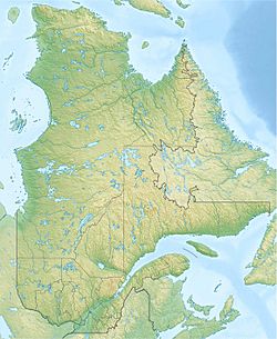
Bazile Lake (Mont-Élie) facts for kids
Quick facts for kids Bazile Lake |
|
|---|---|
| Location | Mont-Élie |
| Coordinates | 47°59′08″N 70°23′07″W / 47.98555°N 70.38528°W |
| Lake type | Natural |
| Primary inflows | la coulée du Bazile, Plusieurs ruisseaux de montagnes et la décharge des lacs Ludger et Marco |
| Primary outflows | Ruisseau Bazile |
| Basin countries | Canada |
| Max. length | 3.8 km (2.4 mi) |
| Max. width | 1.6 km (0.99 mi) |
| Surface elevation | 519 m (1,703 ft) |
Bazile Lake is a beautiful lake in Quebec, Canada. It's part of the water system that flows into the Petit Saguenay River. The lake is located in a wild area called Mont-Élie, which is part of the Charlevoix-Est region.
You can find forest roads near the lake. One runs along the south side, and another is on the northeast side. These roads connect to a larger road called Périgny road to the north.
The main activity around Bazile Lake is forestry, which means managing forests for wood. Recreational tourism is also popular. This includes activities like fishing or hiking.
The lake usually freezes over in late November. It stays frozen until early April. It's generally safe to walk or play on the ice from mid-December to the end of March.
Where is Bazile Lake?
Bazile Lake is surrounded by several important water areas. These are like its neighbors in the water world.
- To the north: You'll find the Bras à Pierre.
- To the east: The Petit Saguenay River is nearby.
- To the south: There's the Pont stream and the Malbaie River.
- To the west: You'll see Épinglette brook, Coulée du Bazile, and the Malbaie River.
How Big is Bazile Lake?
Bazile Lake is about 3.8 km (2.4 mi) long. It is also about 1.6 km (0.99 mi) wide. If you look at it on a map, it looks a bit like the shape of a turtle's back!
Where Does the Water Go?
The water from Bazile Lake flows out from its mouth. This mouth is located:
- 1.3 km (0.81 mi) west of Lac des Caleçons.
- 6.8 km (4.2 mi) west of Lac au Bouleau.
- 22.8 km (14.2 mi) southwest of the village of Sagard. A main road, Route 170, passes through Sagard.
- 31.9 km (19.8 mi) south of where the Petit Saguenay River meets L'Anse-Saint-Jean.
From Bazile Lake, the water travels a long way!
- First, it goes down the Bazile stream for 10.3 km (6.4 mi).
- It passes through Lac des Caleçons and Fraser Lake.
- Then, it reaches Lac au Sable and crosses it for 0.9 km (0.56 mi).
- Next, the water flows into the Petit Saguenay River for 44.4 km (27.6 mi).
- Finally, it joins the Saguenay River and travels 36.6 km (22.7 mi) east to Tadoussac. From there, it flows into the mighty Saint Lawrence River!
How Was it Named?
The name "Bazile" comes from a French first name.
The name "Lac Bazile" was officially recognized on December 5, 1968. This was done by the Commission de toponymie du Québec, which is a group in Quebec that names places.


