Beau Lake (Maine-Quebec) facts for kids
Quick facts for kids Beau Lake |
|
|---|---|
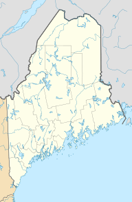
| Location | Rivière-Bleue, Quebec, Témiscouata Regional County Municipality in Quebec and Aroostook County in Maine |
| Coordinates | 47°20′40″N 69°03′13″W / 47.34444°N 69.05361°W |
| Type | Lake consisting of enlargement of the river |
| Primary inflows | Saint Francis River |
| Primary outflows | Saint Francis River |
| Catchment area | Bay of Fundy |
| Basin countries | Canada and United States |
| Max. length | 8.1 km (5.0 mi) |
| Max. width | 1.1 km (0.68 mi) |
| Surface area | 7.23 km2 (2.79 sq mi) |
| Max. depth | 55 m (180 ft) |
| Surface elevation | 394 m (1,293 ft) |
Beau Lake (also known as "Le Beau Lac" in French) is a beautiful freshwater lake. It stretches north to south and is part of the Saint Francis River. This lake sits right on the border between Maine in the United States and Quebec in Canada.
On the Maine side, it's located in Aroostook County. In Quebec, it's found in the Témiscouata Regional County Municipality, near Rivière-Bleue, Quebec.
The area around the lake is mostly forest. For a long time, the main activity here was forestry. But since the mid-1900s, people have started coming to the lake for vacations and tourism. It's a popular spot for fishing and boating because of its amazing mountain views.
A forest road runs along the western side of the lake in Maine. On the Quebec side, there are some homes with an access road near the northern part of the lake.
Contents
Discovering Beau Lake's Geography
Beau Lake is actually a wider part of the Saint Francis River. The lake is surrounded by tall, steep cliffs.
Mountains and Cliffs Around the Lake
- On the western side, in Maine, the mountain peaks are between 329 meters (1,079 feet) and 487 meters (1,598 feet) high.
- On the eastern side, in Quebec, the mountain peaks can reach up to 516 meters (1,693 feet) tall.
Water Flow and Connections
The lake gets its water from the Saint Francis River (Canada–United States) coming from the north. It also receives water from a stream called "Coulée Creuse" (which means "Hollow Flow") from the east. The water then flows out of the lake from its southern end, continuing as the Saint Francis River.
The very southern tip of Beau Lake is where the lake officially ends. This spot is right on the border between Quebec and New Brunswick.
The Name "Le Beau Lac"
The name "Le Beau Lac" was officially recognized on December 5, 1968. This was done by the Commission de toponymie du Québec, which is like Quebec's official board for place names.
 | Shirley Ann Jackson |
 | Garett Morgan |
 | J. Ernest Wilkins Jr. |
 | Elijah McCoy |


