Bedburn Beck facts for kids
Quick facts for kids Bedburn Beck |
|
|---|---|

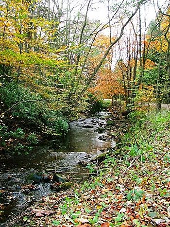
Bedburn Beck in Hamsterley Forest
|
|
|
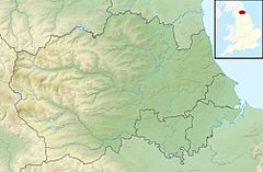
Location of the mouth within County Durham
|
|
| Country | England |
| County | County Durham |
| Physical characteristics | |
| Main source | Woodland Fell |
| River mouth | River Wear 54°41′05″N 1°48′00″W / 54.684743°N 1.800°W |
| Length | 16.8 km (10.4 mi) |
| Basin features | |
| Basin size | 76 km2 (29 sq mi) |
Bedburn Beck is a small river, also called a "beck," located in County Durham, England. It is about 16.8 km (10.4 mi) long. This beck is an important "tributary," which means it's a smaller river that flows into a larger one. Bedburn Beck flows into the River Wear.
The area of land that collects water for Bedburn Beck is called its "catchment area." This area is about 76 km2 (29 sq mi). A big part of this land is covered by Hamsterley Forest, which is a large forest with many evergreen trees.
Contents
Where Does Bedburn Beck Start and Go?
The Journey of the Water
Bedburn Beck begins high up on the land known as Woodland Fell. At its very start, it's called the Spurlswood Beck. It flows towards the east through a rocky valley, also known as a "gill," which shares the same name.
Flowing Through Hamsterley Forest
After its start, the beck enters Hamsterley Forest. Here, another small stream called Euden Beck joins it. Once these two streams meet, the river officially becomes known as Bedburn Beck.
Passing Villages and Joining Other Streams
The beck then flows past a small village called Redford. Soon after, it is joined by another stream, the Ayhope Beck (sometimes called South Grain Beck).
It then reaches the village of Bedburn, where a local road crosses over it with a bridge. Beyond Bedburn village, it meets Harthorpe Beck. Finally, Bedburn Beck flows down into the valley of the River Wear, between the villages of Hamsterley and Witton-le-Wear.
How Much Water Flows in Bedburn Beck?
Measuring the Flow
Since 1959, scientists have been measuring how much water flows in Bedburn Beck. They do this at a special measuring station located near Bedburn village. This station measures almost all the water from the beck's catchment area.
On average, about 1.23 m3/s (43 cu ft/s) of water flows past the station every second. That's like filling about 1,230 one-liter bottles of water every second!
Highest Water Levels
The highest water level ever recorded at the station happened on July 17, 2009. On that day, the water reached a height of 2.31 m (7.6 ft). The amount of water flowing was much higher than usual, reaching 79 m3/s (2,800 cu ft/s).
Rainfall and Landscape
The area around Bedburn Beck gets a good amount of rain each year, about 894 mm (35.2 in). The highest point in the beck's catchment area is near Pawlaw Pike, which is about 533 m (1,749 ft) high.
The land around the beck is mostly countryside. It includes open moorland, grassy fields, and the large Hamsterley Forest, which is full of pine trees.
 | Tommie Smith |
 | Simone Manuel |
 | Shani Davis |
 | Simone Biles |
 | Alice Coachman |


