Bellingham (CDP), Massachusetts facts for kids
Quick facts for kids
Bellingham, Massachusetts
|
|
|---|---|

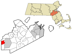
Location in Norfolk County in Massachusetts
|
|
| Country | |
| State | |
| County | |
| Area | |
| • Total | 5.49 sq mi (14.22 km2) |
| • Land | 5.39 sq mi (13.96 km2) |
| • Water | 0.10 sq mi (0.25 km2) |
| Elevation | 295 ft (90 m) |
| Population
(2020)
|
|
| • Total | 4,782 |
| • Density | 886.87/sq mi (342.43/km2) |
| Time zone | UTC-5 (Eastern (EST)) |
| • Summer (DST) | UTC-4 (EDT) |
| ZIP code |
02019
|
| Area code(s) | 508 |
| FIPS code | 25-04965 |
| GNIS feature ID | 0611653 |
Bellingham is a special area in the town of Bellingham, Massachusetts. It's called a census-designated place (CDP). This means it's a specific area that the U.S. Census Bureau identifies for gathering information about people.
Bellingham is located in Norfolk County, in the state of Massachusetts, United States. In 2020, about 4,782 people lived here.
Geography of Bellingham
Bellingham is found at coordinates 42°5′53″N 71°28′36″W. This helps us pinpoint its exact location on a map.
The area of Bellingham is about 13.9 square kilometers (5.39 square miles) of land. A small part, about 0.2 square kilometers (0.1 square miles), is water.
People of Bellingham
| Historical population | |||
|---|---|---|---|
| Census | Pop. | %± | |
| 2020 | 4,782 | — | |
| U.S. Decennial Census | |||
In 2000, there were about 4,497 people living in Bellingham. These people lived in 1,675 households. A household is like a home where people live together. Most of these households were families.
The population density was about 328 people per square kilometer. This tells us how many people live in a certain amount of space.
Many different kinds of people live in Bellingham. About 26% of the people were under 18 years old. The average age of people living here was 36 years old.
See also

- In Spanish: Bellingham (condado de Norfolk) para niños
 | Jessica Watkins |
 | Robert Henry Lawrence Jr. |
 | Mae Jemison |
 | Sian Proctor |
 | Guion Bluford |

