Belvedere Island facts for kids
|
El Potrero de la Punta del Tiburon, Kashow's Island, Peninsula Island, Promontory Island, Still Island
|
|
|---|---|

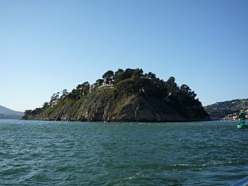
Belvedere Island in 2010
|
|
| Geography | |
| Coordinates | 37°52′18″N 122°28′07″W / 37.87158°N 122.46849°W |
| Administration | |
| State | |
| County | Marin |
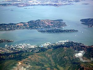
Belvedere Island is a small, rocky piece of land in the San Francisco Bay in Marin County, California. It used to be a true island, surrounded by water and marshland. Over time, it became connected to the mainland by two narrow strips of land. Today, part of the town of Belvedere, California is built on what was once Belvedere Island.
Contents
Nature on the Island
Belvedere Island is home to different kinds of plants and animals. For a long time, people have seen herons, which are large wading birds, living there.
Some of the plants found on the island are also seen on nearby Ring Mountain. Ring Mountain is known for having many different types of plants. It was also a place where early Native American people lived.
Island's Story
Early Inhabitants
Long ago, the Coast Miwok people lived in the Tiburon area, which is close to Belvedere Island. There is proof that they visited the island.
Spanish and Mexican Times
In 1834, the island became part of the first Mexican land grant in Marin County. This grant gave the land to John Reed. During this time, the island was known by a Spanish name: El Potrero de la Punta del Tiburon. This means "The Paddock of Tiburon Point."
Kashow's Island
Later, an American named Israel Kashow came to California during the Gold Rush. He was one of the first people to live permanently on the island. He ran a fishing business there. Because of him, the island was sometimes called Kashow's Island. However, John Reed's family later went to court and had Kashow leave the island.
Becoming Belvedere Island
In 1890, a company called Belvedere Land Co. bought the island. They changed its name to Belvedere Island. They wanted to turn it into a summer getaway for wealthy people.
In 1896, Belvedere officially became a city. This new city included Belvedere Island, a nearby island called Corinthian Island, and part of the Tiburon Peninsula. A post office was opened there the next year.
Connecting to the Mainland
Over the years, the marshland that separated Belvedere Island from the mainland was filled in. Roads were built across it to make it easier to get to the island. The first state highway was built in 1930.
Today, Belvedere Island is connected to the mainland by two causeways, which are like raised roads across water. These are called Beach Road and San Rafael Avenue. Because of these connections and the filled-in land, Belvedere Island is no longer a true island. The two narrow strips of land for the causeways now create an artificial lagoon called the Belvedere Lagoon.
Belvedere is mostly a residential area today, meaning many people live in homes there.
Island's Rocks
Scientists have studied the rocks of Belvedere Island. They found that the island is made of two main types of rock: Franciscan sandstone and Franciscan Greenstone. These rocks are part of a larger group of rocks called the Franciscan Complex.
See also
 In Spanish: Isla Belvedere para niños
 | Selma Burke |
 | Pauline Powell Burns |
 | Frederick J. Brown |
 | Robert Blackburn |


